Millport, New York

Last updated

Millport, New York
USA New York location map.svg
Red pog.svg
Millport
Location within the state of New York
Coordinates: 42°16′3″N76°50′10″W / 42.26750°N 76.83611°W / 42.26750; -76.83611
Country United States
State New York
County Chemung
Town Veteran
Area
[1]
  Total0.35 sq mi (0.90 km2)
  Land0.35 sq mi (0.90 km2)
  Water0.00 sq mi (0.00 km2)
Elevation
719 ft (219 m)
Population
 (2020)
  Total301
  Density864.94/sq mi (334.02/km2)
Time zone UTC-5 (Eastern (EST))
  Summer (DST) UTC-4 (EDT)
ZIP code
14864
Area code 607
FIPS code 36-47427
GNIS feature ID0957345
Website millportny.com

Millport is a village in Chemung County, New York, United States. The population was 312 at the 2010 census. [2] The name comes from its former status as a canal port.

Contents

Millport is in the northwest quadrant of the town of Veteran and is north of Elmira. The mail ZIP code is 14864. It is part of the Elmira Metropolitan Statistical Area.

History

The Sullivan Expedition of 1779 passed through the area.

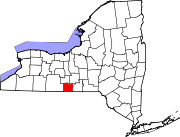
The town's first settler, Green Bently, purchased and developed farmland on the site of the village in 1798. The community was once known as "Millvale" after the village was laid out in 1825. The name was changed to "Millport" in 1829 to recognize its new status by the Chemung Canal which passed by the village. The presence of the canal helped raise the population about 1,000 for a time. Catharine Creek, a north-flowing tributary of Seneca Lake, flows through the village.

In the 1840s, several epidemics reduced the population of Millport.

Geography

Millport is located in northwestern Chemung County at 42°16′3″N76°50′10″W / 42.26750°N 76.83611°W / 42.26750; -76.83611 (42.267634, -76.836122). [3]

According to the United States Census Bureau, the village has a total area of 0.35 square miles (0.9 km2), all land. [2]

New York State Route 14 passes through the village, which is at the junction of County Road 6A.

Demographics

Historical population
CensusPop.Note
1880 500
1930 389
1940 340−12.6%
1950 3626.5%
1960 42517.4%
1970 48012.9%
1980 440−8.3%
1990 342−22.3%
2000 297−13.2%
2010 3125.1%
2020 301−3.5%
U.S. Decennial Census [4]

As of the census [5] of 2000, there were 297 people, 118 households, and 77 families residing in the village. The population density was 821.0 inhabitants per square mile (317.0/km2). There were 132 housing units at an average density of 364.9 per square mile (140.9/km2). The racial makeup of the village was 96.97% White, 1.01% Native American, 0.34% from other races, and 1.68% from two or more races. Hispanic or Latino of any race were 2.02% of the population.

There were 118 households, out of which 32.2% had children under the age of 18 living with them, 44.9% were married couples living together, 13.6% had a female householder with no husband present, and 33.9% were non-families. 28.8% of all households were made up of individuals, and 15.3% had someone living alone who was 65 years of age or older. The average household size was 2.52 and the average family size was 3.03.

In the village, the population was spread out, with 25.6% under the age of 18, 5.7% from 18 to 24, 33.0% from 25 to 44, 23.6% from 45 to 64, and 12.1% who were 65 years of age or older. The median age was 38 years. For every 100 females, there were 100.7 males. For every 100 females age 18 and over, there were 97.3 males.

The median income for a household in the village was $31,250, and the median income for a family was $40,500. Males had a median income of $26,875 versus $17,500 for females. The per capita income for the village was $15,739. About 6.1% of families and 12.8% of the population were below the poverty line, including 17.0% of those under the age of eighteen and 12.8% of those 65 or over.

Related Research Articles

<span class="mw-page-title-main">Chemung County, New York</span> County in New York, United States

Chemung County is a county in the U.S. state of New York. The population was 84,148 as of the 2020 census. Its county seat is Elmira. Its name is derived from a Delaware Indian village whose name meant "big horn". The county is part of the Southern Tier region of the state.

Chemung is a town in Chemung County, New York, United States. The population was 2,368 at the 2020 census. The town name is derived from the Chemung River, which means "Big Horn" in the native language.

<span class="mw-page-title-main">Elmira Heights, New York</span> Village in New York, United States

Elmira Heights is a village in Chemung County, New York, United States. The population was 4,097 at the 2010 census. The village is primarily within the town of Horseheads, but part of the village is in the town of Elmira. The village is a northern suburb of the city of Elmira. It is part of the Elmira, New York Metropolitan Statistical Area.

Erin is a town in Chemung County, New York, United States. The population was 1,820 at the 2020 census. The town was named by early settlers from Ireland.

Horseheads North is a census-designated place (CDP) in Chemung County, New York, United States. It is part of the Elmira Metropolitan Statistical Area. As of the 2010 census, the population of the CDP was 2,843.

Veteran is a town in Chemung County, New York, United States. The population was 3,363 at the 2020 census. The name of the town honors the first settler, a veteran of two wars.

<span class="mw-page-title-main">Wellsburg, New York</span> Village in New York, United States

Wellsburg is a village in Chemung County, New York, United States. The population was 580 at the 2010 census. The village is named after the pioneer family of Abner Wells (1737–1797) who came from Southold on Long Island.

West Elmira is a suburban census-designated place (CDP) in Chemung County, New York, United States. The population was 4,967 at the 2010 census. It is adjacent to the city of Elmira on its west side. West Elmira is in the southwest part of the town of Elmira. It is part of the Elmira Metropolitan Statistical Area.

Catharine is a town in Schuyler County, New York, United States. The population was 1,656 at the 2020 census. The town is one of two in the county named after Catherine Montour, a Native American interpreter and leader in the area. The Town of Catharine is in the southeastern part of the county and is north of Elmira.

<span class="mw-page-title-main">Cayuta, New York</span> Town in New York, United States

Cayuta is a town in Schuyler County, New York, United States. As of the 2020 census, the population was 508.

Dix is a town in Schuyler County, New York, United States. The population was 3,723 at the 2020 census.

Montour is a town in Schuyler County, New York, United States. The population was 2,323 at the 2020 census. The town is one of two towns in the county named after Catherine Montour.

<span class="mw-page-title-main">Montour Falls, New York</span> Village in New York, United States

Montour Falls is a village located in Schuyler County, New York, United States. The population was 2,714 at the time of the 2020 census. A waterfall at the end of West Main Street gives the village its name. The name "Montour" is derived from Queen Catharine Montour, a prominent Native American woman of Seneca Indian heritage who lived at the village site in the 18th century.

<span class="mw-page-title-main">Elmira (town), New York</span> Town in New York, United States

Elmira is a town in Chemung County, New York, United States. It surrounds the city of Elmira on three sides. The town's population was 6,872 at the 2020 census. The town is in the south-central part of the county, in the Southern Tier of New York. It is part of the Elmira Metropolitan Statistical Area.

<span class="mw-page-title-main">Horseheads (village), New York</span> Village in New York, United States

Horseheads is a village in Chemung County, New York, United States. The population was 6,606 at the 2020 census. The name is derived from the number of bleached skulls of pack horses left behind by the Sullivan Expedition.

<span class="mw-page-title-main">Horseheads, New York</span> Town in New York, United States

Horseheads is a town in Chemung County, New York, United States. The population was 19,412 at the 2020 census. The name of the town is derived from the number of bleached horses' skulls once found there.

Southport is a census-designated place (CDP) in the town of Southport in Chemung County, New York, United States. The population of the CDP was 7,238 at the 2010 census, out of a total population in the town of 10,940.

<span class="mw-page-title-main">Southport, New York</span> Town in New York, United States

Southport is a town in Chemung County, New York, United States. The population was 9,684 according to the 2020 census. The town is located in the southwestern corner of Chemung County and is southwest of the city of Elmira. It is part of the Elmira Metropolitan Statistical Area.

Van Etten is a hamlet and census-designated place in Chemung County, New York, United States. It was a village that was absorbed by the Town of Van Etten on December 31, 2018. The population was 537 at the 2010 census. The name came from the two brothers who founded the village.

Van Etten is a town in Chemung County, New York, United States. It is part of the Elmira Metropolitan Statistical Area. The population of the town was 1,541 at the 2020 census. The town is named for the two brothers who founded the village of Van Etten in it. The town is at the northeastern corner of the county, northeast of Elmira.

References

  1. "ArcGIS REST Services Directory". United States Census Bureau. Retrieved September 20, 2022.
  2. 1 2 "Geographic Identifiers: 2010 Demographic Profile Data (G001): Millport village, New York". U.S. Census Bureau, American Factfinder. Archived from the original on February 12, 2020. Retrieved November 4, 2014.
  3. "US Gazetteer files: 2010, 2000, and 1990". United States Census Bureau. February 12, 2011. Retrieved April 23, 2011.
  4. "Census of Population and Housing". Census.gov. Retrieved June 4, 2015.
  5. "U.S. Census website". United States Census Bureau . Retrieved January 31, 2008.