Catharine Creek

Last updated
Catharine Creek
USA New York location map.svg
Red pog.svg
Location of the mouth of Catharine Creek in New York State.
Usa edcp relief location map.png
Red pog.svg
Catharine Creek (the US)
CountryUnited States
State New York
Physical characteristics
Source 
 - location Town of Veteran, Chemung County
 - coordinates 42°16′15″N76°46′21″W / 42.27083°N 76.77250°W / 42.27083; -76.77250 [1]
River mouth Seneca Lake
 - location Watkins Glen, Schuyler County
 - coordinates 42°21′05″N76°51′04″W / 42.35139°N 76.85111°W / 42.35139; -76.85111 Coordinates: 42°21′05″N76°51′04″W / 42.35139°N 76.85111°W / 42.35139; -76.85111 [1]
Length15 mi (24 km)

Catharine Creek is a roughly 15-mile-long (24 km) stream that flows through Chemung and Schuyler counties in New York. [1] The creek, named after Catharine Montour, is a major tributary to Seneca Lake.

Chemung County, New York County in the United States

Chemung County is a county in the southern tier of the U.S. state of New York. As of the 2010 census, the population was 88,830. Its county seat is Elmira. Its name is derived from a Delaware Indian village whose name meant "big horn".

Schuyler County, New York County in the United States

Schuyler County is a county in the U.S. state of New York. As of the 2010 census, the population was 18,343, making it the second-least populous county in New York. The county seat is Watkins Glen. The name is in honor of General Philip Schuyler, one of the four major generals in the Continental Army in the American Revolutionary War.

New York (state) State of the United States of America

New York is a state in the Northeastern United States. New York was one of the original Thirteen Colonies that formed the United States. With an estimated 19.54 million residents in 2018, it is the fourth most populous state. To distinguish the state from the city in the state with the same name, it is sometimes called New York State.

Contents

Course

While the other waterways of Chemung County are part of the Susquehanna River basin, Catharine Creek is part of the St. Lawrence River basin. It flows into Seneca Lake, the largest of the Finger Lakes, which drains into Lake Ontario via the Seneca and Oswego rivers.

Susquehanna River river in the northeastern United States

The Susquehanna River is a major river located in the northeastern and mid-Atlantic United States. At 464 miles (747 km) long, it is the longest river on the East Coast of the United States that drains into the Atlantic Ocean. With its watershed, it is the 16th-largest river in the United States, and the longest river in the early 21st-century continental United States without commercial boat traffic.

Seneca Lake (New York) lake

Seneca Lake is the largest of the glacial Finger Lakes of the U.S. state of New York, and the deepest lake entirely within the state. It is promoted as being the lake trout capital of the world, and is host of the National Lake Trout Derby. Because of its depth and relative ease of access, the US Navy uses Seneca Lake to perform test and evaluation of equipment ranging from single element transducers to complex sonar arrays and systems. The lake takes its name from the Seneca nation of Native Americans. At the north end of Seneca Lake is the city of Geneva, New York, home of Hobart and William Smith Colleges and the New York State Agricultural Experiment Station, a division of Cornell University. At the south end of the lake is the village of Watkins Glen, New York, famed for auto racing and waterfalls.

Finger Lakes group of lakes in New York, USA

The Finger Lakes are a group of 11 long, narrow, roughly north–south lakes in an area informally called the Finger Lakes region in Central New York, in the United States. This region straddles the northern and transitional edge, known as the Finger Lakes Uplands and Gorges ecoregion, of the Northern Allegheny Plateau and the Ontario Lowlands ecoregion of the Great Lakes Lowlands.

Catharine Creek rises atop a ridge in the Town of Veteran in Chemung County. It flows south to an area known locally as the Holding Point in Horseheads. It then flows back to the north, mostly alongside Route 14, through the communities of Pine Valley, Millport, Montour Falls, and Watkins Glen.

Veteran, New York Town in New York, United States

Veteran is a town in Chemung County, New York, United States. The population was 3,313 at the 2010 census. The name of the town honors the first settler, a veteran of two wars.

The Holding Point is an area in the Town of Horseheads, New York that is the site of the Horseheads Industrial Center. The name dates back to World War II, when the federal government used eminent domain to obtain 700 acres (2.8 km2) of farmland north of the Village of Horseheads to hold German prisoners of war and to store ammunition, jeeps and other war supplies. The land reverted to civilian control after the war and since has been converted to an industrial center and recreational sports complex. Schlumberger Technology Corp owns a significant portion of the Holding Point as they prepare the lot for gas drilling in New York.

Horseheads North, New York Census-designated place in New York, United States

Horseheads North is a census-designated place (CDP) in Chemung County, New York, United States. It is part of the Elmira Metropolitan Statistical Area. As of the 2010 census, the population of the CDP was 2,843.

History

The Chemung Canal ran through the Catharine Creek valley from Horseheads to Seneca Lake during the mid-19th century, facilitating transportation and shipping between the southern New York region and the United States' east coast. Some remnants remain in Catharine Creek Marsh, a 1,000-acre (400 ha) wetlands complex located between Montour Falls and Watkins Glen. After the canal closed in 1878, the Pennsylvania Railroad took over much of the canal's right-of-way. [2]

The Chemung Canal is a former canal in New York, United States. The canal connected Seneca Lake at Watkins Glen to the Chemung River at Elmira, New York. It was planned to connect the Finger Lakes region and Pennsylvania's Susquehanna River watershed with New York's Erie Canal system. The latter connected the Great Lakes with the Hudson River and ultimately the Atlantic port of New York City.

Pennsylvania Railroad former American Class I railroad

The Pennsylvania Railroad was an American Class I railroad that was established in 1846 and was headquartered in Philadelphia, Pennsylvania. It was so named because it was established in the Commonwealth of Pennsylvania.

Recreation

The Catharine Valley Trail, a rails to trails project, has been under development since the early 2000s by New York State and volunteers. Following former railroad beds and canal towpaths near Catharine Creek, the multi-use trail is intended to eventually link Horseheads to Seneca Lake. [3] As of 2016, six miles (9.7 km) of the trail are open to the public, with plans for the trail to grow to 12 miles (19 km) in length. [4]

Catharine Valley Trail

Catharine Valley Trail is a state park and recreation trail located in Schuyler and Chemung counties, New York. The park is located near Watkins Glen State Park and maintained by its staff, as well as by volunteers.

Rail trail railroad bed converted to a recreational trail

A rail trail is the conversion of a disused railway track into a multi-use path, typically for walking, cycling and sometimes horse riding and snowmobiling. The characteristics of abandoned railways—flat, long, frequently running through historical areas—are appealing for various developments. The term sometimes also covers trails running alongside working railways; these are called "rails with trails". Some shared trails are segregated, with the segregation achieved with or without separation. Many rail trails are long-distance trails.

The Catharine Creek Wildlife Management Area, managed by the New York State Department of Environmental Conservation, protects a large wetlands complex near the creek's mouth. Although camping is prohibited and no formal recreation facilities exist, the area is open to the public for hunting, hiking, bird watching, boating, and fishing. A spur of the Finger Lakes Trail passes through the marsh. [2]

New York State Wildlife Management Areas

New York State Wildlife Management Areas (WMAs) are conservation areas managed by the New York State Department of Environmental Conservation (NYSDEC) primarily for the benefit of wildlife, and used extensively by the public for hunting, fishing, and trapping. As of 2016, the NYSDEC owns and maintains 113 WMAs, with a total area of approximately 197,000 acres. The Wildlife Management Areas program is administered by the Division of Fish, Wildlife and Marine Resources of the NYSDEC.

New York State Department of Environmental Conservation New Yorks state-level environmental regulator

The New York State Department of Environmental Conservation is a department of New York state government. The department guides and regulates the conservation, improvement, and protection of New York's natural resources; manages Forest Preserve lands in the Adirondack and Catskill parks, state forest lands, and wildlife management areas; regulates sport fishing, hunting and trapping; and enforces the state's environmental laws and regulations. Its regulations are compiled in Title 6 of the New York Codes, Rules and Regulations. It was founded in 1970, replacing the Conservation Department.

Finger Lakes Trail


The Finger Lakes Trail consists of a network of trails in New York. The trail system is administered by the Finger Lakes Trail Conference (FLTC), a non-profit organization, composed primarily of volunteers.

Catharine Creek is a regional sport fishing destination each spring, as anglers target the numerous rainbow trout that enter the creek during their annual spawning runs. [5] [6] Smaller runs of brown trout and landlocked Atlantic salmon take place in the fall. [7]

See also

Related Research Articles

Cayuga Lake lake in central New York, USA

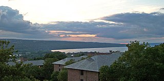
Cayuga Lake is the longest of central New York's glacial Finger Lakes, and is the second largest in surface area and second largest in volume. It is just under 40 miles (64 km) long. Its average width is 1.7 miles (2.7 km), and it is 3.5 mi wide (5.6 km) at its widest point near Aurora. It is approximately 435 ft deep (133 m) at its deepest point.

Dix, New York Town in New York, United States

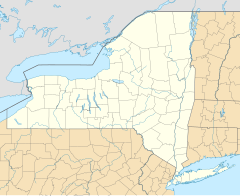
Dix is a town in Schuyler County, New York, United States. The population was 4,197 at the 2000 census.

Montour, New York Town in New York, United States

Montour is a town in Schuyler County, New York, United States. The population was 2,446 at the 2000 census. The town is one of two towns in the county named after Catherine Montour.

Montour Falls, New York Village in New York, United States

Montour Falls is a village located in Schuyler County, New York, United States. A population of 1,711 was reported by the US Census of 2010. A waterfall at the end of West Main Street gives the village its name. The name "Montour" is derived from Queen Catharine Montour, a prominent Native American woman of Seneca Indian heritage who lived at the village site in the 18th century.

Horseheads (village), New York Village in New York, United States

Horseheads is a village in Chemung County, New York, United States. The population was 6,461 at the 2010 census. The name is derived from the number of bleached skulls of pack horses left behind by the Sullivan Expedition.

Horseheads, New York Town in New York, United States

Horseheads is a town in Chemung County, New York, United States. The population was 19,485 at the 2010 census. The name of the town is derived from the number of bleached horses' skulls once found there.

Keuka Lake lake in Steuben County, New York, USA

Keuka Lake is one of the major Finger Lakes in the U.S. state of New York. It is unusual because it is Y-shaped, in contrast to the long and narrow shape of the other Finger Lakes. Because of its shape, it was referred to in the past as Crooked Lake. Keuka means "canoe landing" in the Iroquois language and "lake with an elbow" in the Seneca language.

Watkins Glen State Park

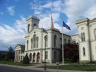
Watkins Glen State Park is located in the village of Watkins Glen, south of Seneca Lake in Schuyler County in New York's Finger Lakes region. The park's lower part is near the village, while the upper part is open woodland. It was opened to the public in 1863 and was privately run as a tourist resort until 1906, when it was purchased by New York State. Initially known as Watkins Glen State Reservation, the park was first managed by the American Scenic and Historic Preservation Society before being turned over to full state control in 1911. Since 1924, it has been managed by the Finger Lakes Region of the New York State Office of Parks, Recreation and Historic Preservation.

Oswego River (New York) river in New York state, United States

The Oswego River is a river in upstate New York in the United States. It is the second-largest river flowing into Lake Ontario. James Fenimore Cooper’s novel The Pathfinder, or The Inland Sea is set in the Oswego River valley.

Seneca River (New York) River in Upstate New York

The Seneca River flows 61.6 miles (99.1 km) through the Finger Lakes region of Upstate New York in the United States. The main tributary of the Oswego River – the second largest river flowing into Lake Ontario – the Seneca drains 3,468 square miles (8,980 km2) in parts of fourteen New York counties. The Seneca flows generally east, and is wide and deep with a gentle gradient. Much of the river has been channelized to form part of the Erie Canal.

Chenango Valley State Park

Chenango Valley State Park is a 1,137-acre (4.60 km2) state park located in Broome County, New York in the United States. The park is located adjacent to the Chenango River in western part of the Town of Fenton.

Bowman Lake State Park

Bowman Lake State Park is a 653-acre (2.64 km2) state park located in Chenango County, New York. The park is located in the Town of McDonough, north of the community of East McDonough.

West Canada Creek river in the United States of America

The West Canada Creek is a 76-mile-long (122 km) river in upstate New York, United States. West Canada Creek is an important water way in Hamilton, Oneida, and Herkimer counties, draining the south part of the Adirondack Mountains before emptying into the Mohawk River near the Village of Herkimer. The name "Canada" is derived from a Native American word for "village" (Kanata).

Catherine's Town was a Seneca village, named informally for a prominent Seneca woman, Catherine Montour. It was located at the south end of Seneca Lake, near present-day Watkins Glen in what is now Schuyler County, New York.

Pine Valley, New York Census-designated place in New York, United States

Pine Valley is a hamlet and census-designated place in the towns of Catlin and Veteran in Chemung County, New York, United States. The population was 813 at the 2010 census.

Butternut Creek (Onondaga County)

Butternut Creek is a stream in the greater Syracuse, New York area and a tributary of Limestone Creek, part of the Oneida Lake watershed. The creek is about 16 miles (26 km) long.

Lake Moraine (New York) lake in Madison County, New York, United States

Lake Moraine is a mesotrophic lake located 2.5 miles (4.0 km) northeast of Hamilton, New York. The lake is 261 acres (1.06 km2), consisting of two basins which are separated by a causeway and interconnected by a culvert. The northern basin is 79 acres (0.32 km2) and is relatively shallow with a maximum depth of 12 feet (3.7 m) and average depth of 3.7 feet (1.1 m). The larger southern basin is 172 acres (0.70 km2) and has a maximum depth of 45 feet (14 m) and an average depth of 17.7 feet (5.4 m). Payne Brook is the lake's outflow that flows into the Chenango River.

References

  1. 1 2 3 "Catharine Creek". Geographic Names Information System . United States Geological Survey . Retrieved April 23, 2016.
  2. 1 2 "Catharine Creek Fish and Wildlife Management Area". NYS Department of Environmental Conservation. Retrieved April 23, 2016.
  3. Price, Kimberly (Fall 2010). "On the Right Path". Life in the Finger Lakes. Retrieved April 23, 2016.
  4. "Catharine Valley Trail". New York State Office of Parks, Recreation and Historic Preservation. Retrieved April 23, 2016.
  5. "Public Fishing Rights: Catharine Creek" (PDF). NYS Department of Environmental Conservation. Retrieved April 23, 2016.
  6. Wheeler, Simon (April 1, 2015). "Big fish, big crowds on opening day of trout season". Ithaca Journal. Retrieved April 23, 2016.
  7. Newman, Eric. Flyfisher's Guide to New York (2nd ed.). Wilderness Adventures Press. p. 404. ISBN   9781932098792 . Retrieved April 24, 2016.