Baar is a municipality in Aichach-Friedberg district, in Bavaria, southern Germany.

Bruckmühl is a market town in the district of Rosenheim, in Bavaria, Germany. It is situated on the river Mangfall, 16 km west of Rosenheim.

Ergolding is a municipality in the district of Landshut, in Bavaria, Germany. It is situated on the left bank of the Isar, 5 km northeast of Landshut.

Thannhausen is a town in the district of Günzburg, in Bavaria, Germany. It is situated on the river Mindel, 24 kilometres (15 mi) southeast of Günzburg, and 33 kilometres (21 mi) west of Augsburg.

Eggolsheim is a municipality in the district of Forchheim in Bavaria in Germany.

Wörnitz is a municipality in the district of Ansbach, in Bavaria, Germany. It is situated on the river Wörnitz, west of Ansbach.

Bechhofen is a market town and municipality in the district of Ansbach in Bavaria in Germany.

Dentlein is a municipality in the district of Ansbach in Bavaria in Germany.
Dürrwangen is a municipality in the district of Ansbach in Bavaria in Germany.

Flachslanden is a municipality in the district of Ansbach in Bavaria in Germany.

Ohrenbach is a municipality in the district of Ansbach in Bavaria in Germany.

Wilburgstetten is a municipality in the district of Ansbach in Bavaria in Germany.

Bischofswiesen is a municipality in the district of Berchtesgadener Land in Bavaria in Germany.

Hausen is a municipality in the district of Forchheim in Bavaria in Germany.

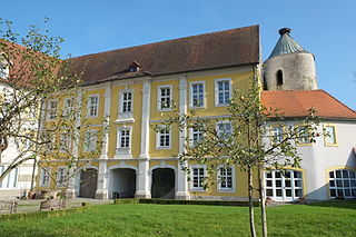
Leuchtenberg is a municipality in the district of Neustadt an der Waldnaab in Bavaria, Germany, essentially a suburb of nearby Weiden in der Oberpfalz, and a larger historical region in the Holy Roman Empire governed by the Landgraves of Leuchtenberg.

Beratzhausen is a market town and municipality in the district of Regensburg in Bavaria in Germany.
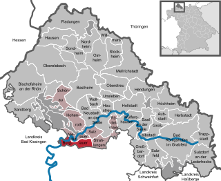
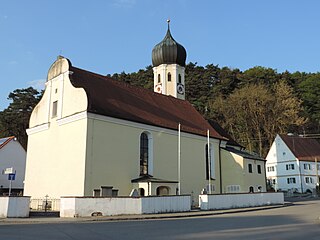
Burglauer is a municipality in the district of Rhön-Grabfeld in Bavaria, Germany. It lies on the river Lauer.

Bad Neualbenreuth is a municipality in the district of Tirschenreuth in Bavaria, Germany.

Buxheim is a municipality in the district of Unterallgäu in Bavaria, Germany.

Kist is a municipality in the district of Würzburg in Bavaria in Germany.


