Gangkofen

Last updated
Gangkofen
Wappen von Gangkofen.png
Coat of arms
Location of Gangkofen within Rottal-Inn district
Gangkofen in PAN.svg
Germany adm location map.svg
Red pog.svg
Gangkofen
Bavaria location map.svg
Red pog.svg
Gangkofen
Coordinates: 48°26′13″N12°33′48″E / 48.43694°N 12.56333°E / 48.43694; 12.56333 Coordinates: 48°26′13″N12°33′48″E / 48.43694°N 12.56333°E / 48.43694; 12.56333
Country Germany
State Bavaria
Admin. region Niederbayern
District Rottal-Inn
Subdivisions9 Ortsteile
Government
   Mayor (202026) Matthäus Mandl [1] (CSU)
Area
  Total108.79 km2 (42.00 sq mi)
Elevation
439 m (1,440 ft)
Population
 (2020-12-31) [2]
  Total6,523
  Density60/km2 (160/sq mi)
Time zone UTC+01:00 (CET)
  Summer (DST) UTC+02:00 (CEST)
Postal codes
84140
Dialling codes 08722 08735 (Kollbach)
Vehicle registration PAN
Website www.gangkofen.de

Gangkofen is a municipality in the county ("Landkreis") of Rottal-Inn in Bavaria in Germany.

Contents

Geography

The market town (Markt) Gangkofen lies in the valley of the river Bina along the federal highway B 388 about 17 km (11 mi) west of Eggenfelden, 26 km (16 mi) south of Dingolfing, 40 km (25 mi) southeast of Landshut, 25 km (16 mi) north of Mühldorf and 32 km (20 mi) west of the county (district) seat, Pfarrkirchen.

Gangkofen is the westernmost municipality of the rural county or district ("Landkreis") named Rottal-Inn, and borders the county of Dingolfing-Landau in the north, the county of Mühldorf in the south and the county of Landshut in the west. Gangkofen is considered part of the historic and geographic Rottal region, because the market town was part of the former county of Eggenfelden (in the Rott valley) and has stronger economic and cultural ties to the east, than in other directions. The western portions of the political municipality - the former rural towns of Dirnaich and Hölsbrunn- historically belonged to the county of Vilsbiburg (now part of the county of Landshut), thus the inhabitants of those parts tend to look to be oriented in that direction (the west) even today.

The political municipality comprises the market town itself and the following villages: Angerbach, Dirnaich, Engersdorf, Hölsbrunn, Kollbach, Malling, Obertrennbach, Panzing, Radlkofen, Reicheneibach und Seemannshausen.

History

Gangkofen is first mentioned in a document in 889 AD. The town is believed to have been part of the properties the Diocese of Bamberg was equipped with upon its foundation in 1007 AD. In 1279 Count Wenhard II. of Leonberg made the Teutonic Knights the patrons over the local parish, thus founding this military order's monastic residence ("Kommende") in Gangkofen. Up to its secularization in 1805/06 this was the only branch of the Teutonic Knights in Lower Bavaria.

In 1379 Gangkofen was awarded the title and privileges of a market town. Its coat of arms was awarded by Duke Ludwig IX. of Bavaria-Landshut around 1450. However, Gangkofen's development was repeatedly thwarted by devastating fires (e.g. around 1590 and in the year 1666) and the trials of war (during the 30 Years' War it was occupied by the Swedes in 1632 and 1648), as well as outbreaks of the plague (1357 and 1649).

The market town Gangkofen was a separate lower administrative and judicial unit ("Pflegamt") prior to 1803 and was part of the tax district ("Rentamt  [ bar; de; es ]") Landshut of the Prince-Electoriate Bavaria. The residence of the Teutonic Knights ("Kommende"), which was equipped with the liberties of a gentry seat ("Hofmarksrecht") and exercised the judicial stewardship over its own properties, was dissolved by the Kingdom of Bavaria in 1806. Additionally, Gangkofen was seat of a market court. In the process of administrative reforms in Bavaria, the municipality edict ("Gemeindeedikt") of 1818 and the territory reforms of the 1970s established the contemporary municipality.

On October 15, 1875, Gangkofen was linked to the railroad system with the completion of the rail line Mühldorf–Pilsting. Since September 27, 1970 this connection has only been used for freight traffic.

Population growth

Between 1988 and 2018 the municipality's population increased from 6032 to 6432 (+6.6%).

Politics

Municipal council

The most recent municipal elections in 2020 had a voter turn-out of 57.4% and resulted in the following allocation of seats (percent of total vote shown in parentheses):

Matthäus Mandl (CSU) is the current Mayor of Gangkofen, and has been in office since 2008. He was re-elected with 91.1% of the votes in 2020. [1]

Cultural sights

The 0,6 hectare(1.5 acres) market place, located in the center of town, is 18 m (59 ft) wide and 210 m (689 ft) long, approximating the typical ratio of 1:8. Many of the houses still have the typical arched gables. The Catholic parish church was rebuilt after the great fire of 1666, completed by 1670, and the steeple added 1695 to 1697. Immediately to the northwest of the Church lies the former monastery of the Teutonic Knights, a three winged structure, newly built in 1691 in the late baroque style.

Media

Two local newspapers are circulated in Gangkofen: The "Rottaler Anzeiger" (regional edition of the Passauer Neue Presse, PNP) has its editorial office in Eggenfelden, 11 miles (18 km) to the east. The Vilsbiburger Zeitung (belonging to the media group Landshuter Zeitung/Straubinger Tagblatt) is from Vilsbiburg, 11 miles (18 km) to the west. For years, an occasional competitive struggle for the patronage of the citizens of this community erupted between the two papers, but now the spoils seem divided and peace prevails.

People

Famous sons and daughters of the town:

People who have lived and worked in Gangkofen:

Related Research Articles

Deggendorf is a Landkreis (district) in Bavaria, Germany. It is bordered by the districts of Regen, Freyung-Grafenau, Passau, Rottal-Inn, Dingolfing-Landau and Straubing-Bogen.

Dingolfing-Landau is a Landkreis (district) in Bavaria, Germany. It is bounded by the districts of Straubing-Bogen, Deggendorf, Rottal-Inn and Landshut.

Erding is a Landkreis (district) in Bavaria, Germany. It is bounded by the districts of Landshut, Mühldorf, Ebersberg, Munich and Freising.

Landshut is a Landkreis (district) in Bavaria, Germany. It is bounded by the districts of Kelheim, Straubing-Bogen, Dingolfing-Landau, Rottal-Inn, Mühldorf, Erding and Freising. The city of Landshut is enclosed by, but does not belong to the district. It is nonetheless its administrative seat.

Mühldorf is a Landkreis (district) in Upper Bavaria, Germany. It is bounded by the districts of Landshut, Rottal-Inn, Altötting, Traunstein, Rosenheim, Ebersberg and Erding.

Rottal-Inn is a Landkreis (district) in the southeastern part of Bavaria, Germany. Neighboring districts are Altötting, Mühldorf, Landshut, Dingolfing-Landau and Passau. To the southeast is the Austrian state Upper Austria (Braunau).

Piding Place in Bavaria, Germany

Piding is an approved climatic spa in Bavaria near to the border of Austria close to Bad Reichenhall and Freilassing.

Landau an der Isar Place in Bavaria, Germany

Landau an der Isar is the second-largest town in the Lower Bavarian district, or Landkreis, of Dingolfing-Landau, in the state of Bavaria, Germany. It lies on the river Isar, 120 km downstream from Munich. In 2020, its population was around 14,000.

Aldersbach Place in Bavaria, Germany

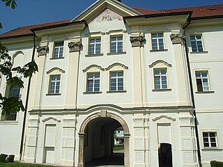
Aldersbach is a municipality in the district of Passau in Bavaria in Germany. The former Cistercian Aldersbach Abbey, of which the Baroque church remains, is located in the village. There is also a brewery with museum. Aldersbach has around 4,500 inhabitants.

Eggenfelden Place in Bavaria, Germany

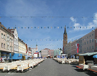
Eggenfelden is a municipality in the district of Rottal-Inn in Bavaria, Germany.

Vilsbiburg Place in Bavaria, Germany

Vilsbiburg is a town on the river Große Vils, 18 km southeast of Landshut, in the district of Landshut, in Bavaria, Germany. The city owes its name to the river Große Vils which runs through Vilsbiburg. As of 2019 Vilsbiburg has 12,203 inhabitants.

Altdorf, Lower Bavaria Place in Bavaria, Germany

Altdorf is a market town and municipality in the district of Landshut, in Bavaria, Germany. It is situated 4 km northwest of Landshut.

Stadtprozelten Place in Bavaria, Germany

Stadtprozelten is a town and municipality in the Miltenberg district in the Regierungsbezirk of Lower Franconia (Unterfranken) in Bavaria, Germany and the seat of the Verwaltungsgemeinschaft of Stadtprozelten.

Eching am Ammersee Place in Bavaria, Germany

Eching am Ammersee is a municipality in the district of Landsberg in Bavaria in Germany. It has a size of 6.15km2.

Velden (Vils) Place in Bavaria, Germany

Velden is a market town and municipality in the district of Landshut in Bavaria in Germany.

Ampfing Place in Bavaria, Germany

Ampfing is a municipality in the district of Mühldorf in Bavaria in Germany.

Haag in Oberbayern Place in Bavaria, Germany

Haag in Oberbayern is a municipality in the district of Mühldorf in Bavaria in Germany, in December 2013 the municipality had a population of 6359.

Bad Griesbach Place in Bavaria, Germany

Bad Griesbach im Rottal, or just Bad Griesbach, is a town in the district of Passau in Bavaria in Germany.

Mitterskirchen Place in Bavaria, Germany

Mitterskirchen is a municipality in the district of Rottal-Inn in Bavaria in Germany.

Rottal-Inn (electoral district) Federal electoral district of Germany

Rottal-Inn is an electoral constituency represented in the Bundestag. It elects one member via first-past-the-post voting. Under the current constituency numbering system, it is designated as constituency 230. It is located in southeastern Bavaria, comprising the Dingolfing-Landau district, Rottal-Inn district, and small parts of the Landkreis Landshut district.

References

  1. 1 2 Liste der ersten Bürgermeister/Oberbürgermeister in kreisangehörigen Gemeinden, Bayerisches Landesamt für Statistik, 15 July 2021.
  2. "Tabellenblatt "Daten 2", Statistischer Bericht A1200C 202041 Einwohnerzahlen der Gemeinden, Kreise und Regierungsbezirke". Bayerisches Landesamt für Statistik und Datenverarbeitung (in German). June 2021.