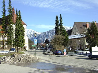
Traunreut is a town in southeastern Bavaria, Germany in the Traunstein district. It is located at 47°58′N12°35′E. Traunreut lies in the heart of the Chiemgau region between Munich and Salzburg, approximately 10 km east of the Chiemsee, 25 km north of the Alps, and 35 km west of Salzburg. Its population is approximately 21,000. Companies present in the area include Siteco Beleuchtungstechnik GmbH, Dr. Johannes Heidenhain GmbH, Bosch and Siemens Household Appliances, BSH, and other midsize firms.

Mantel is a municipality located in the district of Neustadt an der Waldnaab in Bavaria, Germany. It is known as a Markt, a town that was historically granted 'market rights'. The town was first mentioned in official documents in 1212, and in 1945 it was incorporated into the municipality of Rupprechtsreuth. As part of the regional reform in Bavaria, parts of the dissolved municipality of Hütten were added to it in 1972. The town's population fell by 77 people, 2.8%, to 2728 between 1988 and 2018. Mantel is best known for its nature preserve, Naturwaldreservat Gscheibte Loh, as well as its castle, Schloss Steinfels.

Bischofsgrün is a municipality in the district of Bayreuth in Bavaria in Germany.

Ettal is a German municipality and a village in the district of Garmisch-Partenkirchen in Bavaria.

Neufahrn bei Freising is a municipality in the district of Freising, in Bavaria, Germany. It has about 20,000 inhabitants and is located near the river Isar, 12 km southwest of Freising and 20 km northeast of Munich.

Herrieden is a town in the district of Ansbach and situated in the Middle Franconia region of Bavaria, Germany. It lies along the upper Altmühl river, about 9 km (6 mi) southwest of the city of Ansbach, 47 km southwest of the city of Nürnberg, 95 km east of Heilbronn and 144 km northwest of Munich.

Mammendorf is a municipality in Bavaria, Germany. It is located halfway between Munich and Augsburg.

Untermeitingen is a municipality in the district of Augsburg in Bavaria in Germany.

Aura an der Saale is a municipality in the district of Bad Kissingen in Bavaria in Germany.

Bad Bocklet is a municipality in the district of Bad Kissingen in Bavaria in Germany. It is a market town and a health spa.

Geroda is a municipality in the district of Bad Kissingen in Bavaria in Germany.

Grub am Forst is a municipality in the district of Coburg in Bavaria in Germany. It has ca 3,100 residents. The nearest large town is Coburg. The following villages are part of it:

Röthenbach (Allgäu) is a municipality in the administrative region of Swabia Lindau district and seat of the municipal association Röthenbach.

Türkenfeld is a municipality in the district of Fürstenfeldbruck, Bavaria, Germany.

Oberau is a municipality in the district of Garmisch-Partenkirchen, in Bavaria, Germany.

Rottach-Egern is a municipality and town located at Lake Tegernsee in the district of Miesbach in Upper Bavaria, Germany, about 55 km south of central Munich. Late Austrian actor Walter Slezak is buried in this area.

Schwangau is a municipality in the district of Ostallgäu in Bavaria, Germany. The village lies 4 km from the larger town of Füssen and just 1.5 km from Hohenschwangau, a collection of tourist-oriented facilities adjacent to the major tourist attractions of Schloss Neuschwanstein and Schloss Hohenschwangau.

Sonnen is a small municipality in the district of Passau in Bavaria in Germany. It is located in the Danube forest, lower Bavarian forest and is located mostly in the district Passau at a height of 700 to 900 meters. Sonnen lies 28 km from Passau, 9 km from Hauzenberg and from the forest itself 13 km. Sonnen borders with upper Austria which lies only 8 km away.

Waldbüttelbrunn is a municipality in the district of Würzburg in Lower Franconia, Bavaria, Germany. It is located about 8 km (5.0 mi) west of Würzburg. The population is 5055.

Bad Endorf is a municipality and a village in the district of Rosenheim in Bavaria in Germany. The market town is located about 15 km outside of Rosenheim and is in close proximity to Lake Simssee and Chiemsee lake and its larger shore towns, Prien, Gstadt, and Seebruck.


