Related Research Articles

Alexander Island, which is also known as Alexander I Island, Alexander I Land, Alexander Land, Alexander I Archipelago, and Zemlja Alexandra I, is the largest island of Antarctica. It lies in the Bellingshausen Sea west of Palmer Land, Antarctic Peninsula from which it is separated by Marguerite Bay and George VI Sound. The George VI Ice Shelf entirely fills George VI Sound and connects Alexander Island to Palmer Land. The island partly surrounds Wilkins Sound, which lies to its west. Alexander Island is about 390 kilometres (240 mi) long in a north–south direction, 80 kilometres (50 mi) wide in the north, and 240 kilometres (150 mi) wide in the south. Alexander Island is the second-largest uninhabited island in the world, after Devon Island.

Thurston Island is a largely ice-covered, glacially dissected island, 135 nautical miles long and 55 nautical miles wide, lying between Amundsen Sea and Bellingshausen Sea a short way off the northwest end of Ellsworth Land, Antarctica. The island is separated from the mainland by Peacock Sound, which is occupied by the west portion of Abbot Ice Shelf.

Marguerite Bay or Margaret Bay is an extensive bay on the west side of the Antarctic Peninsula, which is bounded on the north by Adelaide Island and on the south by Wordie Ice Shelf, George VI Sound and Alexander Island. The mainland coast on the Antarctic Peninsula is Fallières Coast. Islands within the bay include Pourquoi Pas Island, Horseshoe Island, Terminal Island, and Lagotellerie Island. Marguerite Bay was discovered in 1909 by the French Antarctic Expedition under Jean-Baptiste Charcot, who named the bay for his wife.

The Beethoven Peninsula is a deeply indented, ice-covered peninsula, 60 miles (100 km) long in a northeast–southwest direction and 60 miles (100 km) wide at its broadest part, forming the southwest part of Alexander Island, which lies off the southwestern portion of the Antarctic Peninsula. The south side of the peninsula is supported by the Bach Ice Shelf whilst the north side of the peninsula is supported by the Wilkins Ice Shelf. The Mendelssohn Inlet, the Brahms Inlet and the Verdi Inlet apparently intrude into it. The Bach Ice Shelf, Rossini Point and Berlioz Point are some distance away, on the Ronne Entrance from the Southern Ocean. Beethoven Peninsula is one of the eight peninsulas of Alexander Island.
Shostakovich Peninsula is an ice-covered peninsula lying north of Stravinsky Inlet and extending into Bach Ice Shelf in southern Alexander Island, Antarctica. The peninsula was first mapped by Directorate of Overseas Surveys from satellite imagery of Antarctica supplied by NASA in cooperation with U.S. Geological Survey. Named by United Kingdom Antarctic Place-Names Committee after Dmitri Shostakovich, Russian composer (1906–1975). Shostakovich Peninsula is one of the eight peninsulas of Alexander Island.
Ives Ice Rise is an ice rise about 1 mile (1.6 km) long at the head of Weber Inlet, an ice-filled inlet situated between Bennett Dome and Berlioz Point on the Beethoven Peninsula, situated in the southwest part of Alexander Island in Antarctica. It was mapped by the United States Geological Survey from U.S. Navy aerial photographs taken 1967–68 and Landsat imagery taken 1972–73. In association with the names of composers grouped in this area, it was named by the Advisory Committee on Antarctic Names after Charles Ives, the American composer.
Boccherini Inlet is an ice-filled inlet, 18 nautical miles (33 km) long and 16 nautical miles (30 km) wide, lying between Bennett Dome and Shostakovich Peninsula, which indents the south side of Beethoven Peninsula and forms the northern extremity of the Bach Ice Shelf in Alexander Island. It was first mapped from air photos taken by the Ronne Antarctic Research Expedition, 1947–48, by Derek J.H. Searle of the Falkland Islands Dependencies Survey in 1960, and named by the UK Antarctic Place-Names Committee for Luigi Boccherini, the Italian composer.
Mussorgsky Peaks are two rocky peaks rising to about 500 m lying northwest of Mount Grieg on the base of the Derocher Peninsula, a minor, ice-covered peninsula that protrudes out from the Beethoven Peninsula into the Wilkins Ice Shelf in the southwest portion of Alexander Island, Antarctica. A number of peaks in this vicinity first appear on maps by the Ronne Antarctic Research Expedition (RARE), 1947–48. These peaks, apparently included within that group, were mapped from RARE air photos by Searle of the Falkland Islands Dependencies Survey (FIDS) in 1960. Named by the United Kingdom Antarctic Place-Names Committee (UK-APC) after Modeste Mussorgsky (1839–81), Russian composer.
Derocher Peninsula is a snow-covered peninsula between Brahms Inlet and Mendelssohn Inlet on the north side of Beethoven Peninsula, Alexander Island, Antarctica. It was photographed from the air by the Ronne Antarctic Research Expedition, 1947–48, and mapped from these photographs by D. Searle of the Falkland Islands Dependencies Survey (FIDS), 1960. It was named by the Advisory Committee on Antarctic Names after Commander Paul J. Derocher, U.S. Navy, commanding officer, Antarctic Development Squadron Six (VXE-6), May 1985 to May 1986. Derocher Peninsula is one of the eight peninsulas of Alexander Island.
Monteverdi Peninsula is a large ice-covered peninsula lying between the Bach Ice Shelf and George VI Sound, forming the southernmost extremity of Alexander Island, Antarctica. The southern side of the feature was first seen and charted by Finn Ronne and Carl Eklund of the United States Antarctic Service, 1939–41, who traversed the entire length of George VI Sound. The peninsula was mapped from trimetrogon air photography taken by the Ronne Antarctic Research Expedition in 1947–48, and from survey by the Falkland Islands Dependencies Survey, 1948–50. It was named by the UK Antarctic Place-Names Committee after Italian composer Claudio Monteverdi.
The Franck Nunataks are a scattered group of small rock outcrops, 3 nautical miles (6 km) in extent, at the base of the Beethoven Peninsula in the southwest part of Alexander Island, Antarctica. They were first mapped from air photos taken by the Ronne Antarctic Research Expedition, 1947–48, by D. Searle of the Falkland Islands Dependencies Survey in 1960. They were named by the UK Antarctic Place-Names Committee after César Franck, the French composer, 1822–1890.
Mendelssohn Inlet is an ice-filled inlet, 25 nautical miles (46 km) long and 9 nautical miles (17 km) wide, situated between Derocher Peninsula and Eroica Peninsula on the north side of Beethoven Peninsula, in the southwest part of Alexander Island, Antarctica. The inlet was first sighted from the air and roughly mapped by the United States Antarctic Service, 1939–41, and was resighted and photographed from the air by the Ronne Antarctic Research Expedition (RARE), 1947–48. It was remapped from the RARE photos by D. Searle of the Falkland Islands Dependencies Survey in 1960, and named by the UK Antarctic Place-Names Committee after German composer Felix Mendelssohn.
Hushen Glacier is a glacier lying at the southwestern part of the base of the Mendelssohn Inlet, an inlet lying between Derocher Peninsula and Eroica Peninsula indenting the north face of Beethoven Peninsula, in the southwestern portion of Alexander Island, Antarctica. The glacier flows northeast while joining Reuning Glacier which discharges into the south part of Mendelssohn Inlet. It was mapped by the United States Geological Survey from U.S. Navy aerial photographs taken 1967–68 and from Landsat imagery taken 1972–73, and was named by the Advisory Committee on Antarctic Names for W. Timothy Hushen, Director of the Polar Research Board at the National Academy of Sciences, 1981–88.
Schaus Ice Rises is a group of small ice rises merged within the Wilkins Ice Shelf, aligned east–west just off the north side of Eroica Peninsula, situated off the southwest coast of Alexander Island, Antarctica. Mapped by United States Geological Survey (USGS) from U.S. Navy aerial photographs taken 1967-68 and from Landsat imagery taken 1972–73. Named by Advisory Committee on Antarctic Names (US-ACAN) for Commander Richard Schaus, U.S. Navy, assigned to the Division of Polar Programs, National Science Foundation (NSF), as aviation projects officer, 1979–80.
Holoviak Glacier is a glacier flowing west into the head of Mendelssohn Inlet, facing towards the Wilkins Ice Shelf on the north side of the Beethoven Peninsula, lying in the southwestern portion of Alexander Island, Antarctica. It was mapped by the United States Geological Survey from U.S. Navy aerial photographs taken 1967–68 and from Landsat imagery taken 1972–73, and was named by the Advisory Committee on Antarctic Names for Judy C. Holoviak, technical editor, 1964–77, of the Antarctic Research Series, published by the American Geophysical Union, and director of publications for the Union from 1978.
Verdi Inlet is an ice-filled inlet lying between Pesce Peninsula and Harris Peninsula, on the north side of the Beethoven Peninsula, situated in the southwest portion of Alexander Island, Antarctica. The inlet was observed from the air and first roughly mapped by the Ronne Antarctic Research Expedition in 1947–48. Remapped from the RARE air photos by Searle of the Falkland Islands Dependencies Survey in 1960. Named by United Kingdom Antarctic Place-Names Committee after Giuseppe Verdi (1813–1901), Italian opera composer.
Reuning Glacier is a glacier situated on the north side of Beethoven Peninsula, lying within the southwest portion of Alexander Island, Antarctica. The glacier flows in a northwest direction and joins Hushen Glacier in discharging into south Mendelssohn Inlet. The glacier was first mapped by the United States Geological Survey (USGS) from U.S. Navy aerial photographs taken 1967-68 and U.S. Landsat imagery taken 1972–73. Named by Advisory Committee on Antarctic Names (US-ACAN) for Winifred M. Reuning, Office of Polar Programs, National Science Foundation (NSF), Editor, Antarctic Journal of the United States, from 1980 to 2015.
Alyabiev Glacier is a glacier in Antarctica, flowing south from Gluck Peak into Boccherini Inlet and lies about 3 miles (5 km) West of Arensky Glacier on Beethoven Peninsula, Alexander Island, It was named by the USSR Academy of Sciences, in 1987, after Alexander Alyabiev (1787-1851), the Russian composer.
Arensky Glacier is an Antarctic glacier, lying 3 miles (5 km) east of Alyabiev Glacier and flows south from Beethoven Peninsula, Alexander Island, into the north end of Boccherini Inlet. The glacier was named by the USSR Academy of Sciences in 1987, after Anton Arensky, the Russian composer.
References
- ↑ "Eroica Peninsula". Geographic Names Information System . United States Geological Survey, United States Department of the Interior . Retrieved 3 March 2012.
![]() This article incorporates public domain material from "Eroica Peninsula". Geographic Names Information System . United States Geological Survey.
This article incorporates public domain material from "Eroica Peninsula". Geographic Names Information System . United States Geological Survey.
| Life | 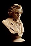 | |
|---|---|---|
| Music | ||
| Memorials | ||
| Depictions |
| |
| Family | ||
| Related | ||
| | This Alexander Island location article is a stub. You can help Wikipedia by expanding it. |