San Isidro de El General Airport is an airport serving the city of San Isidro de El General and Pérez Zeledón county, Costa Rica. The airport is 3 kilometres (2 mi) south of downtown San Isidro.

Herkale Airport is an airstrip 7 kilometres (4 mi) northwest of the hamlet of Khôr ‘Angar in Djibouti. Khôr ‘Angar is by the Bab-el-Mandeb strait, the entrance to the Red Sea.
San Gerónimo Airport is an airstrip serving Algarrobo, a Pacific coastal city in the Valparaíso Region of Chile. The airstrip is 4.6 kilometres (2.9 mi) inland from the coast.
El Algarrobo Airport Spanish: Aeropuerto El Algarrobo, is a rural airstrip 10 kilometres (6.2 mi) up a mountain valley from Cabildo, a town in the Valparaíso Region of Chile.
Santa Rita Airport is an airstrip 6 kilometres (3.7 mi) northwest of Casablanca, a city in the Valparaíso Region of Chile.
El Tapihue Airport (Spanish: Aeropuerto El Tapihue, is an airstrip 6 kilometres east of Casablanca, a city in the Valparaíso Region of Chile.
El Amarillo Airport Spanish: Aeropuerto El Amarillo, is an airstrip 21 kilometres (13 mi) east of Chaitén, a town in the Los Lagos Region of Chile. The Carretera Austral runs through the hamlet of El Amarillo, and passes the south end of the runway.
Viñamar Airport Spanish: Aeropuerto Viñamar, is an airstrip serving the Viñamar winery southeast of Casablanca, a city in the Valparaíso Region of Chile.

El Real de Santa María Airport is an airstrip serving the small town of El Real de Santa María, in the Darién Province of Panama. El Real is 6.5 kilometres (4.0 mi) southwest of Yaviza, the southern end of the North American section of the Pan American Highway. There are no paved roads between the two towns.
El Naranjo Airport is a rural airstrip near El Naranjo, a settlement in the diffuse agricultural community between Masagua, Obero, and Torremolinos in Escuintla Department, Guatemala.

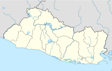
Barrillas Airport is an airport serving Puerto Barillas, a small-craft dockage on an arm of the Bahia de Jiquilisco, 10 kilometres (6.2 mi) southwest of Usulután in Usulután Department, El Salvador.
Ceiba Doblada Airport is an airstrip serving the village of Ceiba Doblada in Usulután Department, El Salvador. The unmarked grass runway is 8 kilometres (5.0 mi) east of the village.
Corral De Mulas Airport is an airport serving the village of Corral De Mulas in Usulután Department, El Salvador. The unmarked grass runway is west of and adjacent to the village.
Punta San Juan Airport is an airport serving the village of Corral De Mulas in Usulután Department, El Salvador. The unmarked grass runway is 7 kilometres (4.3 mi) east of the village on Punta San Juan, the western shore of the entrance to Bahia de Jiquilisco. Corral de Mulas is also served by Corral de Mulas Airport.
Casas Nuevas Airport is an airstrip serving the city of Jiquilisco in Usulután Department, El Salvador. The unmarked grass runway is 7 kilometres (4.3 mi) east of the city.
Los Comandos Airport is an airstrip serving the town of San Francisco Gotera in Morazán Department, El Salvador.
El Jocotillo Airport is an airport serving several small towns and villages in southern Sonsonate Department, El Salvador. The largest nearby city is the Pacific coastal port of Acajutla, at 10 kilometres (6.2 mi) west.
La Cabaña Airport is an airstrip serving the town of La Cabaña in San Salvador Department, El Salvador.
La Chepona Airport is an airstrip serving the village of La Chepona in Usulután Department, El Salvador. The airstrip and village are on an estuarian island just east of the Jiquilisco Bay.
Las Cachas Airport is an airstrip serving the hamlet of Cangrejera in La Libertad Department, El Salvador.