
Mount Whitney is the highest mountain in the contiguous United States, with an elevation of 14,505 feet (4,421 m). It is in East–Central California, in the Sierra Nevada, on the boundary between California's Inyo and Tulare counties, and 84.6 miles (136.2 km) west-northwest of North America's lowest topographic point, Badwater Basin in Death Valley National Park, at 282 ft (86 m) below sea level. The mountain's west slope is in Sequoia National Park and the summit is the southern terminus of the John Muir Trail, which runs 211.9 mi (341.0 km) from Happy Isles in Yosemite Valley. The eastern slopes are in Inyo National Forest in Inyo County. Mount Whitney is ranked 18th by topographic isolation.

Bridge Mountain is a mountain located in the Spring Mountain range of southern Nevada. It is located on land managed by the United States Bureau of Land Management as the Red Rock Canyon National Conservation Area, part of the Rainbow Mountain Wilderness. Bridge Mountain is named for the natural feature of a bridge-like natural arch of sandstone near the summit.

Mount Diablo is a mountain of the Diablo Range, in Contra Costa County of the eastern San Francisco Bay Area in Northern California. It is south of Clayton and northeast of Danville. It is an isolated upthrust peak of 3,849 feet, visible from most of the San Francisco Bay Area. Mount Diablo appears from many angles to be a double pyramid and has many subsidiary peaks. The largest and closest is North Peak, the other half of the double pyramid, which is nearly as high in elevation at 3,557 feet (1,084 m), and is about one mile northeast of the main summit.
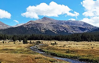
Mount Gibbs is located in the Sierra Nevada of the U.S. state of California, 2.6 miles (4 km) south of Mount Dana. The mountain was named in honor of Oliver Gibbs, a professor at Harvard University and friend of Josiah Whitney. The summit marks the boundary between Yosemite National Park and the Ansel Adams Wilderness, and Mount Gibbs is the sixth-highest mountain, of Yosemite.

White Mountain Peak, at 14,252 feet (4,344 m), is the highest peak in the White Mountains of California, the highest peak in Mono County, and the third highest peak in the state after Mount Whitney and Mount Williamson. In spite of its name, the summit block of the peak has large swaths of very dark and colorful orange scree and rock; it is composed of Mesozoic metavolcanic rock, which is igneous rock altered by rising granite.
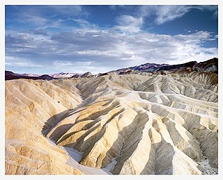
Places of interest in the Death Valley area are mostly located within Death Valley National Park in eastern California.

Mount San Antonio, commonly referred to as Mount Baldy or Old Baldy, is a 10,064 ft (3,068 m) summit in the San Gabriel Mountains on the border of Los Angeles and San Bernardino counties of California. Lying within the San Gabriel Mountains National Monument and Angeles National Forest, it is the highest point within the mountain range, the County of Los Angeles, and the Los Angeles metropolitan area.

El Escorpión Park is a three-acre park located in the Simi Hills of the western San Fernando Valley, in the West Hills district of Los Angeles, California. The park contains the geographic landmark known as Escorpión Peak or Castle Peak, a 1,475-foot-tall rocky peak seen from most parts of the park and the surrounding community.
The Spring Mountains National Recreation Area (SMNRA) is a U.S. national recreation area, administered by the U.S. Forest Service, west of Las Vegas, Nevada. It covers over 316,000 acres. The area runs from low meadows, to the 11,918-foot (3,633 m) Mount Charleston. The SMNRA is a part of the Humboldt-Toiyabe National Forest. It adjoins the Red Rock Canyon National Conservation Area, which is administered by the Bureau of Land Management.

Uvas Canyon County Park is a 1,147-acre (464 ha) natural park located in upper Uvas Canyon on the eastern side of the Santa Cruz Mountains, west of Morgan Hill, California. The park has several small waterfalls, some of which flow perennially, that feed into tributaries confluent with Uvas Creek. The park is part of the Santa Clara County Parks System, and facilitates picnics, hiking and overnight camping. It is one of the few parks in the area that allows dogs in the campgrounds.

Telescope Peak is the highest point within Death Valley National Park, in the U.S. state of California. It is also the highest point of the Panamint Range, and lies in Inyo County. From atop this desert mountain one can see for over one hundred miles in many directions, including west to Mount Whitney, and east to Charleston Peak. The mountain was named for the great distance visible from the summit.

Mount Sill is one of the fourteeners of the Sierra Nevada in California. It is located in the Palisades, a group of prominent rock peaks with a few small glaciers on their flanks. Mount Sill is located 0.6 miles (1 km) east of North Palisade, the high point of the group. The two peaks are connected by a high, rocky ridge, on the north side of which lies the Palisade Glacier. Mount Sill lies on the main Sierra Crest, but is at a point where the crest turns sharply, giving it particularly striking summit views. On one side is Kings Canyon National Park and Fresno County; on the other is the John Muir Wilderness, Inyo National Forest and Inyo County.

Mount Hood, also known as Hood Mountain, is a mountain near the southeastern edge of Santa Rosa, California, at the northeast of the Sonoma Valley and attains a height of 2,733 feet (833 m). The original name was Mount Wilikos, an Indian name meaning "willows." Most of the drainage from Mount Hood contributes to the headwaters of Sonoma Creek. A prominent feature is the extensive rock face visible on the upper half of the mountain as viewed from State Route 12. The habitats on the mountain include mixed oak forest, pygmy forest, chaparral and riparian zones. In prehistoric times the slopes of Mount Hood were inhabited by a division of the Yuki tribe. Most of Mount Hood is within the Hood Mountain Regional Park maintained by Sonoma County. Mount Hood is part of the inner coast Mayacamas Range, and lies mostly within Sonoma County, with a part of the mountain geographically within Napa County. Mount Hood affords overlooks of the Pacific Ocean, San Francisco Bay and "a spectacular view east to the Sierra Nevada Range."

Clouds Rest is a mountain in Yosemite National Park, located east-northeast of Yosemite Village, California. Although there are many peaks in the park having far greater elevation, the proximity of Clouds Rest to the valley gives it a very high degree of visual prominence.

Eaton Canyon is a major canyon beginning at the Eaton Saddle near Mount Markham and San Gabriel Peak in the San Gabriel Mountains in the Angeles National Forest, United States. Its drainage flows into the Rio Hondo river and then into the Los Angeles River. It is named after Judge Benjamin S. Eaton, who lived in the Fair Oaks Ranch House in 1865 not far from Eaton Creek.

Mount Morgan is a mountain located in northwestern Inyo County, California, in the John Muir Wilderness of the Inyo National Forest.
The Piper Mountain Wilderness is a federally designated wilderness area located in the White Mountains 20 miles (32 km) northeast of Big Pine, California in Inyo County, California.

Bear Peak is a mountain summit in the Front Range of the Rocky Mountains of North America. The 8,459-foot (2,578 m) peak is located in Boulder Mountain Park, 5.2 miles (8.3 km) south-southwest of downtown Boulder in Boulder County, Colorado, United States.
Los Pinos Peak is a 4,455-foot (1,358 m) summit in the Santa Ana Mountains in Orange County, California, about 8 miles (13 km) east of Rancho Santa Margarita. Los Pinos is the southernmost peak above 4,000 feet (1,200 m) in the Santa Anas, and provides extensive views south towards San Diego and the Pacific Ocean as well as views of the San Jacinto Mountains and San Bernardino Mountains in the east. The summit rises rather prominently above the main crest of the Santa Anas and is conspicuously visible from much of southern Orange County, although its actual topographic prominence is only about 610 feet (186 m).

