White Sands is a census-designated place (CDP) in Doña Ana County, New Mexico, United States. It consists of the main residential area on the White Sands Missile Range. As of the 2010 census the population of the CDP was 1,651. It is part of the Las Cruces Metropolitan Statistical Area.

Alamogordo is the seat of Otero County, New Mexico, United States. A city in the Tularosa Basin of the Chihuahuan Desert, it is bordered on the east by the Sacramento Mountains and to the west by Holloman Air Force Base. The population was 30,403 as of the 2010 census. Alamogordo is known for its connection with the 1945 Trinity test, which was the first ever explosion of an atomic bomb.

Tularosa is a village in Otero County, New Mexico. It shares its name with the Tularosa Basin, in which the town is located. To the east, Tularosa is flanked by the western edge of the Sacramento Mountains. The population was 2,842 at the 2010 census. During the 1990s and early 2000s, the town, north of the much larger Alamogordo, experienced moderate growth and construction as a bedroom community, especially in the housing industry. Tularosa is noted for its abundance of cottonwood shade trees and its efforts to preserve the adobe-style architecture of its past.

Oryx is a genus consisting of four large antelope species called oryxes. Their pelage is pale with contrasting dark markings in the face and on the legs, and their long horns are almost straight. The exception is the scimitar oryx, which lacks dark markings on the legs, only has faint dark markings on the head, has an ochre neck, and has horns that are clearly decurved.

White Sands National Park is an American national park located in the state of New Mexico and completely surrounded by the White Sands Missile Range. The park covers 145,762 acres in the Tularosa Basin, including the southern 41% of a 275 sq mi (710 km2) field of white sand dunes composed of gypsum crystals. This gypsum dunefield is the largest of its kind on Earth, with a depth of about 30 feet (9.1 m), dunes as tall as 60 feet (18 m), and about 4.5 billion short tons of gypsum sand.

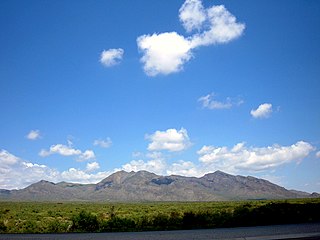
The Sacramento Mountains are a mountain range in the south-central part of the U.S. state of New Mexico, lying just east of Alamogordo in Otero County. From north to south, the Sacramento Mountains extend for 85 miles (137 km), and from east to west they encompass 42 miles (68 km).

The gemsbok, gemsbuck or South African oryx is a large antelope in the genus Oryx. It is native to the arid regions of Southern Africa, such as the Kalahari Desert. Some authorities formerly included the East African oryx as a subspecies.

The Sierra Blanca is an ultra-prominent range of volcanic mountains in Lincoln and Otero counties in the south-central part of the U.S. state of New Mexico. The range is about 40 miles (64 km) from north to south and 20 miles (32 km) wide.

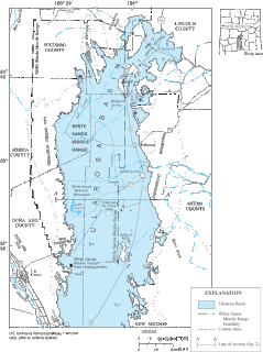
The Tularosa Basin is a graben basin in the Basin and Range Province and within the Chihuahuan Desert, east of the Rio Grande in southern New Mexico and West Texas, in the Southwestern United States.

Organ Needle is the highest point of the Organ Mountains in the south-central part of the U.S. state of New Mexico. It lies in Doña Ana County, 13 miles (20,921 m) east-northeast of Las Cruces and 4 miles (6 km) southwest of White Sands, headquarters of the White Sands Missile Range. It is at the southeast end of a narrow ridge of vertically jointed granite called The Needles.

Oliver Lee Memorial State Park is a state park of New Mexico, United States, whose two tracts preserve a canyon in the Sacramento Mountains and Oliver Lee's historic 19th-century ranch house. The 640-acre (260 ha) park is located in Otero County at an elevation of 4,363 feet (1,330 m). It is situated at the base of Dog Canyon and provides opportunities for camping, hiking, picnicking, wildlife viewing, a nature trail, and guided tours of the ranch house.
The White Sands pupfish is a species of pupfish in the family Cyprinodontidae. It is endemic to the Tularosa Basin in southern New Mexico, in the Western United States. They are only found in two springs and two small streams in southwest New Mexico. White Sands pupfish have dark eyes and silver scales. They grow from 1+3⁄4 to 2+1⁄2 inches long. Adult males have a slight blue color.
The Tularosa Basin Museum of History, formerly the Tularosa Basin Historical Society Museum, is a history museum holding a collection of historical photographs, documents, and relics from Otero County, New Mexico. The museum is located in Alamogordo, New Mexico, and is owned and operated by the Tularosa Basin Historical Society.
Euxesta abana is a species of ulidiid or picture-winged fly in the genus Euxesta of the family Ulidiidae. It was described by Charles Howard Curran in 1935. The species can be found at White Sands National Park in Tularosa Basin, New Mexico.
Euxesta contorta is a species of ulidiid or picture-winged fly in the genus Euxesta of the family Ulidiidae. It was described by Charles Howard Curran in 1935.
Euxesta rubida is a species of ulidiid or picture-winged fly in the genus Euxesta of the family Ulidiidae. It was described by Charles Howard Curran in 1935.
Euxesta lutzi is a species of ulidiid or picture-winged fly in the genus Euxesta of the family Tephritidae. It was described by Charles Howard Curran in 1935.

The San Andres National Wildlife Refuge is located in the southern San Andres Mountains of southcentral New Mexico, USA. The refuge, which lies within the northernmost extension of the Chihuahuan Desert, has elevations ranging from 4,200 feet (1,300 m) to 8,239 feet (2,511 m) feet. Refuge habitats vary from creosote and Chihuahuan desert grasslands in the bajadas to pinyon-juniper woodlands at higher elevations. A few springs, seeps, and seasonal streams provide water for wildlife and riparian habitats in the refuge.

The New Mexico Department of Game and Fish (NMDGF) is a state-level government department within the New Mexico Governor's Cabinet that is responsible for maintaining wildlife and fish in the state. The NMDGF undertakes protection, conservation and propagation, and regulates the use of game and fish to ensure there is an adequate supply for recreation and food.

U.S. Route 70 (US 70) is a part of the U.S. Highway System that travels from Globe, Arizona, east to Atlantic, North Carolina. In the U.S. state of New Mexico, US 70 extends from the Arizona state line south of Virden and ends at the Texas state line in Texico.


