
Urban renewal is a program of land redevelopment often used to address urban decay in cities. Urban renewal involves the clearing out of blighted areas in inner cities in favour of new housing, businesses, and other developments.
Sharpeville is a township situated between two large industrial cities, Vanderbijlpark and Vereeniging, in southern Gauteng, South Africa. Sharpeville is one of the oldest of six townships in the Vaal Triangle. It was named after John Lillie Sharpe who came to South Africa from Glasgow, Scotland, as secretary of Stewarts & Lloyds. Sharpe was elected to the Vereeniging City Council in 1932 and held the position of mayor from 1934 to 1937.
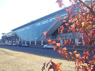
Centurion is an area with 236,580 inhabitants in the Gauteng Province of South Africa, between Pretoria and Midrand. Formerly an independent municipality, with its own town council, it has been part of the City of Tshwane Metropolitan Municipality since 2000. Its heart is at the intersection of the N1 and N14 freeways. The R21 freeway also passes through the eastern part of Centurion.

The Vaal Triangle is a triangular area formed by Vereeniging, Vanderbijlpark and Sasolburg about 60 km south of Johannesburg, South Africa. The area forms a substantial urban complex. Meyerton, just north of Vereeniging, is also sometimes included in the complex, and residents of Sharpeville, Boipatong, Bophelong, the greater Sebokeng area, Three Rivers, Heidelberg and Deneysville also generally tend to consider themselves to live in the Vaal Triangle. The area straddles the Vaal River and is a major industrial region, which is home to former Iron and Steel Corporation Iscor, now ArcelorMittal South Africa, and Sasol, respectively the steel and petrochemical processing facilities.

Vereeniging is a city located in the south of Gauteng province, South Africa, situated where the Klip River empties into the northern loop of the Vaal River. It is also one of the constituent parts of the Vaal Triangle region and was formerly situated in the Transvaal province. Vereeniging is the third largest city in Gauteng. The name Vereeniging is the Dutch word meaning "association", although the spelling has since changed to vereniging, with a single e.
Alexandra, informally abbreviated to Alex, is a township in the Gauteng province of South Africa. It forms part of the City of Johannesburg Metropolitan Municipality and is located next to the wealthy suburb of Sandton. Alexandra is bounded by Wynberg on the west, Marlboro and Kelvin on the north, Kew, Lombardy West and Lombardy East on the south. Alexandra is one of the poorest urban areas in the country. Alexandra is situated on the banks of the Jukskei River. In addition to its original, reasonably well-built houses, it also has a large number of informal dwellings or "shacks" called imikhukhu.
Sebokeng locally called Zweni by residents, is a middle-class township in the Emfuleni Local Municipality in southern Gauteng, South Africa near the industrial cities of Vanderbijlpark and Vereeniging. Other neighboring townships include Evaton to the north and Sharpeville to the south.

Vanderbijlpark is an industrial city with approximately 95,000 inhabitants, situated on the Vaal River in the south of Gauteng province, South Africa. The city is named after Hendrik van der Bijl, an electrical engineer and industrialist.

The R28 is a provincial route in Gauteng, South Africa that connects Krugersdorp with Vereeniging via Randfontein. The R28 used to connect with Pretoria, but that section of the road is now part of the N14.

The R82 is a provincial route in South Africa that connects Johannesburg with Kroonstad via Vereeniging and Sasolburg. It starts just south of the M1 Johannesburg Municipal Highway's interchange with the N12 Southern Bypass, going south, meeting the R59, R54, R42 & R28 routes at Vereeniging before crossing the Vaal River into the Free State & proceeding to Kroonstad. It is an alternative, but longer route to the N1 national route between Johannesburg & Kroonstad.
Marlboro is part of the City of Johannesburg Metropolitan Municipality and is a suburb of Sandton.
Bophelong meaning 'a place of life' is a township near Vanderbijlpark, Gauteng, South Africa. It was established in 1955 to house black residents who worked in Vanderbijlpark and Vereeniging.
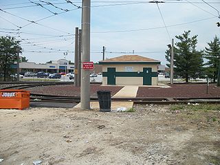
Eastwick is a neighborhood in the Southwest section of Philadelphia, Pennsylvania, United States. It is the southwesternmost neighborhood in the city, bordering Philadelphia International Airport and the city line with Delaware County at Cobbs Creek and Darby Creek. The Elmwood Park neighborhood borders it to the northeast. It includes the Clearview neighborhood.
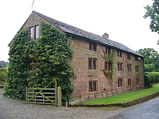
Utkinton is a village and former civil parish, now in the parishes of Utkinton and Cotebrook, in the unitary authority area of Cheshire West and Chester and the ceremonial county of Cheshire, England. It is approximately 2 miles (3.2 km) north of Tarporley, 8 miles (13 km) west of Winsford and 9 miles (14 km) east of Chester. The upper part of Utkinton is known as 'Quarry Bank'. Utkinton is at the heart of the local farming community. The area is also on the Sandstone Trail.
The Diocese of Christ the King is a diocese of the Anglican Church of Southern Africa in the southern part of Gauteng province, South Africa.

Emfuleni Municipality is a local municipality within the Sedibeng District Municipality, in the Gauteng province of South Africa. It is the westernmost local municipality in the district, and covers an area of 987 km2 at the heart of the Vaal Triangle. It is located in the former industrial heartland of Gauteng which created employment and wealth for Sebokeng, Vanderbijlpark, Vereeniging, Three Rivers and Sharpeville. Its head offices are located at the corner of Klasie Havenga St and Frikkie Meyer Blvd, Vanderbijlpark. The municipality was founded in 1999.

Slotermeer is a neighborhood of Amsterdam, Netherlands, in the Dutch province of North Holland. The name of Slotermeer comes from the Slootermeer Lake that used to be in this area
The R551 is a Regional Route in Gauteng, South Africa that connects Evaton and Orange Farm with the Suikerbosrand Nature Reserve via Meyerton.
Mokhaugelo Solomon Chabalala is a South African politician and a Member of the Gauteng Provincial Legislature for the Democratic Alliance.


