
The Vaal River is the largest tributary of the Orange River in South Africa. The river has its source near Breyten in Mpumalanga province, east of Johannesburg and about 30 kilometres (19 mi) north of Ermelo and only about 240 kilometres (150 mi) from the Indian Ocean. It then flows westwards to its conjunction with the Orange River southwest of Kimberley in the Northern Cape. It is 1,120 kilometres (700 mi) long, and forms the border between Mpumalanga, Gauteng and North West Province on its north bank, and the Free State on its south.
The Province of the Transvaal, commonly referred to as the Transvaal, was a province of South Africa from 1910 until 1994, when a new constitution subdivided it following the end of apartheid. The name "Transvaal" refers to the province's geographical location to the north of the Vaal River. Its capital was Pretoria, which was also the country's executive capital.

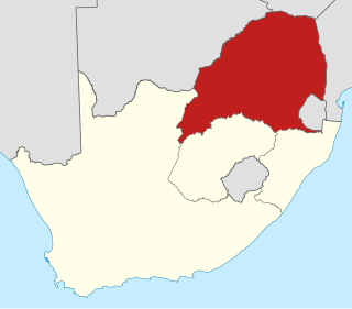
Gauteng is one of the nine provinces of South Africa. The name in Sotho-Tswana languages means "place of gold".

The Vaal Triangle is a triangular area formed by Vereeniging, Vanderbijlpark and Sasolburg about 60km south of Johannesburg, South Africa. The area forms a substantial urban complex. Meyerton, just north of Vereeniging, is also generally included in the complex, and residents of Sharpeville, Boipatong, Bophelong, the greater Sebokeng area, Heidelberg, Zamdela, Deneysville and Potchefstroom also generally tend to consider themselves to live in the Vaal Triangle. The area straddles the Vaal River and is a major industrial region, which is home to former Iron and Steel Corporation Iscor, now ArcelorMittal South Africa, and Sasol, the steel and petrochemical processing facilities.

The Vaal Dam in South Africa was constructed in 1938 and lies 77 km south of OR Tambo International Airport. The lake behind the dam wall has a surface area of about 320 square kilometres (120 sq mi) and is 47 meters deep. The Vaal Dam lies on the Vaal River, which is one of South Africa's strongest-flowing rivers. Other rivers flowing into the dam are the Wilge River, Klip River, Molspruit and Grootspruit. It has over 800 kilometres (500 mi) of shoreline and is South Africa's second biggest dam by area and the fourth largest by volume.

Vereeniging is a city located in the south of Gauteng province, South Africa, situated where the Klip River empties into the northern loop of the Vaal River. It is also one of the constituent parts of the Vaal Triangle region and was formerly situated in the Transvaal province. The name Vereeniging is derived from the Dutch word meaning "union".

The N1 is a national route in South Africa that runs from Cape Town through Bloemfontein, Johannesburg, Pretoria and Polokwane to Beit Bridge on the border with Zimbabwe. It forms the first section of the famed Cape to Cairo Road.

Warrenton is an agricultural town of approximately 18,000 people in the Northern Cape province of South Africa, situated 70 kilometres (40 mi) north of Kimberley on the Vaal River.

The R42 is a provincial route in South Africa that connects Vanderbijlpark with Bronkhorstspruit via Vereeniging, Heidelberg, Nigel and Delmas.
The R54 is a provincial route in South Africa that connects Potchefstroom with Villiers via Vereeniging.

Sedibeng is one of the districts of the Gauteng province of South Africa. The administrative seat of Sedibeng is Vereeniging. The most widely spoken language among its 794,605 inhabitants is Sesotho.

Foundation of Tertiary Institutions of the Northern Metropolis, FOTIM, is the biggest academic association in South Africa. FOTIM consists of nine universities and universities of technology in the Gauteng, Limpopo Province and North West Province.

The Falcons – better known by their Afrikaans name the Valke and now known as the Hino Valke for sponsorship reasons – are a South African rugby union team in Gauteng province that participates in the annual Currie Cup tournament.

Three Rivers Proper is a suburb of Vereeniging, Gauteng, South Africa.

Midvaal Local Municipality is an administrative area within the Sedibeng District Municipality of Gauteng in South Africa. The municipality's name references its geographical location halfway between Johannesburg and East Rand and the Vaal and Vereeniging areas.
The Vaal River Barrage Reservoir is a dam on the Vaal River near Vanderbijlpark, border Gauteng and Free State, South Africa.
Transvaal is a historical geographic term associated with land north of the Vaal River in South Africa. A number of states and administrative divisions have carried the name Transvaal.

The Wilge River is a tributary of the Vaal River in central South Africa. This river is important as part of the Tugela-Vaal Water Transfer Scheme where water is transferred from the Tugela River basin to the Vaal River basin.
The R549 is a Regional Route in South Africa that connects Heidelberg in Gauteng with Deneysville in the Free State.
The R716 is a Regional Route in South Africa that connects Vanderbijlpark with the R26 between Villiers and Frankfort. It passes through Deneysville and Oranjeville.


