
Lowesville is a census-designated place (CDP) in Lincoln County, North Carolina, United States. The population was 2,945 at the 2010 census, up from 1,440 in 2000.
Granville South is a census-designated place (CDP) in Licking County, Ohio, United States. The population was 1,420 at the 2020 census.
Bethel is a census-designated place (CDP) in Kitsap County, Washington, United States. Located a few miles south of the city of Port Orchard, Bethel is a wooded residential area. Most residents commute to Port Orchard or nearby cities. It was first designated a place by the Census Bureau in the 2010 Census, at which time its population was 3,713.
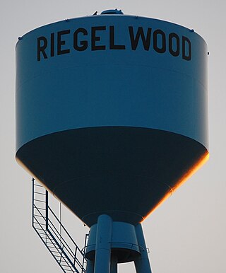
Riegelwood is an unincorporated community and census-designated place (CDP) which sprawls across three counties: Brunswick County, North Carolina; Pender County, North Carolina; Columbus County, North Carolina, United States. As of the 2010 census it had a population of 579. It is the location of a saw mill and a paper mill.

Miamitown is a census-designated place (CDP) in western Whitewater Township, Hamilton County, Ohio, United States. The population was 1,256 at the 2020 census. It has a post office with the ZIP code 45041.

Scipio is an unincorporated community and census-designated place (CDP) in Geneva Township, Jennings County, Indiana, United States. As of the 2010 census it had a population of 153.

Etna is an unincorporated community and census-designated place (CDP) in Licking County, Ohio, United States. As of the 2020 census it had a population of 1,209. It lies at an elevation of 1,069 feet (326 m) at the intersection of U.S. Route 40 and State Route 310. It was listed as a census-designated place in 2010.
Delco is an unincorporated community and census-designated place (CDP) in Columbus County, North Carolina, United States. The population was 348 at the 2010 census.

Engelhard is a census-designated place (CDP) and fishing community in Lake Landing Township on the mainland of Hyde County, North Carolina, United States. It has access to Pamlico Sound. As of the 2010 census it had a population of 445.
Potters Hill is an unincorporated community and census-designated place (CDP) in Duplin County, North Carolina, United States. As of the 2010 United States Census, Potters Hill had a population of 481 and a land area of 5.35 square miles (13.9 km2).
Fruitland is an unincorporated community and census-designated place (CDP) in Henderson County, North Carolina, United States. Its population was 2,031 as of the 2010 census.
Country Squire Lakes is an unincorporated community and census-designated place (CDP) in Geneva Township, Jennings County, Indiana, United States. As of the 2010 census it had a population of 3,571.
Rainbow Lakes is a census-designated place (CDP) in Parsippany-Troy Hills, Morris County, in the U.S. state of New Jersey. It is in the western part of the township and consists of housing built around Rainbow Lake, plus a zone of commercial buildings to the east of the lakes. It is bordered to the east by Parsippany proper, to the north by the borough of Mountain Lakes, and to the west by Denville Township. The northern edge of the CDP is formed by U.S. Route 46 and the NJ Transit Montclair-Boonton Line, and Interstate 80 forms the southern edge. It is 21 miles (34 km) northwest of Newark and 30 miles (48 km) west of the George Washington Bridge over the Hudson River.
Brandywine Bay is a planned community and census-designated place (CDP) in Carteret County, North Carolina, United States. It was first listed as a CDP in the 2020 census with a population of 1,153.

Salem Heights is an unincorporated community and census-designated place (CDP) in Columbiana County, Ohio, United States. It was first listed as a CDP prior to the 2020 census, in which its population was 336. Salem Heights sits on the 1,275-foot (389 m) Blackburn Hill, separated from the city of Salem by the valley of the Middle Fork of the Little Beaver Creek. It is part of the Salem micropolitan area.
Leamersville is an unincorporated community and census-designated place (CDP) in Blair County, Pennsylvania, United States. It was first listed as a CDP prior to the 2020 census.
Finklea is an unincorporated community and census-designated place (CDP) in Horry County, South Carolina, United States. As of the 2020 census it had a population of 291.
Capitol View is an unincorporated part of Richland County, South Carolina, United States, consisting of several neighborhoods that are next to the city of Columbia, the state capital. The area was first listed as a census-designated place (CDP) prior to the 2020 census. In 2020 its population was 4,653.
East Basin is an unincorporated area and census-designated place (CDP) in Summit County, Utah, United States. It was first listed as a CDP prior to the 2020 census.
Fairfield is an unincorporated community and census-designated place (CDP) in Rockbridge County, Virginia, United States. As of the 2020 census, it had a population of 257.


