Ewoldt Township, Carroll County | |
|---|---|
 | |
| Coordinates: 41°54′21″N095°01′53″W / 41.90583°N 95.03139°W | |
| Country | |
| State | |
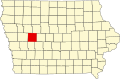
| County | Carroll |
| Area | |
• Total | 33.78 sq mi (87.49 km2) |
| • Land | 33.77 sq mi (87.47 km2) |
| • Water | 0.0077 sq mi (0.02 km2) |
| Elevation | 1,358 ft (414 m) |
| Population (2000) | |
• Total | 282 |
| • Density | 8.3/sq mi (3.2/km2) |
| FIPS code | 19-91254 [2] |
| GNIS feature ID | 0467802 |
Ewoldt Township is one of eighteen townships in Carroll County, Iowa, United States. As of the 2000 census, its population was 282.