Maple River, Iowa | |
|---|---|
 Maple River, Iowa | |
| Coordinates: 42°05′53″N94°56′07″W / 42.09806°N 94.93528°W | |
| Country | United States |
| State | Iowa |
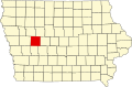
| County | Carroll |
| Elevation | 1,276 ft (389 m) |
| Time zone | UTC-6 (Central (CST)) |
| • Summer (DST) | UTC-5 (CDT) |
| Area code | 712 |
| GNIS feature ID | 458786 [1] |
Maple River is an unincorporated community in Carroll County, in the U.S. state of Iowa. [1]