Maple River Township, Carroll County | |
|---|---|
 | |
| Coordinates: 42°04′49″N094°55′15″W / 42.08028°N 94.92083°W | |
| Country | |
| State | |
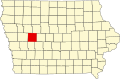
| County | Carroll |
| Area | |
• Total | 32.95 sq mi (85.34 km2) |
| • Land | 32.95 sq mi (85.34 km2) |
| • Water | 0 sq mi (0 km2) |
| Elevation | 1,260 ft (384 m) |
| Population (2000) | |
• Total | 510 |
| • Density | 16/sq mi (6/km2) |
| FIPS code | 19-92820 [2] |
| GNIS feature ID | 0468342 |
Maple River Township is one of eighteen townships in Carroll County, Iowa, United States. As of the 2000 census, its population was 510.