Kniest Township, Carroll County | |
|---|---|
 | |
| Coordinates: 42°09′59″N094°54′47″W / 42.16639°N 94.91306°W | |
| Country | |
| State | |
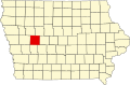
| County | Carroll |
| Area | |
• Total | 35.68 sq mi (92.41 km2) |
| • Land | 35.7 sq mi (92.4 km2) |
| • Water | 0.0039 sq mi (0.01 km2) |
| Elevation | 1,270 ft (387 m) |
| Population (2000) | |
• Total | 441 |
| • Density | 12/sq mi (4.8/km2) |
| FIPS code | 19-92319 [2] |
| GNIS feature ID | 0468169 |
Kniest Township is one of eighteen townships in Carroll County, Iowa, USA. As of the 2000 census, its population was 441.