External massif

Last updated
Location of the external massifs of the Alps External crystalline massifs of the Alps.png
Location of the external massifs of the Alps

An external massif is, in the geology of the Alps, a place where crystalline rocks of the European plate crop out. Such massifs are found north and west of the Penninic zone (the crystalline "core" of the Alps) as tectonic windows in the Helvetic Zone. They differ from the crystalline nappes in that they were originally part of the European plate, while the Penninic nappes were part of the crust below various domains in the Tethys Ocean. [1]

The Alps form part of a Cenozoic orogenic belt of mountain chains, called the Alpide belt, that stretches through southern Europe and Asia from the Atlantic all the way to the Himalayas. This belt of mountain chains was formed during the Alpine orogeny. A gap in these mountain chains in central Europe separates the Alps from the Carpathians to the east. Orogeny took place continuously and tectonic subsidence has produced the gaps in between.

Outcrop visible exposure of bedrock or ancient superficial deposits on the surface of the Earth

An outcrop or rocky outcrop is a visible exposure of bedrock or ancient superficial deposits on the surface of the Earth.

In geology, a massif is a section of a planet's crust that is demarcated by faults or flexures. In the movement of the crust, a massif tends to retain its internal structure while being displaced as a whole. The term also refers to a group of mountains formed by such a structure.

The external massifs are the Argentera in the Alpes Maritimes, the Pelvoux massif and the Belledonne range in the Dauphiné part of the French Alps, the Aiguilles Rouges in the Savoy part of the French Alps, the Mont Blanc Massif at the borders between France, Italy and Switzerland and the Aarmassif and Gotthardmassif in the Central Alps of Switzerland.

Belledonne mountain range

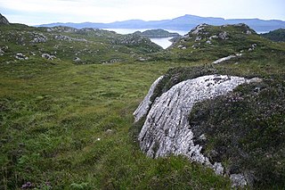
Belledonne is a mountain range in the Dauphiné Alps in southeast France. The southern end of the range forms the eastern wall of the mountains that surround the city of Grenoble.

Dauphiné Place in France

The Dauphiné or Dauphiné Viennois, formerly Dauphiny in English, is a former province in southeastern France, whose area roughly corresponded to that of the present departments of Isère, Drôme, and Hautes-Alpes. The Dauphiné was originally the County of Albon.

The Aiguilles Rouges are a crystalline mountainous massif of the French Prealps, opposite the Mont Blanc Massif. The colour of the iron rich gneiss (metamorphique) mountains gives the range its name. The highest summit is the Aiguille du Belvédère at 2,965 metres (9,728 ft). At the southern end of the range, Le Brévent at 2,525 metres (8,284 ft) is accessible by a cable car in the Planpraz and the Brévent sections.

The massifs are composed of the basement of the former margin of the European plate, consisting of metamorphic and igneous rocks of Hercynian age or older. The Mesozoic cover that was originally on top of these rock has mostly been detached by thin skinned thrusting about 40 to 25 million years ago (Ma). [2] At some places along the Aarmassif, the Mesozoic cover is partly still lying conformally on top of the Hercynian basement rock, this Mesozoic is called the Infrahelvetic complex. The uplift that brought the massifs to the surface involved thick skinned thrusting (the style of thrusting in which the basement is itself involved) and took place in a tectonic phase beginning around 19 million years ago. [2]

Basement (geology) Metamorphic or igneous rocks below a sedimentary platform or cover

In geology, basement and crystalline basement are the rocks below a sedimentary platform or cover, or more generally any rock below sedimentary rocks or sedimentary basins that are metamorphic or igneous in origin. In the same way, the sediments or sedimentary rocks on top of the basement can be called a "cover" or "sedimentary cover".

Metamorphic rock Rock which was subjected to heat and pressure causing profound physical or chemical change

Metamorphic rocks arise from the transformation of existing rock types, in a process called metamorphism, which means "change in form". The original rock (protolith) is subjected to heat and pressure, causing profound physical or chemical change. The protolith may be a sedimentary, igneous, or existing metamorphic rock.

Igneous rock Rock formed through the cooling and solidification of magma or lava

Igneous rock, or magmatic rock, is one of the three main rock types, the others being sedimentary and metamorphic. Igneous rock is formed through the cooling and solidification of magma or lava. The magma can be derived from partial melts of existing rocks in either a planet's mantle or crust. Typically, the melting is caused by one or more of three processes: an increase in temperature, a decrease in pressure, or a change in composition. Solidification into rock occurs either below the surface as intrusive rocks or on the surface as extrusive rocks. Igneous rock may form with crystallization to form granular, crystalline rocks, or without crystallization to form natural glasses. Igneous rocks occur in a wide range of geological settings: shields, platforms, orogens, basins, large igneous provinces, extended crust and oceanic crust.

Related Research Articles

Nappe A large sheetlike body of rock that has been moved a considerable distance above a thrust fault

In geology, a nappe or thrust sheet is a large sheetlike body of rock that has been moved more than 2 km (1.2 mi) or 5 km (3.1 mi) above a thrust fault from its original position. Nappes form in compressional tectonic settings like continental collision zones or on the overriding plate in active subduction zones. Nappes form when a mass of rock is forced over another rock mass, typically on a low angle fault plane. The resulting structure may include large-scale recumbent folds, shearing along the fault plane, imbricate thrust stacks, fensters and klippe.

Helvetic (geology)

The Helvetic zone, Helvetic system or the Helveticum is a geologic subdivision of the Alps. The Helvetic zone crops out mainly in Switzerland, hence the name. Rocks in the Helvetic zone are sedimentary and were originally deposited at the southern margin of the European plate. The Helvetic zone correlates with the French Dauphinois zone, French geologists often prefer the French name but normally this is considered the same thing.

Penninic

The Penninic nappes or the Penninicum are one of three nappe stacks and geological zones in which the Alps can be divided. In the western Alps the Penninic nappes are more obviously present than in the eastern Alps, where they crop out as a narrow band. The name Penninic is derived from the Pennine Alps, an area in which rocks from the Penninic nappes are abundant.

Austroalpine nappes

The Austroalpine nappes are a geological nappe stack in the European Alps. The Alps contain three such stacks, of which the Austroalpine nappes are structurally on top of the other two. The name Austroalpine means Southern Alpine, because these nappes crop out mainly in the Eastern Alps.

Aarmassif

The Aarmassif or Aaremassif is a geologic massif in the Swiss Alps. It contains a number of large mountain chains and parts of mountain chains.

Valais Ocean Subducted ocean basin. Remnants found in the Alps in the North Penninic nappes.

The Valais Ocean is a subducted oceanic basin which was situated between the continent Europe and the microcontinent Iberia or so called Briançonnais microcontinent. Remnants of the Valais ocean are found in the western Alps and in tectonic windows of the eastern Alps and are mapped as the so-called "north Penninic" nappes.

Greywacke zone

The greywacke zone is a band of Paleozoic metamorphosed sedimentary rocks that forms an east-west band through the Austrian Alps.

Penninic thrustfront

The Penninic thrustfront is a major tectonic thrustfront in the French Alps. The thrustfront moves over a developing decollement horizon, and separates the (internal) high grade metamorphic rocks of the Penninic nappes from the (external) sedimentary rocks and crystalline basement of the Helvetic nappes. The last are in France often called zone Dauphiné or Dauphinois.

Western Carpathians Mountain range along the border between Poland, the Czech Republic, and Slovakia

The Western Carpathians are a mountain range and geomorphological province that forms the western part of the Carpathian Mountains.

Fatra-Tatra Area

The Fatra-Tatra Area or the Tatra-Fatra Belt of core mountains is a part of the Inner Western Carpathians, a subprovince of the Western Carpathians. Most of the area lies in Slovakia with small parts reaching into Austria and Poland. The highest summit of the whole Carpathians, the Gerlachovský štít at 2,655 m (8,711 ft), lies in the High Tatras range which belongs to this area.

The Helvetic nappes are a series of nappes in the Northern part of the Alps and part of the Helvetic zone. They consist of Mesozoic limestones, shales and marls that were originally deposited on the southern continental margin of the European continent. During the Alpine orogeny they were thrusted north over a décollement and at the same time were internally deformed by folding and thrusting.

The Infrahelvetic complex is a tectonic unit in the Swiss Alps. It consists of autochthonous rocks of the former southern continental margin of the European Plate.

Moldanubian Zone A tectonic zone in Europe formed during the Variscan or Hercynian Orogeny

The Moldanubian Zone is in the regional geology of Europe a tectonic zone formed during the Variscan or Hercynian Orogeny. The Moldanubian Zone crops out in the Bohemian Massif and the southern part of the Black Forest and Vosges and contains the highest grade metamorphic rocks of Variscan age in Europe.

Geology of the Western Carpathians

The Western Carpathians are an arc-shaped mountain range, the northern branch of the Alpine-Himalayan fold and thrust system called the Alpide belt, which evolved during the Alpine orogeny. In particular, their pre-Cenozoic evolution is very similar to that of the Eastern Alps, and they constitute a transition between the Eastern Alps and the Eastern Carpathians.

The Gotthard nappe is, in the geology of the Alps a nappe in the Helvetic zone of Switzerland. It consists of crystalline rocks that were, before the formation of the Alps, part of the upper crust of the southern margin of the European continent.

Geology of Serbia

The regional geology of Serbia describes the geologic structure and history inside the borders of Serbia.

Geology of Germany

The geology of Germany is heavily influenced by several phases of orogeny in the Paleozoic and the Cenozoic, by sedimentation in shelf seas and epicontinental seas and on plains in the Permian and Mesozoic as well as by the Quaternary glaciations.

The geology of Austria consists of Precambrian rocks and minerals together with younger marine sedimentary rocks uplifted by the Alpine orogeny.

The geology of Belgium encompasses rocks, minerals and tectonic events stretching back more than 500 million years. Belgium covers an area of about 30507 square kilometers and was very instrumental in the development of geology. For instance, the extensive outcrops in Belgium became the standard reference points in stratigraphy in as early as the mid-19th century. Some of them are internationally recognized features related to the Carboniferous and the Devonian. These rocks were folded by two orogeny mountain building events --the Hercynian orogeny, and Caledonian Orogeny. Paleozoic basement rocks cover much of the country and are overlain by Mesozoic and Cenozoic sediments.

References

  1. Schmid et al. (2004)
  2. 1 2 Pfiffner (2009)
International Standard Book Number Unique numeric book identifier

The International Standard Book Number (ISBN) is a numeric commercial book identifier which is intended to be unique. Publishers purchase ISBNs from an affiliate of the International ISBN Agency.