 | |
| Agency overview | |
|---|---|
| Jurisdiction | |
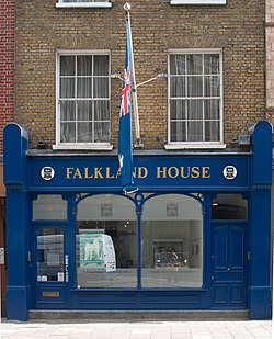
| Headquarters | 14 Broadway, London, SW1H 0BH |
| Agency executive |
|
| Parent agency | Falkland Islands Government |
| Website | London Office Falkland Islands Government |
The Falkland Islands Government Office in London is the representative office of the British Overseas Territory of the Falkland Islands in the United Kingdom, also referred to as Falkland House. [1] It was opened in 1983, one year after the Falklands War. As well as representing the Falkland Islands government in the UK, they provide assistance to their residents travelling to the UK for medical reasons. [2]