Fallowfield is a bustling area of Manchester with a population of 14,869 at the 2021 census. Historically in Lancashire, it lies 3 miles (5 km) south of Manchester city centre and is bisected east–west by Wilbraham Road and north–south by Wilmslow Road. The former Fallowfield Loop railway line, now a shared use path, follows a route nearly parallel with the east–west main road.

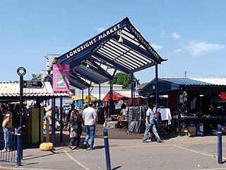
Longsight is an inner city area of Manchester, England, 3 miles (4.8 km) south of the city centre, bounded by Ardwick and West Gorton to the north and east; Levenshulme to the south; and Chorlton-on-Medlock, Victoria Park and Fallowfield to the west. Historically in Lancashire, it had a population of 15,429 at the 2011 census.

Gorton is an area of Manchester in Greater Manchester, North West England. It is to the southeast of Manchester city centre. The population at the 2011 census was 36,055. Neighbouring areas include Levenshulme and Openshaw.

Levenshulme is an area of Manchester, England, bordering Fallowfield, Longsight, Gorton, Burnage, Heaton Chapel and Reddish, halfway between Stockport and Manchester city centre on the A6. Levenshulme is predominantly residential with numerous fast food shops, public houses and antique stores. It has a multi-cultural and multi-ethnic population of 15,430 at the 2011 Census. The Manchester to London railway line passes through Levenshulme railway station.

Fairfield railway station serves the Fairfield area of Droylsden, Tameside, Greater Manchester and is located 3.1 miles (5 km) east of Manchester Piccadilly station. It was opened by the Manchester, Sheffield & Lincolnshire Railway in 1892, when the Fallowfield Loop to Manchester Central opened; it replaced an earlier station that had opened on the line in 1841, west of the present site.

Chorlton is a stop on the South Manchester Line (SML) and Airport Line of the Metrolink light-rail system in Chorlton-cum-Hardy, Manchester, England. It was built as part of Phase 3a of the network's expansion, and opened on 7 July 2011 on a section of the former Cheshire Lines Committee railway.

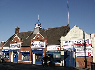
Fallowfield railway station is a disused station that is located on Wilmslow Road in Fallowfield, a southern suburb of Manchester, England. It was on the Fallowfield Loop railway line, a suburban railway which looped around the south of the city and terminated at the former Manchester Central railway station. The station closed to passengers in 1958, but its building still stands on the corner of Wilmslow Road and Ladybarn Road.

Hyde Road was a railway station in Gorton, Manchester, England, on the Fallowfield Loop Line. It opened in 1892 and closed in 1958, when local passenger services on the line were withdrawn. The station was sometimes advertised as Hyde Road for Belle Vue, given its close proximity to Belle Vue Zoo which was about one mile away. The line was closed completely in 1988 and the track was taken up. The station has long since been demolished and the site was partly redeveloped. The former trackbed is now a popular shared use path called the Fallowfield Loop.

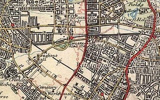
The Fallowfield Loop railway line was a local railway route in south Manchester, England. Trains on the Manchester, Sheffield and Lincolnshire Railway (MS&LR) line from Sheffield Victoria and Guide Bridge used the Loop to access Manchester Central. Some express trains, including the Harwich-Liverpool boat train, used the line.
National Cycle Route 6 is a route of the National Cycle Network, running from London to the Lake District.

Levenshulme South was a railway station in Levenshulme, Manchester, England; it was sited on the Fallowfield Loop railway line, which has since closed and is now a shared-use path.

Wilbraham Road railway station was in Whalley Range, Manchester, England, on the Fallowfield Loop line between Manchester Central and Fairfield, via Chorlton. Opened as Alexandra Park in 1892 by the Manchester, Sheffield and Lincolnshire Railway, it was near the junction of Alexandra Road South and Mauldeth Road West, close to Alexandra Park, and served the expanding residential suburb of Whalley Range. The railway line has since been converted into a shared use path.

Droylsden is a tram stop on the East Manchester Line (EML) of Greater Manchester's light-rail Metrolink system. It opened on 11 February 2013, after a three-day free trial for local residents. The stop was constructed as part of Phase 3a of the Metrolink's expansion, and is located in Droylsden town centre, a part of Tameside, England.

St Werburgh's Road is a tram stop on the South Manchester Line (SML) and Airport Line of Greater Manchester's light-rail Metrolink system in Chorlton-cum-Hardy, Manchester. It was built as part of Phase 3a of the network's expansion and opened on 7 July 2011.

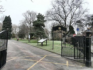
Debdale Park is an inner-city park, located in the Gorton area of Manchester, England. At around 45 acres (18 ha), it is one of the largest inner-city parks in the City of Manchester.

Burton Road is a stop on the South Manchester Line of Greater Manchester's light rail Metrolink system. It is located on Burton Road, on the border of the suburbs of Withington and West Didsbury in Manchester, England.

The history of Manchester Metrolink begins with its conception as Greater Manchester's light rail system in 1982 by the Greater Manchester Passenger Transport Executive, and spans its inauguration in 1992 and the successive phases of expansion.

Cycling for transport and leisure enjoys popularity in Greater Manchester and the city also plays a major role in British cycle racing. The Bee Network was launched in 2018. The University of Manchester is home to the Manchester Cycling Lab.

The South Manchester Line (SML) is a tram line of the Manchester Metrolink in Manchester, England, running from Manchester city centre to Didsbury. The line opened as far as St. Werburgh's Road in 2011 and then to East Didsbury in 2013 as part of phase three of the system's expansion, along a former railway trackbed.


