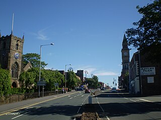
Chorley is a town in Lancashire, England, 8.1 miles (13 km) north of Wigan, 10.8 miles (17 km) south west of Blackburn, 11 miles (18 km) north west of Bolton, 12 miles (19 km) south of Preston and 19.5 miles (31 km) north west of Manchester. The town's wealth came principally from the cotton industry.

Lichfield is a cathedral city and civil parish in Staffordshire, England. Lichfield is situated roughly 16 mi (26 km) north of Birmingham, 8.1 miles (13.0 km) from Rugeley, 9 miles (14 km) from Walsall, 7.9 miles (12.7 km) from Tamworth and 13 miles (21 km) from Burton Upon Trent. At the time of the 2011 Census the population was estimated at 32,219 and the wider Lichfield District at 100,700.
Burntwood is a former mining town and civil parish, it is now a suburban town of the Lichfield District in Staffordshire, England, approximately 4 miles (6 km) west of Lichfield and north east of Brownhills. The town had a population of 43,623 at the time of the 2020 census and forms part of Lichfield district. The town forms one of the largest urbanised parishes in England. Samuel Johnson opened an academy in nearby Edial in 1736. The town is home to the smallest park in the UK, Prince's Park, which is located next to Christ Church on the junction of Farewell Lane and Church Road. The town expanded in the nineteenth century around the coal mining industry.
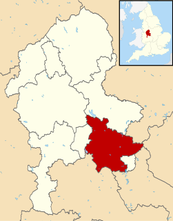
Lichfield is a local government district in Staffordshire, England. It is administered by Lichfield District Council, based in Lichfield.
Alrewas(awl-ree-wuss) is a village and civil parish in the Lichfield District of Staffordshire, England.

Edingale is a village and civil parish in Lichfield District, Staffordshire, England. It lies on the River Mease, around 7 miles (11 km) north of Tamworth. Historically, the village is shared with Derbyshire. In 2001 the parish had a population of 598, increasing to 632 at the 2011 census.

Whittington is a village and civil parish which lies approximately 3 miles south east of Lichfield Lichfield district of Staffordshire, England. According to the 2001 census it had a population of 2,591, increasing to 2,603 at the 2011 Census. The parish council is a joint one with Fisherwick. The Coventry Canal borders the village to the north and east.

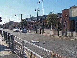
Coppull is a village and civil parish in Lancashire, England. It is part of the Borough of Chorley, lies around 300 feet (91 m) above sea level. Its population is around 8,000, having been counted at 7,959 in the 2011 Census. It is bounded by Whittle Brook, Clancutt Brook, the River Yarrow, Eller Brook, Hic-Bibi Brook and Stars Brook. Coppull is located between Chorley and Standish, Greater Manchester, to the east of the A49 road near Charnock Richard.

Eccleston is a village and civil parish of the Borough of Chorley in Lancashire, England. It is beside the River Yarrow, and was formerly an agricultural and later a weaving settlement.

Statfold is a former village in Staffordshire, England, about 3 miles (5 km) north-east of Tamworth. Population details as taken at the 2011 census can be found under Clifton Campville. These days little remains of the village itself, but the Norman parish church, and the Tudor manor house of Statfold Hall still exist, as do a few scattered farms and houses.

For other uses, see Bretherton (disambiguation).
Fradley is a village in the Lichfield District, in the county of Staffordshire, England. It is in the civil parish of Fradley and Streethay whose population at the 2011 census was 3,753.

Hints is a small village and civil parish between Lichfield and Tamworth in southeastern Staffordshire, within Lichfield local government district. The village is on the line of Watling Street, which was formerly the A5, but the A5 now runs in a cutting north of the village. The name of the parish council is Hints with Canwell. The parish church is dedicated to St Bartholomew.
Clifton Campville is a village, former manor and civil parish in Staffordshire, England. It lies on the River Mease, about 10 miles (16 km) east of the City of Lichfield, 6 miles (10 km) west of Measham and 7 miles (11 km) north of Tamworth. The village lies very close to Staffordshire's borders with Derbyshire, Leicestershire and Warwickshire. In 2001 the parish had a population of 764, increasing to 912 at the 2011 census. In 1848 the parish included both Haunton and Harlaston, and also Chilcote in Derbyshire. Clifton itself then had a population of 341, while the population of the whole parish was 921 on 6,300 acres (25 km2). The core parish of Clifton and Haunton covered around 3,000 acres (12 km2) in 1851. Nowadays the Church of England parish still includes Haunton and Chilcote, and also Statfold. There is a fine gothic church, dedicated to St Andrew, and listed Grade I. The village pub, The Green Man, is also a historic building.
Curborough and Elmhurst is a civil parish in Lichfield District, Staffordshire, England. The hamlets of Curborough and Elmhurst, that make up the parish, lie just north of the City of Lichfield, and are separated from each other by the West Coast Main Line. The parish council is a joint one with Farewell and Chorley. Curborough's name derives from Old English. The words for mill stream in Old English were 'cweorn burna,' and likely referred to Curborough brook.

Fisherwick is a civil parish in Lichfield District, Staffordshire, England. Located about 4 miles (6 km) east of the City of Lichfield, the parish does not include a village, just a scattered collection of farms and houses. The ancient settlement, dating back to the 12th century, and the manor of Fisherwick Park no longer exist. The parish council is a joint one with Whittington.

Harlaston is a village and civil parish in Staffordshire, England. It lies on the River Mease, about 5 miles (8 km) north of Tamworth. There is an Early English church, dedicated to St Matthew, and a public house, the White Lion.

Thorpe Constantine is a small village and civil parish in Staffordshire, England. It lies about 6 miles (10 km) north-east of Tamworth and 6 miles south-west of Measham. The nucleus of the parish is the Thorpe estate.
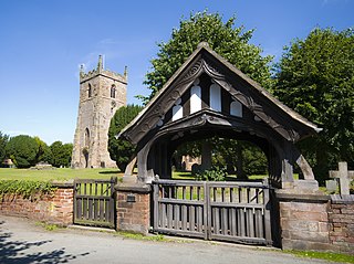
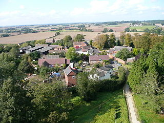
Farewell and Chorley is a civil parish in the district of Lichfield, Staffordshire, England. It contains 13 buildings that are recorded in the National Heritage List for England. Of these, two are listed at Grade II*, the middle of the three grades, and the others are at Grade II, the lowest grade. The parish contains the villages of Farewell and Chorley, and is otherwise rural. Most of the listed buildings are houses, cottages, farmhouses and farm buildings. The other listed buildings are a church, memorials in the churchyard, and a former corn mill.
