History
The FM 1417 designation was previously assigned to a road in Tyler County on July 14, 1949. It was designated to go from US 69 in Colmesneil southeastward 6.0 miles (9.7 km). On November 20, 1951, FM 1417 was extended southeast 4.8 miles (7.7 km) to a road intersection. On December 17, 1952, the road was extended southeast to US 190. On January 29, 1953, FM 1417 was cancelled and mileage was transferred to an extension of FM 256. [5] The current FM 1417 was first designated on October 31, 1958, running from US 75 to FM 120. On June 28, 1963, an extension to what is now SH 56 was designated. The section from SH 11 to SH 56 was never constructed. On July 31, 1972, FM 1417 was extended north to US 82. On June 27, 1995, FM 1417 was redesignated as an Urban Road 1417 (UR 1417). [6] On November 15, 2018, the road was redesignated back to FM 1417.
This page is based on this
Wikipedia article Text is available under the
CC BY-SA 4.0 license; additional terms may apply.
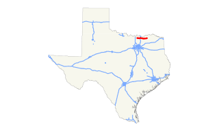
Images, videos and audio are available under their respective licenses.