Colmesneil, Texas

Last updated • 3 min readFrom Wikipedia, The Free Encyclopedia

Colmesneil, Texas
TXMap-doton-Colmesneil.PNG
Location of Colmesneil, Texas
Tyler County Colmesneil.svg
Coordinates: 30°54′30″N94°25′25″W / 30.90833°N 94.42361°W / 30.90833; -94.42361
Country United States
State Texas
County Tyler
Area
[1]
  Total2.00 sq mi (5.18 km2)
  Land2.00 sq mi (5.18 km2)
  Water0.00 sq mi (0.00 km2)
Elevation
[2]
272 ft (83 m)
Population
 (2020)
  Total542
  Density295.35/sq mi (114.06/km2)
Time zone UTC-6 (Central (CST))
  Summer (DST) UTC-5 (CDT)
ZIP code
75938
Area code 409
FIPS code 48-16048 [3]
GNIS feature ID1354805 [2]

Colmesneil ( /ˈklmɪsnl/ KOHL-mis-neel) is a town in Tyler County, Texas, United States. It is located nine miles north of Woodville on U.S. Highway 69. The population was 542 at the 2020 census.

Contents

Geography

Colmesneil is located at 30°54′30″N94°25′25″W / 30.90833°N 94.42361°W / 30.90833; -94.42361 (30.908331, –94.423522). [4]

According to the United States Census Bureau, the town has a total area of 2.0 square miles (5.2 km2), all land.

Historical development

The town's name came from one of the first conductors, W. T. Colmesneil, on the Texas and New Orleans Railroad, which ran through the county. [5] The Trinity and Sabine Railroad extended a 66-mile line from Colmesneil to Trinity, establishing the town as the shipping focal point for the county from 1881. Timber and cattle were the foremost commodities to sell due to the steep slope of the terrain. From the 1880s, the Yellow Pine Lumber Company operated a mill there, and for a while, Colmesneil's population was greater than that of Beaumont. [6]

The surname Colmesneil is probably a misspelling for Colmesnil, a Norman surname originally designating "someone from Colmesnil", a village in the traditional pays de Caux district, in département Seine-Maritime, Normandy, France. It means "Koli′s rural estate", Koli being the name of a Scandinavian settler (see Colleville). [7]

Demographics

Historical population
CensusPop.Note
1980 553
1990 5692.9%
2000 63812.1%
2010 596−6.6%
2020 542−9.1%
U.S. Decennial Census [8]
Colmesneil racial composition as of 2020 [9]
(NH = Non-Hispanic) [lower-alpha 1]
RaceNumberPercentage
White (NH)44481.92%
Black or African American (NH)407.38%
Native American or Alaska Native (NH)40.74%
Mixed/Multi-Racial (NH)173.14%
Hispanic or Latino 376.83%
Total542

As of the 2020 United States census, there were 542 people, 288 households, and 210 families residing in the town.

As of the census [3] of 2019, 626 people, 224 households, and 133 families resided in the town The population density was 298 inhabitants per square mile (115/km2). The racial makeup of the city was 90.10% White, 7.55% African American, 1.17% from other races, and 1.10% from two or more races. Hispanics or Latinos of any race were 3.36% of the population.

Of the 224 households, 50.0% had children under the age of 18 living with them, 56.25% were married couples living together, 12.5% had a female householder with no husband present, and 27.7% were not families. About 23.7% of all households were made up of individuals, and 28.9% had someone who was 65 years of age or older. The average household size was 2.66 and the average family size was 3.13.

In the city, the population was distributed as 24.7% under the age of 18, 5.2% from 18 to 24, 28.2% from 25 to 44, 29.0% from 45 to 64, and 5.2% who were 65 years of age or older. The median age was 39.1 years. For every 100 females, there were 88.0 males. For every 100 females age 18 and over, there were 84.7 males.

The median income for a household in the city was $28,516 and for a family was $31,912. Males had a median income of $33,068 versus $24,464 for females. The per capita income for the city was $15,336. About 25.7% of the population was below the poverty line, including 26.8% of those under age 18 and 13.6% of those age 65 or over.

Education

The City of Colmesneil is served by the Colmesneil Independent School District.

Climate

The climate in this area is characterized by hot, humid summers and generally mild to cool winters. According to the Köppen climate classification, Colmesneil has a humid subtropical climate, Cfa on climate maps. [11]

Related Research Articles

<span class="mw-page-title-main">Tyler County, Texas</span> County in Texas, United States

Tyler County is a county located in the U.S. state of Texas. It is in East Texas and its seat is Woodville.

<span class="mw-page-title-main">Palm Shores, Florida</span> Town in the state of Florida, United States

Palm Shores is a town in Brevard County, Florida. It is part of the Palm Bay–Melbourne–Titusville, Florida Metropolitan Statistical Area. The population was 1,200 at the 2020 US Census, up from 900 at the 2010 census.

<span class="mw-page-title-main">Greenwood, Florida</span> Town in Florida, United States

Greenwood is a town in Jackson County, Florida, United States. It is part of the Florida Panhandle and located in North Florida, specifically Northwest Florida. The population was 539 at the 2020 census.

<span class="mw-page-title-main">Lee, Florida</span> Town in the state of Florida, United States

Lee is a town in Madison County, Florida, United States. The Town of Lee is part of the Florida Panhandle in North Florida. The population was 375 at the 2020 census.

<span class="mw-page-title-main">Paxton, Florida</span> Town in the state of Florida, United States

Paxton is a town in Walton County, Florida, United States. Located near Britton Hill on the Alabama–Florida state line, it has the highest elevation of any in Florida. The Town of Paxton is located on the Florida Panhandle, and is part of the Crestview–Fort Walton Beach–Destin, Florida Metropolitan Statistical Area. The population was 556 as of the 2020 census, down from 644 at the 2010 census.

<span class="mw-page-title-main">Diboll, Texas</span> City in Texas, United States

Diboll is a city in Angelina County, Texas, United States. The population was 4,457 at the 2020 census. Diboll is named for J. C. Diboll, a local timber salesman.

<span class="mw-page-title-main">Paint Rock, Texas</span> Town in Texas, United States

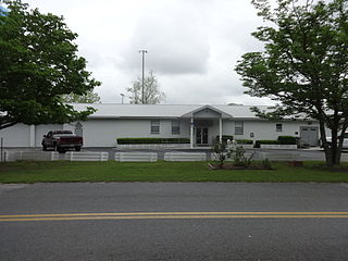
Paint Rock is a town in and the county seat of Concho County, Texas, United States. The population was 237 at the 2020 census.

<span class="mw-page-title-main">Paducah, Texas</span> Town in Cottle County, Texas, United States

Paducah is a town in Cottle County, Texas, United States. The population was 1,063 at the 2020 census, down from 1,186 in 2010. It is the county seat of Cottle County. It is just south of the Texas Panhandle and east of the Llano Estacado.

<span class="mw-page-title-main">Dickens, Texas</span> City in Texas, United States

Dickens is a city in and the county seat of Dickens County, Texas, United States. The population was 219 at the 2020 census, down from 286 at the 2010 census.

<span class="mw-page-title-main">Waelder, Texas</span> City in Texas, United States

Waelder is a city in Gonzales County, Texas, United States and is also part of the Texas-German belt. The population was 933 at the 2020 census.

<span class="mw-page-title-main">Lovelady, Texas</span> City in Texas, United States

Lovelady is a town in Houston County, Texas, United States. The population was 570 at the 2020 census.

<span class="mw-page-title-main">Central Gardens, Texas</span> Census-designated place in Texas, United States

Central Gardens is an unincorporated community and census-designated place (CDP) in Jefferson County, Texas, United States. The population was 4,373 at the 2020 census. It is part of the Beaumont–Port Arthur metropolitan area.

<span class="mw-page-title-main">Ingram, Texas</span> City in Texas, United States

Ingram is a city in Kerr County, Texas, United States. The population was 1,787 at the 2020 census, and 1,804 at the 2010 census.

<span class="mw-page-title-main">Corrigan, Texas</span> Town in Texas, United States

Corrigan is a town in north central Polk County, Texas, United States. It is located along U.S. Highway 59 and is approximately 100 miles from Houston. Its population was 1,477 in the 2020 census.

<span class="mw-page-title-main">San Augustine, Texas</span> City in and county seat of San Augustine County, Texas, United States

San Augustine is the county seat city of San Augustine County, Texas, in East Texas, United States. The population was 1,920 at the 2020 census.

<span class="mw-page-title-main">Aspermont, Texas</span> Town in Texas, United States

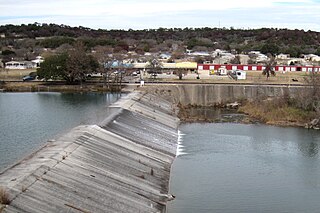
Aspermont is a town and the county seat of Stonewall County, Texas, United States. The population was 789 at the 2020 census.

<span class="mw-page-title-main">Trent, Texas</span> Town in Texas, United States

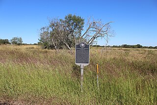
Trent is a town in Taylor County, Texas, United States, that was established in 1881. The population was 295 at the 2020 census. It is part of the Abilene, Texas Metropolitan Statistical Area. Trent, Texas was named in honor of West Texas pioneer and cattleman, Isaac Riley Trent.

<span class="mw-page-title-main">Nassawadox, Virginia</span> Town in Virginia, United States

Nassawadox is a town in Northampton County, Virginia, United States. Per the 2020 census, the population was 533. The town, with an area of 0.4 square miles (1.0 km2), is located on U.S. Route 13 on Virginia's Eastern Shore, approximately five miles south of Exmore and 25 miles (40 km) north of the Chesapeake Bay Bridge-Tunnel.

<span class="mw-page-title-main">Wilson Creek, Washington</span> Town in Washington, United States

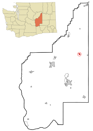
Wilson Creek is a town in Grant County, Washington, United States. The population was 204 at the 2020 census.

<span class="mw-page-title-main">Ackerly, Texas</span> City in Texas, United States

Ackerly is a city in Dawson and Martin Counties in the U.S. state of Texas. As of the 2020 Census, the population was 264. The Martin county portion of Ackerly is part of the Midland-Odessa metropolitan area.

References

  1. "2019 U.S. Gazetteer Files". United States Census Bureau. Retrieved August 7, 2020.
  2. 1 2 U.S. Geological Survey Geographic Names Information System: Colmesneil, Texas
  3. 1 2 "U.S. Census website". United States Census Bureau . Retrieved January 31, 2008.
  4. "US Gazetteer files: 2010, 2000, and 1990". United States Census Bureau. February 12, 2011. Retrieved April 23, 2011.
  5. TSHA Online - Texas State Historical Association
  6. ibid
  7. Beaurepaire, François de (1979). Les noms des communes et anciennes paroisses de la Seine-Maritime (in French). Paris: A. Et J. Picard. p. 61. ISBN   2-7084-0040-1.
  8. "Census of Population and Housing". Census.gov. Retrieved June 4, 2015.
  9. "Explore Census Data". data.census.gov. Retrieved May 25, 2022.
  10. "About the Hispanic Population and its Origin". www.census.gov. Retrieved May 18, 2022.
  11. Climate Summary for Colmesneil, Texas
  1. Note: the US Census treats Hispanic/Latino as an ethnic category. This table excludes Latinos from the racial categories and assigns them to a separate category. Hispanics/Latinos can be of any race. [10]