Farm to Market Road 400

Last updated

Texas FM 400.svg

Farm to Market Road 400

Farm to Market Road 400
Route information
Maintained by TxDOT
Length85.417 mi [1] [nb 1]  (137.465 km)
Existed1945–present
Major junctions
South endUS 87.svg US 87 north of Tahoka
Major intersections
North endTexas FM 145.svg FM 145 east of Kress
Location
Country United States
State Texas
Counties Lynn, Lubbock, Hale, Swisher
Highway system
Texas FM 399.svg FM 399 Texas FM 401.svg FM 401
FM 400 passing through Yellow House Canyon of Lubbock County, Texas. FM400 Lubbock County Texas 2011.jpg
FM 400 passing through Yellow House Canyon of Lubbock County, Texas.

Farm to Market Road 400 (FM 400) is a farm to market road located in Lynn, Lubbock, Hale, and Swisher counties in the Llano Estacado of Texas. [1]

Contents

Route description

The southern terminus of FM 400 is at an interchange with US 87 north of the Tahoka city limits. [2] The route travels to the northeast through rural areas of Lynn County, passing to the west of Tahoka Lake and through Wilson along that city's 10th Street before entering Lubbock County. [3] In Slaton, FM 400 turns to the north and crosses US 84 near the southern city limits before entering that city's downtown, where it is concurrent with Bus. US 84 along 9th Street for 2.4 miles (3.9 km). The route leaves Slaton and continues north along Vetch Avenue, passing to the east of Slaton Airport, then descending into and climbing out of Yellow House Canyon, to the east of the community of Ransom Canyon. [4] The next major intersection is just east of Idalou, with US 62  / US 82  / SH 114. [5] Continuing north, FM 400 crosses into Hale County, approximately 9.0 miles (14.5 km) east of Abernathy. [6] It has a concurrency of about 2.0 miles (3.2 km) with FM 37 and passes through the farming community of Happy Union before entering Plainview, where it is known as Date Street. [7] The highway crosses US 70 and then briefly turns to the east along 24th Street before resuming its northward journey. [8] FM 400 has a brief concurrency with FM 788 in northern Hale County; after the two routes separate, FM 400 enters Swisher County, and reaches its northern terminus at FM 145 east of Kress. [9]

History

FM 400 was originally designated on June 25, 1945; its original routing was exclusively in Lubbock County, from Idalou northward to the Hale County line. [1] On July 9 of that same year saw an extension northward, into Hale County and to a junction with FM 54 west of Petersburg. The road was lengthened, this time to the south, on December 16, 1948, from Idalou to a county road just north of the Slaton Airport (12.2 miles (19.6 km) south of Idalou). On March 19, 1949, a southern section of FM 400 was designated, replacing FM 1074. This southern section was in Lynn County, and ran southward from the Lubbock County line through Wilson to US 87. This created a gap in the routing of FM 400 in and around Slaton; this gap would be closed on May 23, 1951, when the two sections of FM 400 were both extended to connect with US 84 at two different points in Slaton. The route was extended northward to Plainview on January 27, 1950. It was extended north to the FM 145 on February 24, 1953, replacing the section of FM 788 from US 70 north to the junction of FM 788 and FM 400 and all of FM 2078; this created the concurrency with FM 788, which TxDOT officially considers a gap in that route's mileage. [10] On April 24, 1953, the section from FM 145 to the Swisher County line was cancelled, but would be reinstated on October 29, 1953. The route designation was amended in 1965 after the US 84 freeway bypass south of Slaton was constructed; the old location of US 84 was renumbered Loop 251, which would eventually be redesignated as Business US 84 in 1991. [11] [12]

Major intersections

CountyLocationmi [13] [nb 1] kmDestinationsNotes
Lynn 0.00.0US 87.svg US 87  Tahoka, Lubbock Southern terminus
Wilson 9.615.4Texas FM 211.svg FM 211  New Home
Lubbock Slaton 18.329.5US 84.svg US 84  Lubbock, Post
18.629.9South plate.svg
Business plate.svg
US 84.svg
To plate.svg
Texas FM 2150.svg
Bus. US 84 south to FM 2150
South end of US 84 Bus. concurrency
19.431.2Texas FM 41.svg FM 41 (W Division St.)
21.033.8North plate.svg
Business plate.svg
US 84.svg
Bus. US 84 north
North end of US 84 Bus. concurrency
27.444.1Texas FM 3523.svg FM 3523
30.749.4Texas FM 40.svg FM 40  Acuff
35.957.8US 62.svgUS 82.svgTexas 114.svg US 62  / US 82  / SH 114  Idalou, Ralls
46.074.0Texas FM 597.svg FM 597  Abernathy
Hale 50.781.6Texas FM 54.svg FM 54  Petersburg
55.789.6East plate.svg
Texas FM 37.svg
FM 37 east
South end of FM 37 concurrency
57.792.9West plate.svg
Texas FM 37.svg
FM 37 west
North end of FM 37 concurrency
Happy Union 60.797.7Texas FM 784.svg FM 784
63.7102.5Texas FM 1914.svg FM 1914  Hale Center
65.7105.7Texas FM 2883.svg FM 2883
Plainview 71.4114.9Texas FM 3466.svg FM 3466
72.0115.9US 70.svg US 70  Muleshoe, Floydada
72.9117.3Texas FM 2286.svg FM 2286 (E 16th St.)
75.8122.0Texas FM 1767.svg FM 1767 (E 34th St.) Seth Ward
77.8125.2Texas FM 3183.svg FM 3183
78.3126.0East plate.svg
Texas FM 788.svg
FM 788 east Providence
South end of FM 788 concurrency
Swisher 79.9128.6West plate.svg
Texas FM 788.svg
FM 788 west
North end of FM 788 concurrency
87.7141.1Texas FM 145.svg FM 145  Kress Northern terminus
1.000 mi = 1.609 km; 1.000 km = 0.621 mi

See also

Notes

  1. 1 2 The certified length given is shorter than the actual mileage, as the TxDOT description of FM 400 considers it to be discontinuous at US 84 Business in Slaton.

Related Research Articles

<span class="mw-page-title-main">Texas State Highway 72</span> State highway in Texas

State Highway 72 is a Texas state highway that runs approximately 111 miles (179 km) from near Fowlerton to Cuero in South Texas.

<span class="mw-page-title-main">Farm to Market Road 973</span>

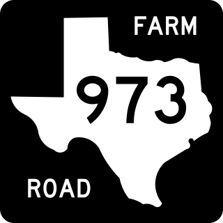
Farm to Market Road 973 is a farm-to-market road in Travis and Williamson counties in the U.S. state of Texas.

<span class="mw-page-title-main">Texas State Highway 174</span>

State Highway 174 is a state highway in Texas that connects Meridian and Burleson.

<span class="mw-page-title-main">Texas State Highway 127</span>

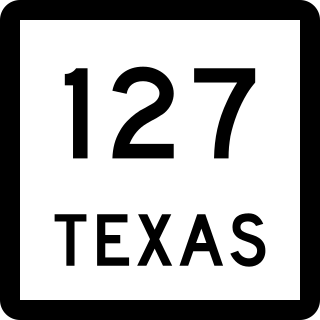
State Highway 127 is a state highway in Uvalde County in the U.S. state of Texas that connects Sabinal and Concan in south Texas.

<span class="mw-page-title-main">Farm to Market Road 1125</span>

Farm to Market Road 1125 is a farm to market road that connects the farming areas of northern Jack County and southern Montague County with Bowie, Texas.

<span class="mw-page-title-main">Farm to Market Road 1954</span> Road in Texas

Farm to Market Road 1954 is a farm to market road in Archer and Clay counties, Texas.

<span class="mw-page-title-main">Texas State Highway 220</span>

State Highway 220 is a Texas state highway located in Hamilton and Erath Counties.

<span class="mw-page-title-main">Texas State Highway 186</span>

State Highway 186 is a state highway located in the Rio Grande Valley of the U.S. state of Texas. The route connects US 281 to the Gulf of Mexico at Port Mansfield.

<span class="mw-page-title-main">Texas State Highway 240</span>

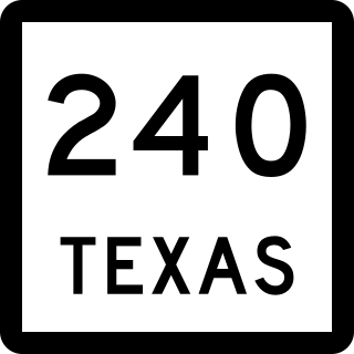
State Highway 240 is a Texas state highway that runs from Harrold east to Burkburnett, then south parallel to Interstate 44 to Wichita Falls.

<span class="mw-page-title-main">Farm to Market Road 1750</span>

Farm to Market Road 1750 is a farm to market road located primarily in Taylor County, Texas.

<span class="mw-page-title-main">Texas State Highway 315</span>

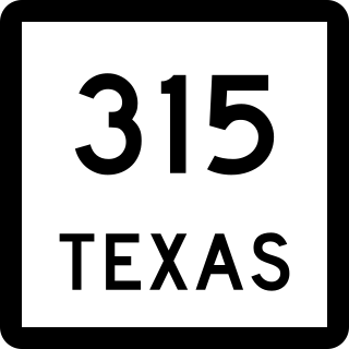
State Highway 315 is a state highway in Texas that runs from Mount Enterprise northeast to Carthage.

<span class="mw-page-title-main">Farm to Market Road 423</span> Highway in Texas

Farm to Market Road 423 is a farm to market road in Denton County, Texas.

<span class="mw-page-title-main">Farm to Market Road 407</span>

Farm to Market Road 407 is a farm to market road in Wise and Denton counties, Texas.

<span class="mw-page-title-main">Farm to Market Road 1171</span>

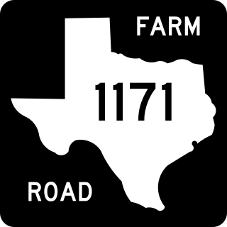
Farm to Market Road 1171 is a farm to market road in Denton County, Texas.

<span class="mw-page-title-main">Farm to Market Road 170</span>

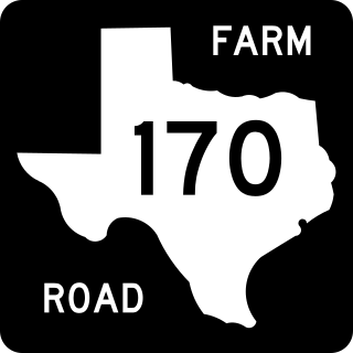
Farm to Market Road 170 is a 114.6-mile (184.4 km) highway maintained by the Texas Department of Transportation (TxDOT) in Presidio and Brewster counties in Texas. The route, known locally as the River Road, runs along the United States side of the Rio Grande which in Texas forms the international boundary between the U.S. and Mexico. The road runs from Candelaria through the city of Presidio as well as several smaller communities and former settlements to State Highway 118 in Study Butte near Big Bend National Park. The road also passes through the southern portion of Big Bend Ranch State Park.

<span class="mw-page-title-main">Farm to Market Road 149</span>

Farm to Market Road 149 is a farm to market road in the U.S. state of Texas. It runs approximately 48.3 miles (77.7 km) in Montgomery and Grimes counties, connecting the cities of Montgomery and Anderson.

<span class="mw-page-title-main">Farm to Market Road 1459</span>

Farm to Market Road 1459 is a farm to market road in Brazoria County, Texas.

<span class="mw-page-title-main">Ranch to Market Road 187</span> Highway in Texas

Ranch to Market Road 187 (RM 187) is an 81.9-mile (131.8 km) Ranch to Market Road located in Zavala, Uvalde, Bandera, and Kerr counties in the US state of Texas. The route passes through the cities of Sabinal, Utopia, and Vanderpool. The road helps connect several small south Texas ranches to major highways. RM 187 was first designated in 1945, and was extended three times during the 1940s. As of 2012, it is the longest Ranch to Market Road in the state of Texas.

<span class="mw-page-title-main">Farm to Market Road 1450</span>

Farm to Market Road 1450 is a Farm to Market Road in the U.S. state of Texas maintained by the Texas Department of Transportation (TxDOT). The road, located in southeastern Reeves and northern Pecos counties, begins at U.S. Route 285 near Pecos and intersects FM 1776, State Highway 18, and Ranch to Market Road 2593 before terminating at FM 1053. The route number was formerly designated over a road in Freestone County.

<span class="mw-page-title-main">Farm to Market Road 1776</span>

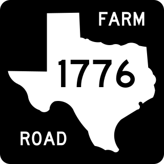
Farm to Market Road 1776 (FM 1776) is a Farm to Market Road in the U.S. state of Texas maintained by the Texas Department of Transportation (TxDOT). The 45-mile (72 km) road begins at a junction with Interstate 10 (I-10) and U.S. Highway 67 (US 67) in Pecos County west of Fort Stockton and extends northward through the town of Coyanosa before ending at State Highway 18 (SH 18) in Ward County south of Monahans. The road has an interchange with US 285 northeast of Fort Stockton.

References

  1. 1 2 3 Transportation Planning and Programming Division (n.d.). "Farm to Market Road No. 400". Highway Designation Files. Texas Department of Transportation . Retrieved 2011-01-18.
  2. Transportation Planning and Programming Division (2012). Texas County Mapbook (PDF) (Map) (2012 ed.). 1:120,000. Texas Department of Transportation. p. 191. OCLC   867856197 . Retrieved 2011-01-18.[ dead link ]
  3. Transportation Planning and Programming Division (2012). Texas County Mapbook (PDF) (Map) (2012 ed.). 1:120,000. Texas Department of Transportation. p. 217. OCLC   867856197 . Retrieved 2011-01-18.[ dead link ]
  4. Transportation Planning and Programming Division (2012). Texas County Mapbook (PDF) (Map) (2012 ed.). 1:120,000. Texas Department of Transportation. p. 216. OCLC   867856197 . Retrieved 2011-01-18.[ dead link ]
  5. Transportation Planning and Programming Division (2012). Texas County Mapbook (PDF) (Map) (2012 ed.). 1:120,000. Texas Department of Transportation. p. 190. OCLC   867856197 . Retrieved 2011-01-18.[ dead link ]
  6. Transportation Planning and Programming Division (2012). Texas County Mapbook (PDF) (Map) (2012 ed.). 1:120,000. Texas Department of Transportation. p. 189. OCLC   867856197 . Retrieved 2011-01-18.[ dead link ]
  7. Transportation Planning and Programming Division (2012). Texas County Mapbook (PDF) (Map) (2012 ed.). 1:120,000. Texas Department of Transportation. p. 188. OCLC   867856197 . Retrieved 2011-01-18.[ dead link ]
  8. Transportation Planning and Programming Division (2012). Texas County Mapbook (PDF) (Map) (2012 ed.). 1:120,000. Texas Department of Transportation. p. 214. OCLC   867856197 . Retrieved 2011-01-18.[ dead link ]
  9. Transportation Planning and Programming Division (2012). Texas County Mapbook (PDF) (Map) (2012 ed.). 1:120,000. Texas Department of Transportation. p. 213. OCLC   867856197 . Retrieved 2011-01-18.[ dead link ]
  10. Transportation Planning and Programming Division (n.d.). "Farm to Market Road No. 788". Highway Designation Files. Texas Department of Transportation . Retrieved 2011-01-18.
  11. Transportation Planning and Programming Division (n.d.). "State Highway Loop No. 251". Highway Designation Files. Texas Department of Transportation . Retrieved 2011-01-18.
  12. Transportation Planning and Programming Division (n.d.). "Business U.S. Highway No. 84-E". Highway Designation Files. Texas Department of Transportation . Retrieved 2011-01-18.
  13. Google (2011-01-18). "Overview map of Farm to Market Road 400 Distances Between Interchanges" (Map). Google Maps . Google. Retrieved 2011-01-18.

Commons-logo.svg Media related to Farm to Market Road 400 at Wikimedia Commons