Fasanvej station

Last updated
Fasanvej
Copenhagen Metro Station
Fasanvej Station2.jpg
General information
Location26D Nordre Fasanvej, 2000 Frederiksberg
Frederiksberg Municipality
Denmark
Coordinates 55°40′54″N12°31′24″E / 55.68167°N 12.52333°E / 55.68167; 12.52333
Owned byMetroselskabet
Operated byMetro Service A/S
Line(s) M1 icon.svg M2 icon.svg
Platforms1 island platform
Tracks2
Bus routes BSicon BUS2.svg 37, 74, 4A
Construction
Structure typeUnderground
AccessibleYes
Other information
Station codeSot
History
Opened13 December 1986 (S-train)
12 October 2003 (Metro)
Closed1 January 2000 (S-train)
Passengers
2018 [1] 7,000 per weekday
Services
Preceding station Copenhagen Metro Logo.svg Copenhagen Metro Following station
Lindevang
towards Vanløse
M1 Frederiksberg
towards Vestamager
M2 Frederiksberg
towards Lufthavnen
Location
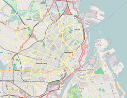
Location map Denmark Copenhagen.png
Red pog.svg
Fasanvej
Location within Copenhagen
Denmark Greater Copenhagen adm location map.svg
Red pog.svg
Fasanvej
Fasanvej (Greater Copenhagen)
Denmark adm location map.svg
Red pog.svg
Fasanvej
Fasanvej (Denmark)

Fasanvej station is a rapid transit station on the Copenhagen Metro in Frederiksberg, Denmark. It was known as Solbjerg Station until 25 September 2006. The station opened 12 October 2003, and serves the M1 and M2 lines. It is located in fare zone 2.
Contents

History

The former Solbjerg Station functioned between 13 December 1986 and 1 January 2000 as a stop on the Copenhagen S-train track between Vanløse station and Frederiksberg station. Following the closure of Frederiksberg station on 20 June 1998, Solbjerg became the line terminus until this line stopped operations as part of the S-train network and the line converted to a part of the Metro network. The former S-train station was located above ground on the western side of Søndre Fasanvej. The Metro station is located below ground on the eastern side of the street.

Related Research Articles

<span class="mw-page-title-main">Copenhagen Metro</span> Rapid transit railway in Copenhagen, Denmark

The Copenhagen Metro is a light rapid transit system in Copenhagen, Denmark, serving the municipalities of Copenhagen, Frederiksberg, and Tårnby.

<span class="mw-page-title-main">S-train (Copenhagen)</span> Local train network in Copenhagen

The Copenhagen S-train, the S-train of Copenhagen, Denmark, is a key part of public transport in the city. It is a hybrid urban-suburban rail serving most of the Copenhagen urban area, and is analogous to the S-Bahn systems of Berlin, Vienna and Hamburg. The trains connect the Copenhagen inner city with Hillerød, Klampenborg, Frederikssund, Farum, Høje-Taastrup and Køge. There are 170 km (110 mi) of double track with 87 S-train stations, of which eight are in neighbouring towns outside greater Copenhagen.

<span class="mw-page-title-main">M1 (Copenhagen Metro)</span> Metro line in Copenhagen, Denmark

M1 of the Copenhagen Metro, colored green on the map, runs from Vanløse to Vestamager. It connects the Ørestad neighborhood of Copenhagen, Denmark, to the city center. The line is elevated while traveling through Ørestad, while it runs through a tunnel below the city center. From Christianshavn to Vanløse, the line is shared with M2.

<span class="mw-page-title-main">M2 (Copenhagen Metro)</span> Metro line in Copenhagen, Denmark

M2 is a line of the Copenhagen Metro, colored yellow on the map. It runs from Vanløse to Lufthavnen through the center of Copenhagen, sharing track with the M1 from Vanløse to Christianshavn. The line was built along with M1 as part of the redevelopment of Ørestad. The principle of the line was passed in 1992, and construction commenced in 1998. The line opened in several stages between 2002 and 2007. It is owned by Metroselskabet and operated by Metro Service, and operates with a headway between four and twenty minutes.

<span class="mw-page-title-main">Copenhagen Central Station</span> The main railway station in Copenhagen, Denmark

Copenhagen Central Station is the main railway station in Copenhagen, Denmark, and the largest railway station in Denmark. With more than 100,000 travellers every day, it is the second busiest station in Denmark after Nørreport station. It is located in central Copenhagen, situated between the districts of Indre By and Vesterbro with entrances from Bernstorffsgade, Banegårdspladsen, Reventlowsgade and access to platforms from Tietgensgade.

<span class="mw-page-title-main">Nørreport station</span> Main line, commuter and rapid transit railway station in Copenhagen, Denmark

Nørreport station is an S-train, metro and main line railway station in Copenhagen, Denmark. It is located in the district of Indre By, and is named after the historic Nørreport city gate, at the original location of which it is located. It is one of the busiest railway stations in Denmark, serving 165,000 people daily. The entire station is underground, with three pairs of platforms: one for S-trains, one for main line trains and one for the metro. The station is located on the Boulevard Line of the S-train and main line network. Several bus lines run through and start from Nørreport above ground.

<span class="mw-page-title-main">M3 (Copenhagen Metro)</span> Copenhagen Metro line

The M3 line or City Circle Line is a loop line of the Copenhagen Metro. It has been claimed by COWI A/S that the line is the largest construction project to have taken place in Copenhagen during the last 400 years. The network's total length is 15.5 kilometres (9.6 mi) and has 17 stations. The line opened on 29 September 2019.

<span class="mw-page-title-main">Frederiksberg station</span> Copenhagen metro station

Frederiksberg station is an underground Copenhagen Metro station located at Falkonér Plads, off Falkonér Allé, in the Frederiksberg district of Copenhagen, Denmark. The station is an interchange station between the M1/M2 and M3 lines and is in fare zone 2. Nearby landmarks include Frederiksberg Centret, Falkoner Center, Frederiksberg Gymnasium, Frederiksberg Central Library and Copenhagen Business School's Solbjerg Campus.

<span class="mw-page-title-main">Ringbanen</span> Commuter railway line in Greater Copenhagen, Denmark

Ringbanen is an S-train line in Copenhagen. Its route is roughly semicircular, running around the central part of Copenhagen and connecting the S-train radials about 5 km out.

<span class="mw-page-title-main">Lindevang station</span> Copenhagen metro station

Lindevang station is a rapid transit station on the Copenhagen Metro in Frederiksberg, Denmark. It serves the M1 and M2 lines. It is located where the Metro line crosses Dalgas Boulevard in Frederiksberg. It opened 12 October 2003. It is located in fare zone 2.

<span class="mw-page-title-main">Nørrebro railway station</span> Commuter and rapid transit railway station in Copenhagen, Denmark

Nørrebro station is an interchange station between the S-train Ring Line and the Copenhagen Metro City Circle Line in the Outer Nørrebro district of Copenhagen, Denmark. It is situated at the junction of Nørrebrogade, Folmer Bendtsens Plads, Frederikssundsvej and Nordre Fasanvej. The functionalist station building from 1930 designed by the architect Knud Tanggaard Seest was listed on the Danish registry of protected buildings and places in 1992.

<span class="mw-page-title-main">Frederiksberg</span> Part of the Capital Region of Denmark

Frederiksberg is a part of the Capital Region of Denmark. It is an independent municipality, Frederiksberg Municipality, separate from Copenhagen Municipality, but both are a part of the region of Copenhagen. It occupies an area of less than 9 km2 and had a population of 103,192 in 2015.

<span class="mw-page-title-main">Fasanvej</span>

Søndre and Nordre Fasanvej are two streets that form a lengthy south-to-north artery through Frederiksberg, an independent municipality surrounded by the larger Copenhagen Municipality in Copenhagen, Denmark. The southern part of the street is characterized by large green spaces and attractive residential neighborhoods. In contrast, its northern part, extending into the Nørrebro and North-West districts of Copenhagen, is marked by former industrial sites. The street is named after Fasangården, a former royal pheasantry located in Frederiksberg Park.

<span class="mw-page-title-main">Smallegade</span>

Smallegade is a busy shopping street in the central part of Frederiksberg in Copenhagen, Denmark. It runs from the Town Hall Square in the east to Fasanvej in the west, along the north side of Frederiksberg Town Hall and Frederiksberg Park, linking Gammel Kongevej with Peter Bangs Vej. On the other side of the Town Hall is Bredegade, now smaller than Smallegade, which after a while joins Smallegade at Møstings Hus, an 18th-century country house-turned-exhibitions space, which overlooks a small pond.

Transport in Copenhagen and the surrounding area relies on a well-established infrastructure making it a hub in Northern Europe due to its road and rail networks as well as its international airport. Thanks to its many cycle tracks, Copenhagen is considered one of the world's most bicycle-friendly cities. The metro and S-train systems are key features of the city's well-developed public transport facilities. Since July 2000, the Øresund Bridge has served as a road and rail link to Malmö in Sweden. The city is also served by ferry connections to Oslo in Norway while its award-winning harbour is an ever more popular port of call for cruise ships.

<span class="mw-page-title-main">Godthåbsvej</span> Street in Copenhagen, Denmark

Godthåbsvej is a street in the northwestern part of Copenhagen, Denmark. It begins at Bülowsvej in Frederiksberg as the direct continuation of Rosenørns Allé/Rolighedsvej and passes through Vanløse before reaching Bellahøj in Brønshøj. A metro station on the Copenhagen Metro City Circle Line is located at Aksel Møllers Have.

<span class="mw-page-title-main">Peter Bangs Vej</span> Street in Copenhagen, Denmark


Peter Bangs Vej is a 2.2 km long street in Frederiksberg, a city in the Copenhagen area on the island of Zealand, Denmark. The direct continuation of Smallegade, it initially runs west, from Nordre Fasanvej, but then turns south along the east side of Damhus Lake to meet Roskildevej. There is a large sports complex on the south end of the street with the football club F.C. Copenhagen's training facilities as well as the multi-purpose venue K.B. Hallen.

<span class="mw-page-title-main">Nyelandsvej</span> Street in Copenhagen, Denmark

Nyelandsvej is a street in the Frederiksberg district of Copenhagen, Denmark. It runs from Falkoner Allé in the southeast to a roundabout at the north end of Dalgas Boulevard in the northwest. The more urban, eastern part of the street, between Falkoner Allé and Nordre Fasanvej, separates an area with Copenhagen Business School's Solbjerg Campus and Frederiksberg Centret to the south from the Svømmehal Quarter to the north. The western part of the street is passes the multi-purpose venue Keddelhallen and Frederiksberg Hospital before entering an area with Single-family detached homes.

<span class="mw-page-title-main">Finsensvej</span>

Finsensvej is a major street in the Frederiksberg district of Copenhagen, Denmark. The direct continuation of Howitzvej, it runs from Nordre Fasanvej in the east to the northern end of Sønderjyllands Allé in the west where it turns into Jernbane Allé on the municipal border with Vanløse. The street crosses Dalgas Boulevard and passes under the S-train network's Frederikssund radial. The modern Flintholm neighbourhood is located on the north side of the street and the Lindevang Park on its south side. The street is named after the Nobel Prize-winning physician Niels Ryberg Finsen.

<span class="mw-page-title-main">Howitzvej</span> Street in Frederiksberg Municipality, Denmark

Howitzvej is a street in Frederiksberg, a municipality surrounded by Copenhagen, Denmark. It runs from Falkoner Allé in the east to Nordre Fasanvej where it turns into Finsensvej before the name changes again to Jernbane Allé on the border with Vanløse.

References

  1. "Passagertal pr. hverdagsdøgn i gennemsnit 2018". m.dk. Retrieved 29 September 2020.