The Copenhagen Metro is a light rapid transit system in Copenhagen, Denmark, serving the municipalities of Copenhagen, Frederiksberg, and Tårnby.

The rail transport system in Denmark consists of 2,633 km (1,636 mi) of railway lines, of which the Copenhagen S-train network, the main line Helsingør-Copenhagen-Padborg, and the Lunderskov-Esbjerg line are electrified. Most traffic is passenger trains, although there is considerable transit goods traffic between Sweden and Germany.

Copenhagen Central Station is the main railway station in Copenhagen, Denmark, and the largest railway station in Denmark. With more than 100,000 travellers every day, it is the second busiest station in Denmark after Nørreport station. It is located in central Copenhagen, situated between the districts of Indre By and Vesterbro with entrances from Bernstorffsgade, Banegårdspladsen, Reventlowsgade and access to platforms from Tietgensgade.

The M3 line or City Circle Line is a loop line of the Copenhagen Metro. It has been claimed by COWI A/S that the line is the largest construction project to have taken place in Copenhagen during the last 400 years. The network's total length is 15.5 kilometres (9.6 mi) and has 17 stations. The line opened on 29 September 2019.
Østerport station is a metro, S-train and main line railway station in Copenhagen, Denmark. It is located between the districts of Indre By and Østerbro, and is named for the historic Østerport city gate, near the original location of which it is located.

Ørestad station is a main line and rapid transit railway station serving the development area of Ørestad in the district of Amager Vest in Copenhagen, Denmark. The station is a junction station served by both the Copenhagen Metro and regional trains. The penultimate stop of the M1 Line, it is located in zone 3 in the west-central section of the island of Amager.

Flintholm station is an S-train and Metro interchange junction station in Copenhagen, Denmark. It opened on 24 January 2004, and it is located in the west of Copenhagen where the Frederikssund S-train Line crosses the S-train Ring Line. It is located in fare zone 2.

Dybbølsbro station is a central S-train railway station serving the district of Vesterbro in Copenhagen, Denmark.

Nordhavn station is a commuter rail and rapid transit railway station in Copenhagen, Denmark.

Copenhagen Airport railway station is a railway station in Tårnby, Denmark, serving Copenhagen Airport. It is located below ground directly under the check-in and arrival area in the airport's Terminal 3.

Copenhagen South station is a main line and S-train railway station in the district of Valby in southwestern Copenhagen, Denmark. The station is located on numerous railway and branch lines passing through or diverging from the main lines at this station, and is gradually being developed into a major transport hub for public transport in Copenhagen.

Nørrebro station is an interchange station between the S-train Ring Line and the Copenhagen Metro City Circle Line in the Outer Nørrebro district of Copenhagen, Denmark. It is situated at the junction of Nørrebrogade, Folmer Bendtsens Plads, Frederikssundsvej and Nordre Fasanvej. The functionalist station building from 1930 designed by the architect Knud Tanggaard Seest was listed on the Danish registry of protected buildings and places in 1992.

The M4 of the Copenhagen Metro connects Nordhavn in the north with Sydhavn in the south. The central part of the line shares tracks with the City Circle Line (M3).
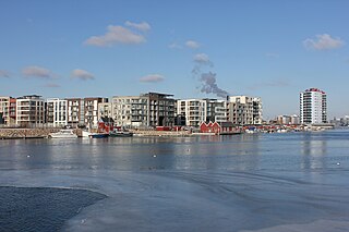
Sluseholmen is an artificial peninsula in the South Harbour of Copenhagen, Denmark. It takes its name from Slusen, a lock immediately to the south, regulating water levels in the harbor. Previously the site of heavy industry and part of the Southern Docklands of Port of Copenhagen, Sluseholmen has, since the turn of the millennium, undergone massive redevelopment, transforming it into a mainly residential district known for its canals and maritime atmosphere. It is connected to Teglholmen by the Teglværk Bridge.

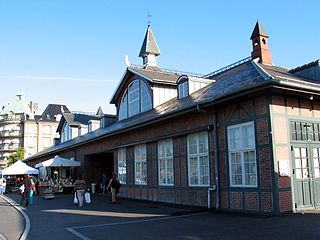
Roskilde Station is the principal railway station serving the city of Roskilde on the island of Zealand, Denmark. It is located in central Roskilde, on the southeastern edge of the historic town centre, and lies immediately adjacent to the Roskilde bus station.

Marmorkirken station is an underground Copenhagen Metro station located at the Marble Church, facing Bredgade, in downtown Copenhagen, Denmark. The station is on the City Circle Line, between Østerport and Kongens Nytorv, and is in fare zone 1. Marmorkirken is unique in its design in that it is the only station on the Copenhagen Metro where the platforms for the two tracks are at different levels, unlike the island platform design used at every other station. This design was chosen to avoid excavating underneath, and risk compromising, the foundations of the Marble Church. With the lower platform at 30 meters beneath street level, it is also the deepest station of all stations on the Copenhagen Metro.

Havneholmen is a mixed-use development located on reclaimed land off Kalvebod Brygge in the harbor of Copenhagen, Denmark. It is located just east of the shopping centre Fisketorvet from which it is separated by a narrow canal, although it is annexed to mainland Kalvebod Brygge at its southern end.
Transport in Copenhagen and the surrounding area relies on a well-established infrastructure making it a hub in Northern Europe due to its road and rail networks as well as its international airport. Thanks to its many cycle tracks, Copenhagen is considered one of the world's most bicycle-friendly cities. The metro and S-train systems are key features of the city's well-developed public transport facilities. Since July 2000, the Øresund Bridge has served as a road and rail link to Malmö in Sweden. The city is also served by ferry connections to Oslo in Norway while its award-winning harbour is an ever more popular port of call for cruise ships.

Enghave Brygge station is an underground Copenhagen Metro station, located in the eponymous area of Copenhagen, Denmark. The station is on the M4 Line, between Havneholmen and Sluseholmen.