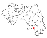
Télimélé is a town in the Fouta Djallon highlands of Guinea. Its population was estimated at 15,973 in 2008. It is the capital of Télimélé Prefecture.
Faranah is a town and sub-prefecture in central Guinea, lying by the River Niger. As of 2014 it had a population of 78,108 people. The town is mainly inhabited by the Malinke people.

The Nzérékoré Region is a region in the southern part of Guinea. Its capital and largest city is Nzérékoré. It is one of the eight regions of Guinea. It is bordered by the countries of Sierra Leone, Liberia, and Ivory Coast, and the Guinean regions of Kankan and Faranah.
Boffa is a town and sub-prefecture located on Guinea's coast. It is the capital of Boffa Prefecture. Boffa is the nearest town to the mouth of the River Pongo. As of 2014 it had a population of 27,047 people.
Gbakedou is a town and sub-prefecture in the Beyla Prefecture in the Nzérékoré Region of south-eastern Guinea.
Kolaboui is a town and sub-prefecture in the Boké Prefecture in the Boké Region of western Guinea. As of 2014 it had a population of 57,251 people.
Arfamoussaya is a town and sub-prefecture in the Dabola Prefecture in the Faranah Region of western Guinea. As of 2014 it had a population of 16,561 people.
Banguingny is a town and sub-prefecture in the Fria Prefecture in the Boké Region of western Guinea. As of 2014 it had a population of 8,684 people.
Bardou is a town and sub-prefecture in the Kissidougou Prefecture in the Faranah Region of Guinea. As of 2014 it had a population of 9,767 people.
Kondiadou or Koundiatou is a town and sub-prefecture in the Kissidougou Prefecture in the Faranah Region of Guinea. As of 2014 it had a population of 14,897 people.
Sambailo is a town and sub-prefecture in the Koundara Prefecture in the Boké Region of northern Guinea. As of 2014 it had a population of 15,479 people.
Kounsankoro is a town and sub-prefecture in the Kérouané Prefecture in the Kankan Region of south-eastern Guinea. As of 2014, it had a population of 7,053 people.
Sibiribaro is a town and sub-prefecture in the Kérouané Prefecture in the Kankan Region of south-eastern Guinea. As of 2014 it had a population of 16,485 people.
Hidayatou is a town and sub-prefecture in the Mali Prefecture in the Labé Region of northern Guinea.
Madina-Wora is a town and sub-prefecture in the Mali Prefecture in the Labé Region of northern Guinea.
Yimbéring is a town and sub-prefecture in the Mali Prefecture in the Labé Region of northern Guinea.
Soyah is a town and sub-prefecture in the Mamou Prefecture in the Mamou Region of Guinea.
Kiniébakoura is a town and sub-prefecture in the Siguiri Prefecture in the Kankan Region of northern Guinea.

Widewater is a hamlet in northern Alberta, Canada within the Municipal District of Lesser Slave River No. 124. It is located on Highway 2, approximately 225 kilometres (140 mi) northwest of Edmonton.