The vast majority of placenames in Ireland are anglicisations of Irish language names; that is, adaptations of the Irish names to English phonology and spelling. However, some names come directly from the English language, and a handful come from Old Norse and Scots. The study of placenames in Ireland unveils features of the country's history and geography and the development of the Irish language. The name of Ireland itself comes from the Irish name Éire, added to the Germanic word land. In mythology, Éire was an Irish goddess of the land and of sovereignty.

Wexford Harbour in County Wexford, Ireland is the natural harbour at the mouth of the River Slaney. In earlier times, the area occupied by the harbour was considerably larger than it is today, up to ten miles (16 km) wide at its widest point, with large mud flats on both sides. These were known as the North Slob and the South Slob from the Irish word slab, meaning mud. It contained several islands, among which the large island of Beggerin was known to be a safe refuge for early Christian settlements.

Great Island is an island in Cork Harbour, at the mouth of the River Lee and close to the city of Cork, Ireland. The largest town on the island is Cobh. The island's economic and social history has historically been linked to the naval, ship-building, and shipping activities in the town's environs.

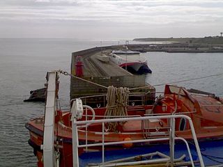
The village of Rosslare Harbour, also known as Ballygeary, grew up to serve the needs of the harbour of the same name, first developed in 1906 by the Great Western Railway and the Great Southern and Western Railway to accommodate steamferry traffic between Great Britain and Ireland. This port also serves France and Spain, traffic is mainly roll-on roll-off (RoRo). Rosslare Harbour railway station opened on 30 August 1906.

Ferrybank is a suburb of Waterford City in Ireland. Much of Ferrybank is under the political jurisdiction of Waterford City and County council and thus an area of administration for Waterford City, on the northern bank of the River Suir, extending into County Waterford. However, some parts of Ferrybank extend into County Kilkenny and are administered by Kilkenny County Council. There is an ongoing boundary dispute between both jurisdictions, with debates and proposals ongoing for many decades.

Scotshouse (Irish: Teach an Scotaigh is a small agricultural village about 7 kilometres from the border town of Clones, in County Monaghan, Ireland. It is close to the border with both County Cavan and County Fermanagh. Cavan town is 18 km away and Monaghan town is 27 km away from Scotshouse.
Castletown is the name of several places in County Cork in Ireland, including:

Hollyfort is a village north of County Wexford, Ireland. It lies within the townland of Mongan in the valley of the River Bann, 5 km northwest of Gorey.

Killurin is a village in County Wexford, Ireland on the R730 regional road. Sited along the banks of the River Slaney, it is approximately 7 miles north-west of Wexford town.

Ballyedmond is a small village and townland in County Wexford in Ireland. It is situated on the R741 regional road.

Rosbercon is a village in Ireland, on the opposite side of the River Barrow from New Ross, County Wexford. Although the village was originally in County Kilkenny, much of it is now in Wexford for administrative purposes. It had a population of 628 as of the 2006 census.

Goresbridge is a small village located in the east of County Kilkenny, in the province of Leinster, Ireland. Goresbridge is named after a 1756 bridge, built by Colonel Ralph Gore, which provides a crossing of the River Barrow between County Kilkenny and County Carlow in the South-East region.

Bective is a small hamlet and townland in County Meath, Ireland. Bective is situated on the left bank of the River Boyne and on the Clady River which joins the former in the east of the townland, approximately 6 kilometres east of Trim, on the Athboy to Dunshaughlin road.

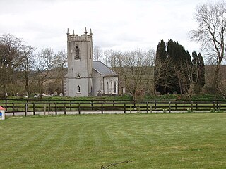
Ballycarney is a small village in County Wexford in Ireland. It is located on the R745 regional road on the east bank of the River Slaney. It is centered on All Saints Ballycarney Church of Ireland chapel, which sits on a height overlooking the river.

Kilculliheen is a civil parish, electoral division and barony in Ireland, on the north bank of the River Suir across from the centre of Waterford City. Historically, it has been transferred several times between the county of the city of Waterford and the counties of Kilkenny and Waterford. It now contains the only part of Waterford city on the left bank of the River Suir. The Parliamentary Gazetteer of 1846 states "as it lies on the left bank of the Suir, which, for the most part, divides co. Waterford from co. Kilkenny, most topographists mistakingly assign it to the barony of Ida, co. Kilkenny". It is now partly in County Kilkenny and partly in Waterford City. Of the barony's eleven townlands, five are entirely in Kilkenny and six are split between Kilkenny and Waterford. The city portion contains the former village of Ferrybank, which gives its name to a wider suburb which has spread across the county boundary.

Wexford Bridge is a road bridge in Wexford, the county town of County Wexford in Ireland. It crosses the mouth of the River Slaney from Wexford town on the west bank to Ferrybank on the east bank. It carries the R741 road from Wexford towards Dublin and the north. The bridge consists of 7 spans of maximum length 63 metres and 12 metres wide, made of continuous steel girders carrying composite concrete slabs. Including the approach roads, the total length of the bridge is 590 metres, of which 380 metres are over water.

Oldbridge is a townland near Drogheda in County Meath, Ireland. The area is home to the Boyne Navigation, the Battle of the Boyne Interpretive Centre and the southern half of the Mary McAleese Boyne Valley Bridge.

Upperthird or Upper Third is a barony in County Waterford, Republic of Ireland.

Carlanstown is a village and townland in County Meath, Ireland. It is located approximately 4 km northeast of the larger town of Kells, County Meath on the N52 road. As of the 2016 census, there were 664 people living in the village.
Clonsilla or “Clonsillagh” is a civil parish and a townland located in the south-western corner of the modern county of Fingal, Ireland. The civil parish is part of the ancient barony of Castleknock. It is centred on the suburban village of Clonsilla. In geology, the parish rests on a substratum of limestone and comprises 2943 statute acres, the whole of which is arable land. It is roughly bounded to the north by the old “Navan Road” – the modern N3; to the east by the civil parish of Castleknock; to the south by the River Liffey; to the south-east by the civil parish of Leixlip, chiefly in County Kildare, and to the north-west by the civil parish of Dunboyne in County Meath.


