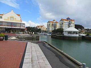
Fitzroy is a coastal suburb of New Plymouth, in the western North Island of New Zealand. It is located to the east of the city centre.

New Plymouth is the major city of the Taranaki Region on the west coast of the North Island of New Zealand. It is named after the English city of Plymouth from where the first English settlers migrated. The New Plymouth District, which includes New Plymouth City and several smaller towns, is the 10th largest district in New Zealand, and has a population of 74,184 – about two-thirds of the total population of the Taranaki Region and 1.7% of New Zealand's population. This includes New Plymouth City (58,300), Waitara (6,483), Inglewood (3,380), Oakura (1,359), Okato (561) and Urenui (429).

The North Island, also officially named Te Ika-a-Māui, is one of the two main islands of New Zealand, separated from the larger but much less populous South Island by Cook Strait. The island's area is 113,729 square kilometres (43,911 sq mi), making it the world's 14th-largest island. It has a population of 3,749,200.

New Zealand is a sovereign island country in the southwestern Pacific Ocean. The country geographically comprises two main landmasses—the North Island, and the South Island —and around 600 smaller islands. New Zealand is situated some 2,000 kilometres (1,200 mi) east of Australia across the Tasman Sea and roughly 1,000 kilometres (600 mi) south of the Pacific island areas of New Caledonia, Fiji, and Tonga. Because of its remoteness, it was one of the last lands to be settled by humans. During its long period of isolation, New Zealand developed a distinct biodiversity of animal, fungal, and plant life. The country's varied topography and its sharp mountain peaks, such as the Southern Alps, owe much to the tectonic uplift of land and volcanic eruptions. New Zealand's capital city is Wellington, while its most populous city is Auckland.
The population was 3,591 in the 2006 Census, a decrease of 48 from 2001. [1]
The area was initially named the Fitzroy Block after Governor Robert FitzRoy reduced the land purchased by the Plymouth Company from local Māori from 25,000 hectares (62,000 acres) to 1,500 hectares (3,700 acres) in the mid-1840s. [2]
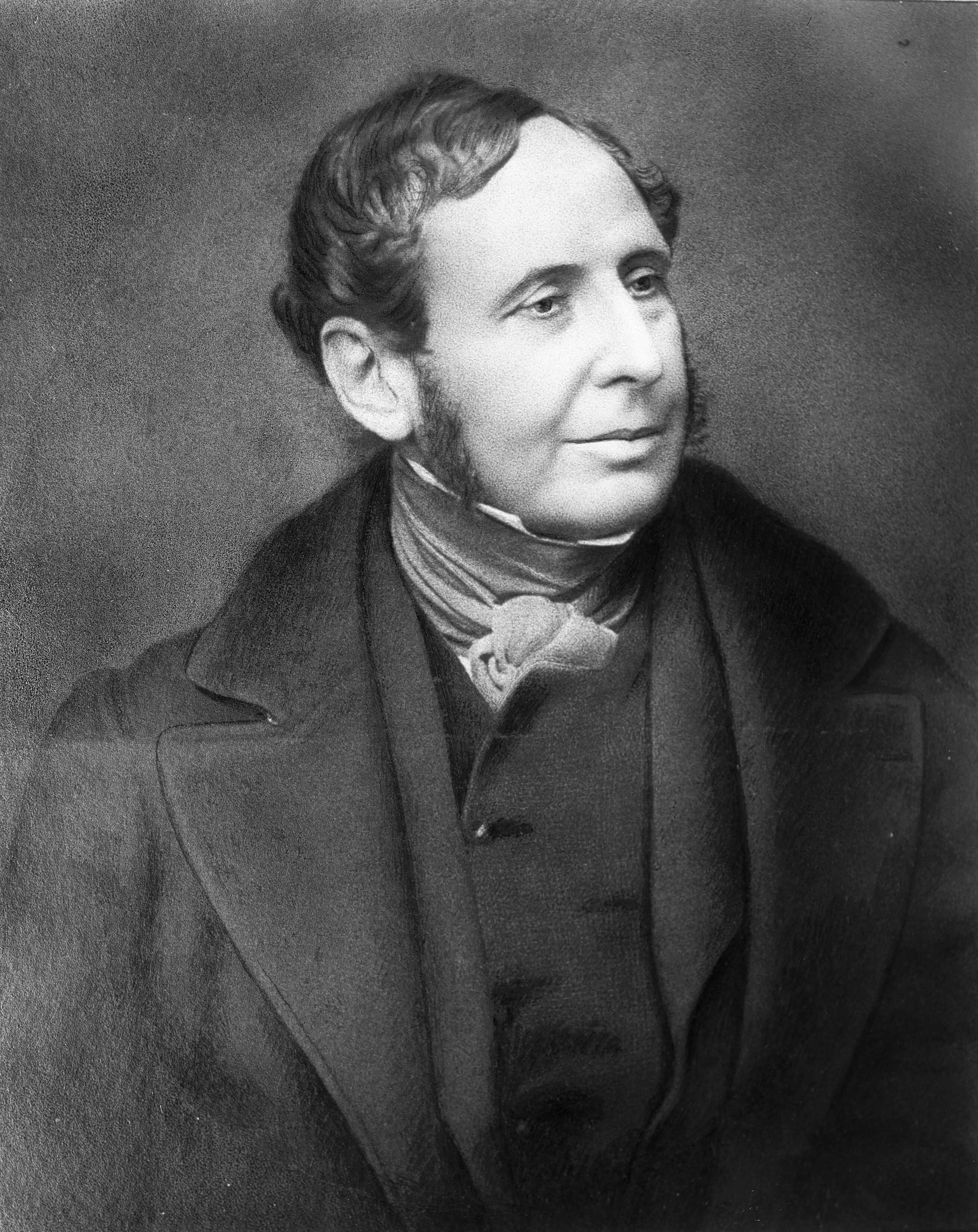
Vice-Admiral Robert FitzRoy FRS was an English officer of the Royal Navy and a scientist. He achieved lasting fame as the captain of HMS Beagle during Charles Darwin's famous voyage, FitzRoy's second expedition to Tierra del Fuego and the Southern Cone.
Holy Trinity Church in Henui Street is listed as a Category I structure with Heritage New Zealand. [3]
Holy Trinity Church in New Plymouth, New Zealand, is registered by Heritage New Zealand as a Category I structure. Built in 1872 as an Anglican church, it was extended in 1888 by James Sanderson and again in 1903 by Francis Messenger, and renovated in 1927 and the 1960s.

Heritage New Zealand Pouhere Taonga is a Crown entity with a membership of around 20,000 people that advocates for the protection of ancestral sites and heritage buildings in New Zealand. It was set up through the Historic Places Act 1954 with a mission to "...promote the identification, protection, preservation and conservation of the historical and cultural heritage of New Zealand" and is an autonomous Crown entity. Its current enabling legislation is the Heritage New Zealand Pouhere Taonga Act 2014.
Education
Fitzroy School is a coeducational contributing primary (years 1-6) school with a roll of 299. [4] The school celebrated its 125th jubilee in 2007. [5]
Sacred Heart Girls' College is a Catholic girls' secondary (years 7-13) school with a roll of 688. [6] The school was founded in 1884 and moved to its present site in 1960. It became a state integrated school in 1982. The secondary school has an attached intermediate school. [7]
Sacred Heart Girls' College is a secondary and intermediate school in New Plymouth, New Zealand.
St John Bosco School is a coeducational contributing primary (years 1-6) school with a roll of 205. [8] It is a state integrated Catholic school, established in 1942. [9]
All these schools have a decile rating of 8.

Maungaturoto is a small town in the Northland Region of New Zealand. The population was 837 in the 2006 Census, an increase of 87 from 2001.

Dairy Flat is a rural district 8 km south of Orewa beach in the North Island of New Zealand, 28 km north of central Auckland. Until the early 1990s most of the district was in dairy farms of 40 to 60 hectares, but with the growth of Auckland City and the extension of the Northern Motorway into the area, these are being gradually subdivided into lifestyle blocks of around 2 to 5 hectares, many of which are grazing sheep, horses, beef cattle or deer. Although it still retains a rural character, it is counted as part of the Auckland urban area in official statistics.
Gulf Harbour is a development some 4 km from the end of the Whangaparaoa Peninsula, towards the northern end of Auckland, New Zealand. It has one of the country's largest marinas, one of the country's top golf courses, and is regarded as a retreat for Auckland's well-off. The site is also known as Hobbs Bay, and was sold in the early seventies by landowners, the Hobbs family, who still retain some of the coastal area including the Hobbs Bay beach.

Normanby is a small village in South Taranaki, New Zealand. It is approximately 6 km inland from Hawera along State Highway 3. Eltham is 13 km further north. It is also situated on the Marton - New Plymouth Line railway, which has been freight-only through Normanby since the cessation of passenger railcar services between Wellington and New Plymouth on 30 July 1977.
Midhirst is a small village in Taranaki, New Zealand, approximately 4 km north of Stratford, on State Highway 3. Inglewood is 17 km (11 mi) north of Midhirst, and New Plymouth is 35 km (22 mi) to the northwest.

Westown is a suburb of New Plymouth, in the western North Island of New Zealand. It is located to the southwest of the city centre and west of Frankleigh Park.
Vogeltown is a suburb of New Plymouth, in the western North Island of New Zealand. It is located to the southeast of the city centre and east of Frankleigh Park. The suburb was named after Sir Julius Vogel, Prime Minister of New Zealand in the 1870s.
Frankleigh Park is a suburb of New Plymouth, in the western North Island of New Zealand. It is located to the south of the city centre. The suburb is built around the site of early settler Henry King's farm, Woodleigh, the father of William Cutfield King. The population was 3,447 in the 2006 Census, a decrease of 33 from 2001.
Moturoa is a coastal suburb of New Plymouth, in the western North Island of New Zealand. It is located to the west of the city centre. The population was 3,558 in the 2006 Census, an increase of 315 from 2001.
Hurleyville is a community in south Taranaki, in the western North Island of New Zealand. It is located 18 kilometres north of Patea and 30 km southeast of Hawera.
Urenui is a settlement in northern Taranaki, in the North Island of New Zealand. It is located on State Highway 3 close to the shore of the North Taranaki Bight, 13 kilometres east of Waitara and 6 km south-west of Mimi. The Urenui River flows past the settlement into the North Taranaki Bight.
Maunu is a suburb in the south west of Whangarei in Northland, New Zealand. A volcanic hill to the west is also called Maunu and has a peak 395 m above sea level. State Highway 14 runs through the suburb.
Whau Valley is a suburb of Whangarei, in Northland Region, New Zealand. State Highway 1 runs through it. The valley was named for the whau trees which grew there in the 1850s.

Spotswood is a suburb of New Plymouth in the Taranaki Region of New Zealand. It is located to the west of the city centre. The population was 2,010 in the 2006 Census, an increase of 27 from 2001.
Welbourn is a suburb of New Plymouth, in the western North Island of New Zealand. It is located to the southeast of the city centre. Te Henui Stream runs through the suburb and State Highway 3 forms its western boundary.
Hurdon is a suburb of New Plymouth, in the western North Island of New Zealand. It is located to the southwest of the city centre.
Marfell is a suburb of New Plymouth, in the western North Island of New Zealand. It is located to the southwest of the city centre. The Mangaotuku Stream runs past Marfell.
Mangorei is a locality on the outskirts of New Plymouth in Taranaki, New Zealand. The city centre is about 5 km to the north-west. State Highway 3 passes to the south-west.

Brooklands is a suburb of New Plymouth, in the Taranaki region of the western North Island of New Zealand. It is located on the southern edge of the city and east of Vogeltown. The area is named after Brooklands farm, established in 1842.