Demographics
Merrilands covers 1.73 km2 (0.67 sq mi) [1] and had an estimated population of 3,110 as of June 2023, [2] with a population density of 1,798 people per km2.
Historical population| Year | | |
|---|
| 2006 | 2,787 | — |
|---|
| 2013 | 2,811 | +0.12% |
|---|
| 2018 | 2,925 | +0.80% |
|---|
| Source: [4] |
Merrilands had a population of 2,925 at the 2018 New Zealand census, an increase of 114 people (4.1%) since the 2013 census, and an increase of 138 people (5.0%) since the 2006 census. There were 1,182 households, comprising 1,404 males and 1,521 females, giving a sex ratio of 0.92 males per female. The median age was 42.8 years (compared with 37.4 years nationally), with 540 people (18.5%) aged under 15 years, 501 (17.1%) aged 15 to 29, 1,236 (42.3%) aged 30 to 64, and 642 (21.9%) aged 65 or older.
Ethnicities were 83.6% European/Pākehā, 14.7% Māori, 2.2% Pacific peoples, 7.3% Asian, and 2.4% other ethnicities. People may identify with more than one ethnicity.
The percentage of people born overseas was 18.4, compared with 27.1% nationally.
Although some people chose not to answer the census's question about religious affiliation, 49.3% had no religion, 39.1% were Christian, 0.3% had Māori religious beliefs, 1.3% were Hindu, 0.7% were Muslim, 0.5% were Buddhist and 1.2% had other religions.
Of those at least 15 years old, 465 (19.5%) people had a bachelor's or higher degree, and 501 (21.0%) people had no formal qualifications. The median income was $29,200, compared with $31,800 nationally. 399 people (16.7%) earned over $70,000 compared to 17.2% nationally. The employment status of those at least 15 was that 1,029 (43.1%) people were employed full-time, 369 (15.5%) were part-time, and 105 (4.4%) were unemployed. [4]
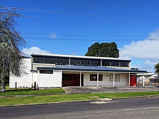
Commerce
There is one main shopping centre located in Merrilands. This is located on the corner of Cumberland St and Mangorei Rd. Shops there include Lotto and Post Shop, New World Supermarket, pharmacy, hair salon, dentist, medical centre, along with a Z fuel station. A smaller group of shops, including a dairy and bakery, are at the intersection of Mangorei Rd and Karaka St.
Tikokino is a town in the Central Hawke's Bay District on the east coast of the North Island of New Zealand. It is located 20 kilometres (12 mi) northwest of Waipawa and 55 kilometres (34 mi) southwest of Hastings. The township is located on State Highway 50.
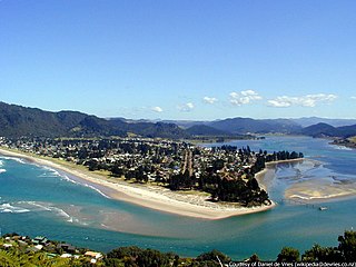
The town of Pauanui is on the east coast of the Coromandel Peninsula in the North Island of New Zealand. It lies at the mouth of the Tairua River on its south bank, directly opposite the larger town of Tairua.

Lincoln is a suburb in West Auckland, New Zealand. It is also the filming location of Shortland Street. The suburb is sometimes called Lincoln North or treated as part of Henderson North to avoid confusion with Lincoln in Canterbury.
Ashburton Forks, formerly known as Spreadeagle, is a defined locality on the Canterbury Plains between the forks of the Ashburton / Hakatere Rivers and within the Ashburton District of the Canterbury Province of New Zealand's South Island. It is approximately 50 km west of Ashburton and about 17 km from the foot of the Southern Alps.

Oropi is a rural settlement located in the Bay of Plenty region of the North Island of New Zealand. It is located 20 kilometres south of Tauranga and 43 kilometres north of Rotorua. It has been suggested that the word Oropi is the Māori language equivalent of Europe. This is derived from the 1860s when government forces were based in the area at the time of the Battle of Gate Pā.

Alicetown is a central suburb of Lower Hutt located at the bottom of the North Island of New Zealand.

Silverdale is a suburb in south-eastern Hamilton in New Zealand. It is east from Hillcrest and home to Hillcrest High School, despite the school's name. Part of Silverdale is covered by the University of Waikato.
Gate Pa or Gate Pā is a suburb of Tauranga, in the Bay of Plenty Region of New Zealand's North Island.

Normanby is a small village in South Taranaki, New Zealand. It is approximately 6 km inland from Hāwera along State Highway 3. Eltham is 13 km further north.

Frankleigh Park is a suburb of New Plymouth, in the western North Island of New Zealand. It is located to the south of the city centre. The suburb is built around the site of early settler Henry King's farm, Woodleigh, the father of William Cutfield King.
Strowan is an affluent suburb of Christchurch, New Zealand, located approximately 5 km north-west of Christchurch's central business district. It had a population of 3,705 at the 2013 census. It is located between the suburbs of Merivale, Papanui, Bryndwr, Fendalton, and St Albans.
Marfell is a suburb of New Plymouth, in the western North Island of New Zealand. It is located to the southwest of the city centre. The Mangaotuku Stream runs past Marfell.

Mount Pleasant (Tauhinukorokio) is a coastal suburb of Christchurch, New Zealand. The suburb is located on the northern flank of the mountain Tauhinukorokio/Mount Pleasant in the Port Hills. It takes its name from the English version of the mountain's name.

Maoribank is a suburb of Upper Hutt, located 2–3 km east-northeast of the city centre. It was predominantly developed between 1950-1970 and had a population of just less than 1000 at the 2013 Census.

Walton is a settlement in New Zealand. It is sited at the junction of Walton Road and Morrinsville Walton Road, in the Central Waikato Region.

Hamilton West is a suburb in western Hamilton in New Zealand.
St James Park is a suburb in north-eastern Hamilton in New Zealand by a 2010 map. It was developed by Chedworth/Grasshopper Joint Venture in 2001. In 2012 Hamilton Libraries described it as being in Huntington, as do some valuers and land agents. St James shopping area is in the centre of Rototuna, with a Countdown supermarket, a gym and a Palmers Garden Centre.
Onewhero is a village and rural community in the Waikato District and Waikato region of New Zealand's North Island.
New Plymouth Central is the central business district and central suburb of New Plymouth, in the Taranaki region of the western North Island of New Zealand.
Wharemoa is a southeastern suburb of Greymouth on the West Coast of New Zealand. Marsden Road is a major road running through the suburb. Sawyers Creek runs northwest through the suburb to join the Grey River / Māwheranui near its mouth on the Tasman Sea.
This page is based on this
Wikipedia article Text is available under the
CC BY-SA 4.0 license; additional terms may apply.
Images, videos and audio are available under their respective licenses.

