
Inglewood is a town in the Taranaki Region of New Zealand's North Island. It is 16 kilometres (10 mi) southeast of New Plymouth on State Highway 3, close to Mount Taranaki, and sits 200 metres (660 ft) above sea level. The town services a mainly dairy farming region.

Waitara is a town in the northern part of the Taranaki region of the North Island of New Zealand. Waitara is located just off State Highway 3, 15 kilometres (9.3 mi) northeast of New Plymouth.

Ōkato is a small town in rural Taranaki, New Zealand. It is situated about 25 minutes drive around the coast from New Plymouth on State Highway 45. Oakura is 12 km to the north-east, and Warea is 9 km to the south-west. The place offers popular rocky surfing spots around coastal beaches. The town was established as a military settlement in the 1860s.
Toko is a small rural settlement 10 kilometres east of Stratford, New Zealand, at the intersection of East Road and Toko Road. It is located on a railway, the Stratford–Okahukura Line, the western portion of which was operated as a branch line known as the Toko Branch prior to the line's completion. The Toko Stream flows through the area to join the Patea River.
Lepperton is a small village in North Taranaki, New Zealand. It is approximately 6 km (3.7 mi) inland from Waitara township, 5 km (3.1 mi) west of the Waitara River, and 1 km (0.62 mi) east of State Highway 3A, which connects Inglewood to Waitara.
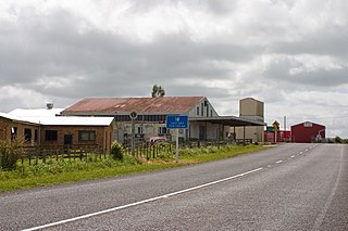
Midhirst is a small village in Taranaki, New Zealand, approximately 4 km north of Stratford, on State Highway 3. Inglewood is 17 km (11 mi) north of Midhirst, and New Plymouth is 35 km (22 mi) to the northwest.

Hurleyville is a community in south Taranaki, in the western North Island of New Zealand. It is located 18 kilometres north of Patea and 30 km southeast of Hāwera.
Huiakama is a settlement in inland Taranaki, in the western North Island of New Zealand. It is located just to the north of Strathmore on State Highway 43.
Urenui is a settlement in northern Taranaki, in the North Island of New Zealand. It is located on State Highway 3 close to the shore of the North Taranaki Bight, 13 kilometres east of Waitara and 6 km south-west of Mimi. The Urenui River flows past the settlement into the North Taranaki Bight.

Aranga is a locality in Northland, New Zealand. State Highway 12 passes through it. Omapere is 47 km north west, and Dargaville is 42 km south east. The Waipoua Forest is to the north. Maunganui Bluff and the Tasman Sea are to the west, with the small settlement of Aranga Beach lying at the northern end of Ripiro Beach.
Makahu is a settlement in inland Taranaki, in the western North Island of New Zealand. It is located to the southeast of Strathmore. the Makahu Stream runs south through the area to join with the Mangaehu Stream, which flows into the Patea River.
Auroa is a locality in southern Taranaki. Opunake is to the west, Kaponga to the northeast, and Manaia to the southeast. Mount Taranaki is directly north of Auroa.
Ahititi is a locality in Taranaki, New Zealand. State Highway 3 runs through it. Mokau is 23 km to the north, Mimi is 26 km to the south-west, and Kotare is 16 km to the east. The Tongaporutu River flows through the area and into the North Taranaki Bight at Tongaporutu to the north-west. The name means "fire for cooking" (ahi) "muttonbirds" (titi).
Egmont Village is a settlement in Taranaki, New Zealand. State Highway 3 runs through it. New Plymouth is 12 km to the north-west, and Inglewood is 6 km to the south-east. Waiwhakaiho River and Mangaoraka Stream flow past to the west and east, respectively.
Norfolk is a locality in Taranaki, in the North Island of New Zealand. It is located on State Highway 3, about 5.5 kilometres south-east of Inglewood and 10.5 km north-west of Midhirst.
Ratapiko is a locality in Taranaki, New Zealand. Kaimata is about six kilometres to the north-west.
Tikorangi is a settlement in Taranaki, New Zealand. Waitara lies about 6 kilometres to the north-west. The Waitara River flows to the west of the settlement, with the Bertrand Road suspension bridge providing access to the other side. The Mangaemiemi or Otaraua Marae and Te Ahi Kaa Roa meeting house are a local meeting place for Otaraua, a hapū of Te Āti Awa.
Uruti is a locality in northern Taranaki, in the North Island of New Zealand. It is located on State Highway 3, north-east of Mimi and south-west of Ahititi. The Uruti Stream meets the Mimi River at this point. The river flows past the settlement into the North Taranaki Bight.

Woodhill is a locality in the Auckland Region of New Zealand. It is in the Western Ward of the Rodney District. Woodhill is approximately 6 kilometres northwest of Waimauku and 10 km south of Helensville on State Highway 16. The North Auckland Line passes through the area. The Woodhill Forest lies to the west.

Bell Block is a town in Taranaki, New Zealand. State Highway 3 runs through it. It is 6 km north-east of the centre of New Plymouth and 1 km from the outer edge of New Plymouth at Waiwhakaiho. Waitara is about 9 km to the north-east. New Plymouth Airport is located immediately to the north-east of Bell Block.
