Demographics
Historical population| Year | Pop. | ±% p.a. |
|---|
| 2006 | 3,468 | — |
|---|
| 2013 | 3,450 | −0.07% |
|---|
| 2018 | 3,633 | +1.04% |
|---|
| Source: [3] |
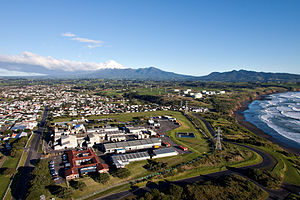
Spotswood had a population of 3,633 at the 2018 New Zealand census, an increase of 183 people (5.3%) since the 2013 census, and an increase of 165 people (4.8%) since the 2006 census. There were 1,416 households. There were 1,806 males and 1,827 females, giving a sex ratio of 0.99 males per female. The median age was 37.9 years (compared with 37.4 years nationally), with 750 people (20.6%) aged under 15 years, 678 (18.7%) aged 15 to 29, 1,596 (43.9%) aged 30 to 64, and 612 (16.8%) aged 65 or older.
Ethnicities were 79.9% European/Pākehā, 25.8% Māori, 4.3% Pacific peoples, 4.6% Asian, and 2.9% other ethnicities (totals add to more than 100% since people could identify with multiple ethnicities).
The proportion of people born overseas was 14.9%, compared with 27.1% nationally.
Although some people objected to giving their religion, 51.7% had no religion, 35.3% were Christian, 0.3% were Hindu, 0.8% were Muslim, 0.9% were Buddhist and 3.0% had other religions.
Of those at least 15 years old, 375 (13.0%) people had a bachelor or higher degree, and 684 (23.7%) people had no formal qualifications. The median income was $25,900, compared with $31,800 nationally. The employment status of those at least 15 was that 1,314 (45.6%) people were employed full-time, 414 (14.4%) were part-time, and 171 (5.9%) were unemployed. [3]

Drury is a rural town near Auckland, in northern New Zealand. Located 36 kilometres to the south of Auckland CBD, under authority of the Auckland Council. Drury lies at the southern border of the Auckland metropolitan area, 12 kilometres to the northeast of Pukekohe, close to the Papakura Channel, an arm of the Manukau Harbour.
Henderson is a major suburb of Auckland, in the North Island of New Zealand. It is 13 kilometres (8.1 mi) west of Auckland city centre, and two kilometres (1.2 mi) west of the Whau River, a southwestern arm of the Waitematā Harbour. The suburb is located within the Henderson-Massey Local Board of the Waitākere Ward, one of the thirteen administrative divisions of Auckland Council.
Tāmaki is a small suburb of East Auckland, 11 kilometres from the Auckland CBD, in the North Island of New Zealand. It is located by the banks of the estuarial Tāmaki River, which is a southern arm of the Hauraki Gulf. The suburb is between the suburbs of Point England to the north and Panmure to the south.

Blockhouse Bay is a residential suburb in the south west of Auckland, in New Zealand's North Island. It is sited on the northern coast of the Manukau Harbour, and is also close to the administrative boundary that existed between Auckland City and Waitakere City, two of the former four cities of what was the Auckland conurbation before amalgamation into Auckland Council.
Northcote Central is a suburb of Auckland's North Shore, in northern New Zealand. It is located on the northern shore of the Waitematā Harbour.

Waterview is a suburb of Auckland, New Zealand, located along the western side of Auckland's isthmus. Its boundaries are Oakley Creek in the east, Heron Park in the south, the Waitematā Harbour in the west, and the Northwestern Motorway and the Oakley Creek inlet in the north.
Dannemora is a residential suburb in Auckland, New Zealand. It is located in the east of the city, close to Pakuranga and Botany Downs, and in the Howick ward and local board area of Auckland Council.
Henderson North is a suburb of Auckland, New Zealand.

Papakura is a southern suburb of Auckland, in northern New Zealand. It is located on the shores of the Pahurehure Inlet, approximately 32 kilometres south of the Auckland CBD. It is under the authority of the Auckland Council.

Westown is a suburb of New Plymouth, in the western North Island of New Zealand. It is located to the southwest of the city centre and west of Frankleigh Park.
Fitzroy is a coastal suburb of New Plymouth, in the western North Island of New Zealand. It is located to the north-east of the city centre.
Lynmouth is a suburb of New Plymouth in the Taranaki Region of New Zealand. It is located to the west of the city centre.
Welbourn is a suburb of New Plymouth, in the western North Island of New Zealand. It is located to the southeast of the city centre. Te Henui Stream runs through the suburb and State Highway 3 forms its western boundary.
Ratapiko is a locality in Taranaki, New Zealand. Kaimata is about six kilometres to the north-west.
Campbells Bay is a suburb of the North Shore located in Auckland, New Zealand.
The Gardens is a suburb of Auckland, New Zealand. It is located to the north of Manurewa East, east of Wiri and south of Totara Heights. It was formerly under the local governance of Manukau City Council until it was merged with all of Auckland's councils to form the Auckland 'super city' in 2010. It is now under the local governance of Auckland Council.
Sunnyhills is a suburb of Auckland, New Zealand. It is part of the Pakuranga Electorate.

Strathmore Park is a suburb of Wellington City, New Zealand. It is located at the southern end of the Miramar Peninsula to the south of the suburb of Miramar, and due east of airport. A hill suburb, it overlooks Lyall Bay, Evans Bay and several bays along the Seatoun coast close to the mouth of Wellington Harbour, which lies to the east.

Taupō Central is the central suburb and business district of Taupō in the Waikato region of New Zealand's North Island.
Rānui is an Auckland suburb, which is under the local governance of Auckland Council. The area is densely populated but close to the western fringe of the Auckland urban area.
This page is based on this
Wikipedia article Text is available under the
CC BY-SA 4.0 license; additional terms may apply.
Images, videos and audio are available under their respective licenses.