Demographics
Historical population| Year | Pop. | ±% p.a. |
|---|
| 2006 | 2,487 | — |
|---|
| 2013 | 2,514 | +0.15% |
|---|
| 2018 | 2,535 | +0.17% |
|---|
| Source: [2] |
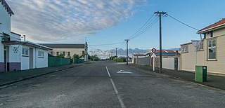
The Strandon statistical area covers 1.76 km2 (0.68 sq mi). [1] It had a population of 2,535 at the 2018 New Zealand census, an increase of 21 people (0.8%) since the 2013 census, and an increase of 48 people (1.9%) since the 2006 census. There were 1,038 households. There were 1,194 males and 1,341 females, giving a sex ratio of 0.89 males per female. The median age was 46.7 years (compared with 37.4 years nationally), with 372 people (14.7%) aged under 15 years, 426 (16.8%) aged 15 to 29, 1,167 (46.0%) aged 30 to 64, and 570 (22.5%) aged 65 or older.
Ethnicities were 88.5% European/Pākehā, 11.6% Māori, 1.2% Pacific peoples, 6.6% Asian, and 1.8% other ethnicities (totals add to more than 100% since people could identify with multiple ethnicities).
The proportion of people born overseas was 18.5%, compared with 27.1% nationally.
Although some people objected to giving their religion, 47.2% had no religion, 41.8% were Christian, 1.4% were Hindu, 0.6% were Muslim, 0.5% were Buddhist and 1.3% had other religions.
Of those at least 15 years old, 531 (24.5%) people had a bachelor or higher degree, and 303 (14.0%) people had no formal qualifications. The median income was $34,100, compared with $31,800 nationally. The employment status of those at least 15 was that 1,035 (47.9%) people were employed full-time, 351 (16.2%) were part-time, and 57 (2.6%) were unemployed. [2]
Waverley is a town located in the South Taranaki District in New Zealand. It is 44 km northwest of Whanganui. Patea is 17 km to the west, and Waitōtara is 10 km to the southeast. State Highway 3 and the Marton - New Plymouth Line railway run through the town.

Napier Hill is a limestone outcrop and suburb rising above the lowland districts of the city of Napier on New Zealand's North Island.

Normanby is a small village in South Taranaki, New Zealand. It is approximately 6 km inland from Hawera along State Highway 3. Eltham is 13 km further north.

Westown is a suburb of New Plymouth, in the western North Island of New Zealand. It is located to the southwest of the city centre and west of Frankleigh Park.
Vogeltown is a suburb of New Plymouth, in the western North Island of New Zealand. It is located to the southeast of the city centre and east of Frankleigh Park. The suburb was named after Sir Julius Vogel, Prime Minister of New Zealand in the 1870s.
Frankleigh Park is a suburb of New Plymouth, in the western North Island of New Zealand. It is located to the south of the city centre. The suburb is built around the site of early settler Henry King's farm, Woodleigh, the father of William Cutfield King.
Fitzroy is a coastal suburb of New Plymouth, in the western North Island of New Zealand. It is located to the north-east of the city centre.
Lynmouth is a suburb of New Plymouth in the Taranaki Region of New Zealand. It is located to the west of the city centre.

Spotswood is a suburb of New Plymouth in the Taranaki Region of New Zealand. It is located to the west of the city centre.
Welbourn is a suburb of New Plymouth, in the western North Island of New Zealand. It is located to the southeast of the city centre. Te Henui Stream runs through the suburb and State Highway 3 forms its western boundary.
Hurdon is a suburb of New Plymouth, in the western North Island of New Zealand. It is located to the southwest of the city centre.
Marfell is a suburb of New Plymouth, in the western North Island of New Zealand. It is located to the southwest of the city centre. The Mangaotuku Stream runs past Marfell.

Merrilands is a suburb of New Plymouth, in the western North Island of New Zealand. It is located to the south-east of the city centre. The Waiwhakaiho River runs past Merrilands to the east, and Te Henui Stream runs past to the west.

Hutt Central, a suburb of the city of Lower Hutt in New Zealand, forms part of the urban area of greater Wellington. It includes the Lower Hutt CBD.

The Taranaki District Health Board is a district health board with the focus on providing healthcare to the Taranaki region of New Zealand.
New Plymouth Central is the central business district and central suburb of New Plymouth, in the Taranaki region of the western North Island of New Zealand.
Highlands Park is a suburb of the New Zealand city of New Plymouth.
Whalers Gate is a suburb of New Plymouth, in the western North Island of New Zealand. It is located to the southwest of the city centre.
Ferndale is a suburb of New Plymouth, in the western North Island of New Zealand. It is located to the south of the city centre.

Timaru Central is the central business district of Timaru, in the South Canterbury area and Canterbury region of New Zealand's South Island.
This page is based on this
Wikipedia article Text is available under the
CC BY-SA 4.0 license; additional terms may apply.
Images, videos and audio are available under their respective licenses.

