Omata

Last updated

Omata
Tapuae to nga motu (5240314789).jpg
Tapuae Beach
Omata
Coordinates: 39°5′38″S174°1′13″E / 39.09389°S 174.02028°E / -39.09389; 174.02028
Country New Zealand
Region Taranaki Region
Territorial authority New Plymouth District
Ward
  • Kaitake-Ngāmotu General Ward
  • Te Purutanga Mauri Pūmanawa Māori Ward
CommunityKaitake Community
Electorates
Government
  Territorial Authority New Plymouth District Council
  Regional council Taranaki Regional Council
Area
[1]
  Total21.60 km2 (8.34 sq mi)
Population
 (June 2022) [2]
  Total1,040
  Density48/km2 (120/sq mi)

Omata is a locality in Taranaki, in the western North Island of New Zealand. [3] It is located on State Highway 45 just southwest of New Plymouth. [4] [5] Omata and Western New Plymouth are adjacent to the Tapuae Marine Reserve.

Contents

The area was the site of the Omata Stockade, built to house soldiers during tensions at the time of the First Taranaki War in 1860–61, and is near the site of the Battle of Waireka on 28 March 1860. [6] The stockade, designed and constructed by local settlers, was built on the site of Ngāturi Pā. [7] In August 1860, most of Omata village was burnt down during the war. [7] Troops were stationed at the stockade until 1866, and it was demolished by farmers and the remains auctioned off in late 1867. [7]

Demographics

Omata statistical area covers 21.60 km2 (8.34 sq mi) [1] and had an estimated population of 1,040 as of June 2022, [2] with a population density of 48 people per km2.

Historical population
YearPop.±% p.a.
2006771    
2013837+1.18%
2018939+2.33%
Source: [8]

Omata had a population of 939 at the 2018 New Zealand census, an increase of 102 people (12.2%) since the 2013 census, and an increase of 168 people (21.8%) since the 2006 census. There were 330 households, comprising 468 males and 468 females, giving a sex ratio of 1.0 males per female. The median age was 46.3 years (compared with 37.4 years nationally), with 180 people (19.2%) aged under 15 years, 126 (13.4%) aged 15 to 29, 498 (53.0%) aged 30 to 64, and 132 (14.1%) aged 65 or older.

Ethnicities were 94.9% European/Pākehā, 7.7% Māori, 1.0% Pacific peoples, 1.9% Asian, and 1.3% other ethnicities. People may identify with more than one ethnicity.

The percentage of people born overseas was 13.7, compared with 27.1% nationally.

Although some people chose not to answer the census's question about religious affiliation, 55.0% had no religion, 37.7% were Christian, 0.6% had Māori religious beliefs, 0.3% were Buddhist and 0.6% had other religions.

Of those at least 15 years old, 159 (20.9%) people had a bachelor's or higher degree, and 102 (13.4%) people had no formal qualifications. The median income was $39,400, compared with $31,800 nationally. 192 people (25.3%) earned over $70,000 compared to 17.2% nationally. The employment status of those at least 15 was that 408 (53.8%) people were employed full-time, 144 (19.0%) were part-time, and 21 (2.8%) were unemployed. [8]

Education

Clubrooms of the New Plymouth Clay Target Club near Omata destroyed by a tornado Tornado season in Taranaki.jpg
Clubrooms of the New Plymouth Clay Target Club near Omata destroyed by a tornado

Omata School is a coeducational full primary (years 1–8) school with a roll of 196 students as of February 2024. [9] [10] In 2003, the school celebrated its 150th jubilee. [11]

Omata electorate

Omata was an electorate for the New Zealand House of Representatives from 1853 to 1870. Seven Members of Parliament represented the electorate in the 1st to 4th Parliament.

Related Research Articles

<span class="mw-page-title-main">Waitara, New Zealand</span> Settlement in Taranaki Region, New Zealand

Waitara is a town in the northern part of the Taranaki region of the North Island of New Zealand. Waitara is located just off State Highway 3, 15 kilometres (9.3 mi) northeast of New Plymouth.

<span class="mw-page-title-main">Hāwera</span> Town in Taranaki Region, New Zealand

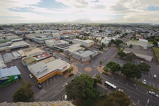
Hāwera is the second-largest centre in the Taranaki region of New Zealand's North Island, with a population of 10,350. It is near the coast of the South Taranaki Bight. The origins of the town lie in a government military base that was established in 1866, and the town of Hāwera grew up around a blockhouse in the early 1870s.

<span class="mw-page-title-main">Ōkato</span> Town in Taranaki, New Zealand

Ōkato is a small town in rural Taranaki, New Zealand. It is situated about 25 minutes drive around the coast from New Plymouth on State Highway 45. Ōakura is 12 km to the north-east, and Warea is 9 km to the south-west. The place offers popular rocky surfing spots around coastal beaches. The town was established as a military settlement in the 1860s.

Douglas is a lowly populated locality and a rural centre in east Taranaki, surrounded by dairy, sheep and beef pastoral farming. It is situated 18 km east of Stratford at the intersection of East Road, Ohura Road, Douglas Road South and Bredow Road. East Road and Ohura Road meet to form State Highway 43, linking Stratford to the King Country town of Taumarunui. The Stratford–Okahukura Line, a secondary railway line, runs through Douglas where it veers north-east and away from the state highway for approximately 20 km.

Lepperton is a small village in North Taranaki, New Zealand. It is approximately 6 km (3.7 mi) inland from Waitara township, 5 km (3.1 mi) west of the Waitara River, and 1 km (0.62 mi) east of State Highway 3A, which connects Inglewood to Waitara.

<span class="mw-page-title-main">Normanby, Taranaki</span> Settlement in Taranaki Region, New Zealand

Normanby is a small village in South Taranaki, New Zealand. It is approximately 6 km inland from Hāwera along State Highway 3. Eltham is 13 km further north.

<span class="mw-page-title-main">Ōakura</span> Settlement in Taranaki Region, New Zealand

Ōakura is a small township in New Plymouth District, Taranaki, in the western North Island of New Zealand. It is located on State Highway 45, 15 kilometres south-west of New Plymouth. Ōkato is 12 km further south-west. The Oakura River flows past the town and into the North Taranaki Bight. To the south is the Kaitake Range, part of Egmont National Park.

<span class="mw-page-title-main">Westown</span> Suburb of New Plymouth, New Zealand

Westown is a suburb of New Plymouth, in the western North Island of New Zealand. It is located to the southwest of the city centre and west of Frankleigh Park.

<span class="mw-page-title-main">Fitzroy, New Plymouth</span> Suburb of New Plymouth, New Zealand

Fitzroy is a coastal suburb of New Plymouth, in the western North Island of New Zealand. It is located to the north-east of the city centre.

Urenui is a settlement in northern Taranaki, in the North Island of New Zealand. It is located on State Highway 3 close to the shore of the North Taranaki Bight, 13 kilometres east of Waitara and 6 km south-west of Mimi. The Urenui River flows past the settlement into the North Taranaki Bight.

Auroa is a locality in southern Taranaki, New Zealand. Ōpunake is to the west, Kaponga to the northeast, and Manaia to the southeast. Mount Taranaki is directly north of Auroa.

Lynmouth is a suburb of New Plymouth in the Taranaki Region of New Zealand. It is located to the west of the city centre.

<span class="mw-page-title-main">Spotswood, New Plymouth</span> Suburb of New Plymouth, New Zealand

Spotswood is a suburb of New Plymouth in the Taranaki Region of New Zealand. It is located to the west of the city centre.

<span class="mw-page-title-main">Welbourn, New Zealand</span> Suburb of New Plymouth, New Zealand

Welbourn is a suburb of New Plymouth, in the western North Island of New Zealand. It is located to the southeast of the city centre. Te Henui Stream runs through the suburb and State Highway 3 forms its western boundary.

Egmont Village is a settlement in Taranaki, New Zealand. State Highway 3 runs through it. New Plymouth is 12 km to the north-west, and Inglewood is 6 km to the south-east. Waiwhakaiho River and Mangaoraka Stream flow past to the west and east, respectively.

<span class="mw-page-title-main">Mangorei</span> Rural community in Taranaki, New Zealand

Mangorei is a locality on the outskirts of New Plymouth in Taranaki, New Zealand. The city centre is about 5 km to the north-west. State Highway 3 passes to the south-west.

<span class="mw-page-title-main">Uruti</span> Settlement in Taranaki, New Zealand

Uruti is a locality in northern Taranaki, in the North Island of New Zealand. It is located on State Highway 3, north-east of Mimi and south-west of Ahititi. The Uruti Stream meets the Mimi River at this point. The river flows past the settlement into the North Taranaki Bight.

Waitoriki is a locality in Taranaki, New Zealand. Inglewood is about 4.5 km to the southwest.

<span class="mw-page-title-main">Bell Block, New Zealand</span> Settlement in Taranaki Region, New Zealand

Bell Block is a town in Taranaki, New Zealand. State Highway 3 runs through it. It is 6 km north-east of the centre of New Plymouth and 1 km from the outer edge of New Plymouth at Waiwhakaiho. Waitara is about 9 km to the north-east. New Plymouth Airport is located immediately to the north-east of Bell Block.

Paraite is a rural community in the New Plymouth District and Taranaki region of New Zealand's North Island. The area is east of New Plymouth and south of Bell Block. The Marton–New Plymouth line separates Paraite from the industrial area of Bell Block.

References

  1. 1 2 "ArcGIS Web Application". statsnz.maps.arcgis.com. Retrieved 3 March 2023.
  2. 1 2 "Population estimate tables - NZ.Stat". Statistics New Zealand . Retrieved 25 October 2022.
  3. "Place name detail: Omata". New Zealand Gazetteer. New Zealand Geographic Board . Retrieved 30 October 2007.
  4. Peter Dowling, ed. (2004). Reed New Zealand Atlas. Reed Books. pp. map 34. ISBN   0-7900-0952-8.
  5. Roger Smith, GeographX (2005). The Geographic Atlas of New Zealand. Robbie Burton. pp. map 84. ISBN   1-877333-20-4.
  6. "The New Zealand Wars" by James Cowan, 1922, chapter 19.
  7. 1 2 3 Prickett, Nigel (1994). "Pakeha and Maori Fortifications of the First Taranaki War, 1860–61". Records of the Auckland Institute and Museum . 31: 1–87. ISSN   0067-0464. JSTOR   42906439. Wikidata   Q58677455.
  8. 1 2 "Statistical area 1 dataset for 2018 Census". Statistics New Zealand. March 2020. Omata (216400). 2018 Census place summary: Omata
  9. "New Zealand Schools Directory". New Zealand Ministry of Education. Retrieved 14 March 2024.
  10. Education Counts: Omata School
  11. "Jubilees & reunions: Omata-Hurford School 150th Jubilee". Education Gazette New Zealand. 81 (20). 4 November 2002.[ dead link ]