
The Au Sable River in Michigan, United States runs approximately 138 miles (222 km) through the northern Lower Peninsula, through the towns of Grayling and Mio, and enters Lake Huron at the town of Oscoda. It is considered one of the best brown trout fisheries east of the Rockies and has been designated a blue ribbon trout stream by the Michigan Department of Natural Resources. In French, au sable literally means "at the sand." A 1795 map calls it the Beauais River.
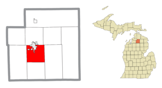
Otsego County is a county located in the U.S. state of Michigan. As of the 2010 census, the population was 24,164. The county seat is Gaylord. The county was founded in 1840 and organized in 1875.
Bagley Township is a civil township of Otsego County in the U.S. state of Michigan. The population was 5,838 at the 2000 census.
Otsego Lake Township is a civil township of Otsego County in the U.S. state of Michigan. The population was 2,532 at the 2000 census. The township takes its name from Otsego Lake, in which the southern half is within the township. Otsego Lake State Park is located in the township on the southeast shore of the lake.

Otsego is a town in the north-central part of Otsego County, New York, United States. The population was 3,900 at the 2010 census. The town is named after Lake Otsego, which forms part of the town's eastern border.

Springfield is a town in Otsego County, New York, United States. The population was 1,358 at the 2010 census.

Otsego Lake is a 4,046-acre (16.37 km2) lake located in Otsego County in the U.S. state of New York. It is the source of the Susquehanna River and largest lake in Otsego County. The Village of Cooperstown is located at the lake's southern end. Glimmerglass State Park is located on the lake's northeastern shore, and includes Hyde Hall, a large mansion constructed in 1817, that overlooks the lake. The Glimmerglass Opera, opened in June 1987, is located on the western shore.

Canadarago Lake is a 1,917-acre (7.76 km2) lake located in Otsego County, New York and is the source of Oaks Creek. The Village of Richfield Springs is located at the lake's northern end. It is the second largest lake in Otsego County, lying to the west of and parallel to the larger Otsego Lake. The lake's name is also spelled "Candajarago Lake" or "Caniadaraga Lake".

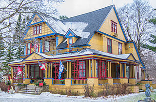
Heart Lake, Michigan is located in Otsego County in northern Michigan, about nine miles (14 km) south of Gaylord, just west of Interstate 75.

Otsego Township is one of twelve townships in Steuben County, Indiana, United States. As of the 2010 census, its population was 2,575 and it contained 1,839 housing units.

Leatherstocking Creek is a small creek in central Otsego County, New York. It begins northwest of Pierstown and flows southeast then south before flowing into Otsego Lake north of Cooperstown, and just south of Three Mile Point.

Rum Hill is a mountain located in Central New York Region of New York northwest of the Hamlet of Pierstown. Red House Hill is located southeast, Metcalf Hill is located south, Allen Lake and Mohegan Hill are located north-northwest and Otsego Lake is located east of Rum Hill.
Red House Hill is a mountain in the Central New York Region of New York. It is located south-southwest of the Hamlet of Springfield Center, New York, west of Hutter Point and Six Mile Point of Otsego Lake, and southeast of Rum Hill. Mohican Brook flows eastward along the southern edge of the hill.

Pierstown is a hamlet located on CR-28 north of Cooperstown and west of Five Mile Point in the Town of Otsego, in Otsego County, New York, United States.
Mohican Brook is a creek in central Otsego County, New York. It flows into Otsego Lake north of Cooperstown, New York at Five Mile Point.
Brookwood Point is a geographic cape extending into Otsego Lake in the Town of Otsego north of Cooperstown, New York. Brookwood Creek flows into Otsego Lake on Brookwood Point.
Three Mile Point also known as Wild Rose Point is a geographic cape extending into Otsego Lake in the Town of Otsego in Otsego County in the U.S. State of New York. It is located north of the Village of Cooperstown and is accessible via State Route 80. In the summer months it is also a public swimming beach and offers changing rooms, a picnic area, and a pavilion. In the winter months it serves as a place for ice fishers to park.
Six Mile Point also known as Hickory Grove is a geographic cape extending into Otsego Lake in the Town of Otsego north of Cooperstown, New York. Six Mile Point is the location in The Deerslayer that Natty Bumppo makes an unsuccessful effort to escape from the Hurons.

Point Judith also known as Kingfisher Point is a geographic cape extending into Otsego Lake in the Town of Otsego north of Cooperstown, New York. Kingfisher Tower is located on the lake off Point Judith.
Gravelly Point is a geographic cape extending into Otsego Lake in the Town of Middlefield in Otsego County in the U.S. State of New York. It is located on the east side of the lake, roughly 5 miles (8.0 km) north of the Village of Cooperstown. The point is not accessible from land but only the lake.

