
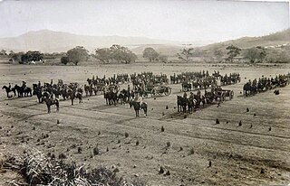
Sorell is a town in Tasmania, Australia, north-east of Hobart. It is located on the Tasman Highway at the junction with the Arthur Highway. Sorell is one of Tasmania's oldest towns, being first settled in 1808 as a small farming community and becoming an official township in 1821. At the 2006 census, Sorell had a population of 1,546, and at the 2011 census, a population of 2,476. and at the 2016 census, a population of 2,907.

Somerset is a small township to the west of Burnie, Tasmania, Australia, which shares its name with the County of Somerset, England, UK. Today the city of Burnie encompasses the entire Burnie-Somerset urban area; however, the town is part of the Waratah/Wynyard municipal area.
Cressy is a small town 35 kilometres (22 mi) south-west of Launceston, Tasmania. It came into existence in the 1850s to service the surrounding wheat farms. At the 2006 census, Cressy had a population of 670. It is known as Tasmania's "Trout capital" for the good fishing in the area. It is also home to an extensive agriculture research facility for the Tasmanian Institute of Agricultural Research.
Pontville is a rural locality in the local government areas (LGA) of Brighton and Southern Midlands in the Hobart and Central LGA regions of Tasmania. The locality is about 4 kilometres (2.5 mi) north-west of the town of Brighton. The 2016 census has a population of 623 for the state suburb of Pontville.
Rossarden is a rural locality in the local government areas (LGA) of Northern Midlands (89%) and Break O'Day (11%) in the Central and North-east LGA regions of Tasmania. The locality is about 81 kilometres (50 mi) east of the town of Longford. The 2016 census recorded a population of 42 for the state suburb of Rossarden.

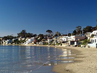
Hawley Beach is a rural and residential locality in the local government area (LGA) of Latrobe in the north-west and west region of Tasmania. The locality is about 22 kilometres (14 mi) north-east of the town of Latrobe. The 2016 census has a population of 484 for the state suburb of Hawley Beach. It is a locality and seaside resort town 22 kilometres (14 mi) from the nearest main town (Devonport). Nearby is the small town of Port Sorell and locality of Shearwater.
Saltwater River is a rural locality in the local government area (LGA) of Tasman in the South-east LGA region of Tasmania. The locality is about 14 kilometres (8.7 mi) north of the town of Nubeena. The 2016 census has a population of 123 for the state suburb of Saltwater River.
Weymouth is a rural locality in the local government area (LGA) of George Town in the Launceston LGA region of Tasmania. The locality is about 37 kilometres (23 mi) north-east of the town of George Town. The 2016 census has a population of 129 for the state suburb of Weymouth. It is a small township in northern Tasmania, on the Pipers River opposite Bellingham and about 60 km from Launceston. It has a very small permanent population; however, it attracts many visitors during the summer months. Weymouth has a beach, a tennis court, and a community hall with a playground.
Old Beach is a residential / rural locality in the local government area (LGA) of Brighton in the Hobart LGA region of Tasmania. The locality is about 10 kilometres (6.2 mi) south of the town of Brighton. The 2016 census recorded a population of 3779 for the state suburb of Old Beach.
Opossum Bay is a rural residential locality in the local government area of Clarence in the Hobart region of Tasmania. The locality is about 37 kilometres (23 mi) south-east of the town of Rosny Park. The 2016 census has a population of 329 for the state suburb of Opossum Bay.
Blackwall is a rural locality in the local government area (LGA) of West Tamar in the Launceston LGA region of Tasmania, Australia. The locality is about 21 kilometres (13 mi) south-east of the town of Beaconsfield. The 2016 census has a population of 270 for the state suburb of Blackwall. It is a small town located near Gravelly Beach on the western side of the Tamar River, north of Launceston.
Neika is a rural locality in the local government areas (LGA) of Hobart and Kingborough in the Hobart LGA region of Tasmania. The locality is about 20 kilometres (12 mi) south-west of the city of Hobart. The 2016 census recorded a population of 198 for the state suburb of Neika. It is a suburb of Hobart, to the north-west of Kingston.
Hampshire is a semi-rural locality in the local government areas (LGA) of Waratah Wynyard and Burnie in the North-west and west LGA region of Tasmania. The locality is about 30 kilometres (19 mi) south-west of the town of Burnie. The 2016 census has a population of 51 for the state suburb of Hampshire.
Kellevie is a rural locality in the local government area (LGA) of Sorell in the South-east LGA region of Tasmania. The locality is about 28 kilometres (17 mi) east of the town of Sorell. The 2016 census has a population of 164 for the state suburb of Kellevie.
Lapoinya is a small agricultural centre on the north-west coast of Tasmania west of Wynyard. The name is Tasmanian Aboriginal word for "fern tree", a plant that abounds in those surviving untouched parts of the original temperate rainforest. At the 2006 census, Lapoinya had a population of 368.
Moogara is a rural locality in the local government area (LGA) of Derwent Valley in the South-east LGA region of Tasmania. The locality is about 14 kilometres (8.7 mi) west of the town of New Norfolk. The 2016 census has a population of 49 for the state suburb of Moogara.

Royal George is a rural locality in the local government areas (LGA) of Northern Midlands (46%), Break O'Day (27%) and Glamorgan-Spring Bay (27%) in the Central, North-east and South-east LGA regions of Tasmania. The locality is about 86 kilometres (53 mi) south-east of the town of Longford. The 2016 census recorded a population of 45 for the state suburb of Royal George.

Magra is a rural residential locality in the local government areas (LGA) of Brighton (7%), Southern Midlands (9%) and Derwent Valley (84%) in the Hobart, Central and South-east LGA regions of Tasmania. The locality is about 26 kilometres (16 mi) west of the town of Brighton. The 2016 census recorded a population of 699 for the state suburb of Magra. It is in the Derwent Valley a few kilometres north of New Norfolk.
Grassy is a rural locality in the local government area (LGA) of King Island in the north-west and west LGA region of Tasmania. It is about 25 kilometres (16 mi) south-east of the town of Currie. The 2016 census recorded a population of 139 for the state suburb of Grassy. It was a tungsten mining town. Evidence of this can still be found in the small town. The highest population of Grassy was 767 in 1971.

Corfield is a town and locality in the Shire of Winton in north-western Queensland, Australia. In the 2016 census, Corfield had a population of 183 people.
