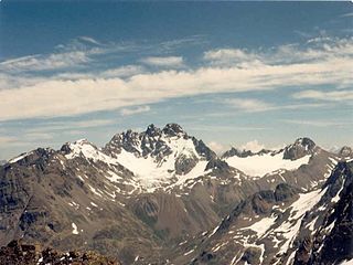
The Fluchthorn or Piz Fenga is a mountain in the Silvretta Alps, located on the border between Austria and Switzerland. With a height of 3,399 metres (11,152 ft) above sea level, it is the second highest summit of the Silvretta Alps. The Fluchthorn lies between the Jamtal (Tyrol) and the Val Fenga (Graubünden). It consists of three summits of which the southern one is the highest.

The golden age of alpinism was the decade in mountaineering between Alfred Wills's ascent of the Wetterhorn in 1854 and Edward Whymper's ascent of the Matterhorn in 1865, during which many major peaks in the Alps saw their first ascents.

The Muttler is the highest mountain in the Samnaun Alps. It is located south of Samnaun in the Swiss canton of Graubünden. From 1972 - 2011 a transmitter was located west of the summit.

The Fimbatal, also Fimbertal, is an alpine valley situated between the Silvretta Alps and the Samnaun Alps. The valley is drained by the Fimbabach river, a tributary of the Inn basin (Trisanna) at Ischgl. The highest mountain bordering the Fimbatal is the Fluchthorn.

Johann Jakob Weilenmann was a Swiss mountaineer and Alpine writer.
Krone is a mountain of the Silvretta Alps, located on the border between Austria and Switzerland. It lies south of the Fluchthorn, on the range between the Jamtal (Tyrol) and the Val Fenga (Graubünden).

