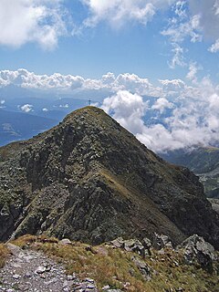
The Alps are the highest and most extensive mountain range system that lies entirely in Europe, stretching approximately 750 mi (1,210 km) across eight Alpine countries : France, Switzerland, Monaco, Italy, Liechtenstein, Austria, Germany, and Slovenia.

The Dom is a mountain of the Pennine Alps, located between Randa and Saas-Fee in the canton of Valais in Switzerland. With a height of 4,545 m (14,911 ft), it is the seventh highest summit in the Alps, overall. Based on prominence, it can be regarded as the third highest mountain in the Alps, and the second highest in Switzerland, after Monte Rosa. The Dom is the main summit of the Mischabel group, which is the highest massif lying entirely in Switzerland.

Piz Palü is a mountain in the Bernina Range of the Alps, located between Switzerland and Italy. It is a large glaciated massif composed of three main summits, on a ridge running from west to east. The main summit is 3,900 metres high and is located within the Swiss canton of Graubünden, although the border with the Italian region of Lombardy runs about 100 metres west of it at almost the same height. The western summit is named Piz Spinas and is the only one not covered by ice. The eastern summit is named Piz Palü Orientale. The name Palü derives from the Latin palus, meaning a swamp, and the mountain is said to be named after the Alpe Palü, a high alpine pasture some 4 km to its east.

The Grenzgipfel is a peak of Monte Rosa Massif, located on the border between Italy and Switzerland.

The Eggishorn is a mountain in the southeastern part of the Bernese Alps, located north of Fiesch in the Swiss canton of Valais. A cable car station is located on a secondary summit named Fiescherhorli, 500 metres south of the main peak.

The Schwarzberghorn is a mountain of the Pennine Alps, located on the border between Switzerland and Italy. Its summit is the tripoint between the valleys Mattertal, Saastal and Valle Anzasca and the southernmost point of the Mischabel-Strahlhorn chain, and northern end of the Weissgrat.

The Fluchthorn is a mountain of the Swiss Pennine Alps, located south of Saas-Almagell in the canton of Valais. It lies east of the Strahlhorn.

The Sarntal Alps are a mountain range of the Eastern Rhaetian Alps, in South Tyrol (Italy), which surrounds the Sarntal (valley). It is limited by the Etschtal, Eisacktal, Passeiertal and the Jaufen Pass.
The Strahlhorn is a mountain of the Pennine Alps, east of Zermatt and south of Saas Fee in Valais. It is also the name of several other mountains in Switzerland:


