A glacier is a persistent body of dense ice that is constantly moving under its own weight. A glacier forms where the accumulation of snow exceeds its ablation over many years, often centuries. It acquires distinguishing features, such as crevasses and seracs, as it slowly flows and deforms under stresses induced by its weight. As it moves, it abrades rock and debris from its substrate to create landforms such as cirques, moraines, or fjords. Although a glacier may flow into a body of water, it forms only on land and is distinct from the much thinner sea ice and lake ice that form on the surface of bodies of water.

The Pennine Alps, also known as the Valais Alps, are a mountain range in the western part of the Alps. They are located in Italy and Switzerland (Valais).

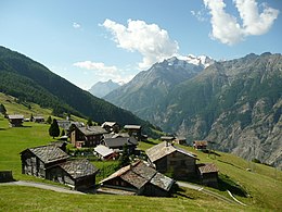
The Bernese Alps are a mountain range of the Alps, located in western Switzerland. Although the name suggests that they are located in the Berner Oberland region of the canton of Bern, portions of the Bernese Alps are in the adjacent cantons of Valais, Fribourg and Vaud, the latter being usually named Fribourg Alps and Vaud Alps respectively. The highest mountain in the range, the Finsteraarhorn, is also the highest point in the canton of Bern.

Glaciology is the scientific study of glaciers, or more generally ice and natural phenomena that involve ice.
A kame delta is a glacial landform formed by a stream of melt water flowing through or around a glacier and depositing material, known as kame deposits. Upon entering a proglacial lake at the end (terminus) of a glacier, the river/stream deposit these sediments. This landform can be observed after the glacier has melted and the delta's asymmetrical triangular shape is visible. Once the glacier melts, the edges of the delta may subside as ice under it melts. Glacial till is deposited on the lateral sides of the delta, as the glacier melts.

An arête is a narrow ridge of rock that separates two valleys. It is typically formed when two glaciers erode parallel U-shaped valleys. Arêtes can also form when two glacial cirques erode headwards towards one another, although frequently this results in a saddle-shaped pass, called a col. The edge is then sharpened by freeze-thaw weathering, and the slope on either side of the arête steepened through mass wasting events and the erosion of exposed, unstable rock. The word arête is actually French for "edge" or "ridge"; similar features in the Alps are often described with the German equivalent term Grat.

The Waterton-Glacier International Peace Park is the union of Waterton Lakes National Park in Canada and Glacier National Park in the United States. Both parks are declared Biosphere Reserves by UNESCO and their union as a World Heritage Site.

Canada Glacier is a small glacier flowing south-east into the northern side of Taylor Valley in Victoria Land, Antarctica. It is in the Ross Dependency. Its melting season is in the summer.

Ferrar Glacier is a glacier in Antarctica. It is about 35 nautical miles long, flowing from the plateau of Victoria Land west of the Royal Society Range to New Harbour in McMurdo Sound. The glacier makes a right (east) turn northeast of Knobhead, where it also feeds the upper end of the Taylor Glacier, which flows on the other (northern) side of the Kukri Hills from the Ferrar Glacier, which continues east along the south side of the Kukri Hills to New Harbour.

An icefall is a portion of certain glaciers characterized by relatively rapid flow and chaotic crevassed surface, caused in part by gravity. The term icefall is formed by analogy with the word waterfall, which is a similar phenomenon of the liquid phase but at a more spectacular speed. When ice movement of a glacier is faster than elsewhere, because the glacier bed steepens or narrows, and the flow cannot be accommodated by plastic deformation, the ice fractures, forming crevasses. Where two fractures meet, seracs can be formed. When the movement of the ice slows down, the crevasses can coalesce, resulting in the surface of the glacier becoming smoother.

Monte Rosa is a mountain massif in the eastern part of the Pennine Alps, on the border between Italy and Switzerland (Valais). The highest peak of the massif, amongst several peaks of over 4.000 m, is the Dufourspitze, the second highest mountain in the Alps and western Europe, after Mont Blanc. The east face of the Monte Rosa towards Italy has a height of about 2.400 meters and is the highest mountain wall of the Alps.

The Dom is a mountain of the Pennine Alps, located between Randa and Saas-Fee in the canton of Valais in Switzerland. With a height of 4,545 m (14,911 ft), it is the seventh highest summit in the Alps, overall. Based on prominence, it can be regarded as the third highest mountain in the Alps, and the second highest in Switzerland, after Monte Rosa. The Dom is the main summit of the Mischabel group, which is the highest massif lying entirely in Switzerland.


Zélée Glacier is a glacier about 6 kilometres (3 nmi) wide and 11 kilometres (6 nmi) long, flowing north-northwest from the continental ice along the west side of Lacroix Nunatak and terminating in a prominent tongue at the west side of Port Martin. Probably first sighted in 1840 by the French expedition under Captain Jules Dumont d'Urville, although no glaciers were noted on d'Urville's chart of this coast. Photographed from the air by U.S. Navy Operation Highjump, 1946–47. Charted by the French Antarctic Expedition under Liotard, 1949–51, and named for the Zélée, corvette which accompanied d'Urville's flagship, the Astrolabe.
Wright Lower Glacier is a stagnant glacier occupying the mouth of Wright Valley and coalescing at its east side with Wilson Piedmont Glacier, in Victoria Land, Antarctica.
Bates Glacier is a small tributary glacier flowing north from the west side of Mount Queensland, and entering the west side of Campbell Glacier just north of Mills Peak, in Victoria Land, Antarctica. It was named by the Northern Party of the New Zealand Geological Survey Antarctic Expedition, 1965–66, for D.R. Bates, field assistant with that party.

Arapya Glacier is the 11.4 kilometres (7.1 mi) long and 5 kilometres (3.1 mi) wide glacier on the east side of north-central Sentinel Range in Ellsworth Mountains, Antarctica, situated south of Young Glacier. It flows southwards along the west side of Barnes Ridge and east of Chapman Peak and joins Ellen Glacier southwest of Mount Besch.

Obelya Glacier is the 4.6 nautical miles long and 1.5 nautical miles wide glacier on the east side of southern Sentinel Range in Ellsworth Mountains, Antarctica, situated south of Remington Glacier, and flowing southeastwards along the southwest side of Johnson Spur and east of Mount Benson to join Thomas Glacier.
Walter Glacier is a glacier flowing east-northeast, merging with the south side of Moran Glacier to enter Schokalsky Bay, in the northeast portion of Alexander Island, Antarctica. The glacier was named by the Advisory Committee on Antarctic Names for Lieutenant Commander Howard J. Walter, U.S. Navy, LC-130 aircraft commander, Squadron VXE-6, Operation Deepfreeze, 1970 and 1971.
Lovejoy Glacier is a broad glacier descending eastward through the Usarp Mountains of Antarctica between Anderson Pyramid and the Sample Nunataks. In its lower course, the glacier runs side by side with the larger Harlin Glacier to the south without a ridge separating the two. It was mapped by the United States Geological Survey from surveys and U.S. Navy air photos, 1960–62, and was named by the Advisory Committee on Antarctic Names for Lieutenant Owen B. Lovejoy of U.S. Navy Squadron VX-6, a pilot of R4D aircraft in Antarctica, 1962–63 and 1963–64.