
The Jura Mountains are a sub-alpine mountain range a short distance north of the Western Alps and mainly demarcate a long part of the French–Swiss border. While the Jura range proper is located in France and Switzerland, the range continues as the Table Jura northeastwards through northern Switzerland and Germany.

The Diablerets are a huge ice-covered mountain massif of the Alps, culminating at the Sommet des Diablerets at 3,210 metres (10,530 ft) above sea level and straddling the border between the Swiss cantons of Vaud (VD) and Valais (VS). The northeastern part of the massif stretches also into the canton of Bern (BE).

Col des Mosses is a mountain pass in the western Bernese Alps of Switzerland. The pass is located in the municipality of Ormont-Dessous in the canton of Vaud. It links Aigle, to the south in the valley of the Rhone, with Château-d'Œx, to the north in the valley of the Sarine, and is flanked to the west by the Mont d'Or and to the east by the Pic Chaussy.
The Lägern is a wooded mountain of the Jura Mountains, stretching from Baden to Dielsdorf, about 15 km north-west of Zurich. The culminating point is located 1 km west of Hochwacht within the canton of Zurich, the border with the canton of Aargau running on a slightly lower summit named Burghorn.

La Dôle is a mountain of the Jura, overlooking Lake Geneva in the westernmost part of the canton of Vaud. Rising to an altitude of 1677 meters, it is the second highest peak in the Swiss portion of the Jura, after Mont Tendre. Administratively, the summit is split between the municipalities of Gingins, Chéserex and La Rippe. The mountain is also close to and easily accessible from Saint-Cergue and the Col de la Givrine to the north, both above 1000 meters and connected to Nyon on Lake Geneva by road and by the Nyon–St-Cergue–Morez Railway. A paved road also climbs to the Chalet de la Dôle below the summit from Gingins.

Col du Mont d'Orzeires is a high mountain pass in the Jura Mountains in the canton of Vaud in Switzerland.

The Chasseral is a mountain of the Jura Mountains, overlooking Lake Biel in the Swiss canton of Bern. With an elevation of 1,606 metres above sea level, the Chasseral is the highest summit in the canton of Bern outside the Alps. It is also both the northernmost and easternmost mountain reaching over 1,500 metres in the Jura Mountains. West of the summit is located the Chasseral Ouest, where runs the border with the canton of Neuchâtel. The Chasseral Pass is located further on the west.

The Vanil Noir is a mountain of the Fribourg Prealps, located on the border between the cantons of Fribourg and Vaud in western Switzerland. Reaching a height of 2,389 metres above sea level, the Vanil Noir is the highest summit of the canton of Fribourg and of the Alpine foothills lying north of the Saane and Simme. It is also the northernmost point in the canton of Vaud above 2,300 metres and the most prominent summit of both cantons.

The Scex Rouge is a mountain of the Alps, overlooking Les Diablerets in the canton of Vaud. Along with the Oldenhorn to the east, it is one of the main peaks of the Diablerets, a huge ice-covered mountain near the western end of the Bernese Alps, straddling the border between the cantons of Vaud, Valais, and Bern, and exceeding 3,000 metres (9,800 ft) above sea level. On its west side, the Scex Rouge is part of a nearly 2,000-metre-high (6,600 ft) amphitheatre of cliffs surrounding the Creux de Champ valley, south of Les Diablerets. On its southeast side, the Scex Rouge overlooks the Tsanfleuron Glacier, the largest in the massif. Administratively, the mountain is part of the municipality of Ormont-Dessus, which also includes Les Diablerets.
Le Chasseron is a mountain in the Jura Mountains, overlooking Sainte-Croix in the canton of Vaud. It has an elevation of 1,607 metres above sea level and is amongst the most isolated mountains of Switzerland.

The Hasenmatt is a mountain of the Jura range, located north of Grenchen and Solothurn in the Swiss canton of Solothurn. Reaching a height of 1,445 metres above sea level, it is the highest summit in the canton of Solothurn. The Hasenmatt is also the easternmost summit above 1,400 metres of the Jura Mountains.

Mont Raimeux is a mountain of the Jura range, located on the border between the Swiss cantons of Jura and Berne. Reaching a height of 1,302 metres above sea level, it is the highest summit in the canton of Jura.
The Schafberg is a mountain peak above Boltigen located on the border between the cantons of Fribourg and Berne, north of Jaun. With a height 2,239 metres above sea level, it is the highest summit on the range lying north of the Jaun Pass. It is also the most isolated mountain in the canton of Fribourg.

Le Soliat is a mountain of the Jura, overlooking Lake Neuchâtel in western Switzerland. The main summit is located within the canton of Neuchâtel. A secondary summit is located within the canton of Vaud.

Le Noirmont is a mountain of the Jura, located north of Saint-Cergue in the canton of Vaud. At 1,567 metres, it is the highest mountain between the Col de la Givrine and Mont Tendre. Although Le Noirmont is wholly in Switzerland, the border with France runs on the western base of the mountain.
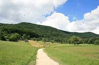
Montagne du Château is the highest hill of the Jorat. It lies west of Montpreveyres in the canton of Vaud, above the city of Lausanne. The hill is entirely wooded, except for its summit, where is a clearing.
Mont Vully is a hill of the Swiss Plateau, located between Lake Morat and Lake Neuchâtel in the canton of Fribourg, east of the border with the canton of Vaud.

Mont d'Or is a mountain of the Jura, located in the French department of Doubs and extending into the Swiss canton of Vaud. Its main summit is 1,463 metre-high and lies within France, 500 metres north of the border with Switzerland. The mountain is located between Jougne, France and Vallorbe, Switzerland.

