
The Brienzer Rothorn is a mountain of the Emmental Alps, in Switzerland. With an elevation of 2,350 metres (7,710 ft) above sea level, the Brienzer Rothorn is the highest summit of the range. To its west lies the Tannhorn, whilst to its east are Arnihaaggen, Höch Gumme and the Brünig Pass. On its south side it overlooks Lake Brienz, whilst to the north it looks out over the Waldemme valley.
The Lägern is a wooded mountain of the Jura Mountains, stretching from Baden to Dielsdorf, about 15 km north-west of Zurich. The culminating point is located 1 km west of Hochwacht within the canton of Zurich, the border with the canton of Aargau running on a slightly lower summit named Burghorn.

La Dôle is a mountain of the Jura, overlooking Lake Geneva in the westernmost part of the canton of Vaud. Rising to an altitude of 1677 meters, it is the second highest peak in the Swiss portion of the Jura, after Mont Tendre. Administratively, the summit is split between the municipalities of Gingins, Chéserex and La Rippe. The mountain is also close to and easily accessible from Saint-Cergue and the Col de la Givrine to the north, both above 1000 meters and connected to Nyon on Lake Geneva by road and by the Nyon–St-Cergue–Morez Railway. A paved road also climbs to the Chalet de la Dôle below the summit from Gingins.
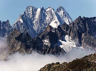
The Lauteraarhorn is a peak of the Bernese Alps, located in the canton of Bern. Together with the higher Schreckhorn, to which it is connected by a high ridge, it lies between the valleys of the Lower Grindelwald Glacier and the Unteraar Glacier, about 10 kilometres southeast of Grindelwald, the closest locality. The Lauteraarhorn belongs to the Aaremassif and is surrounded by large glaciers: the Lauteraargletscher and the Strahlegg-Gletscher and the Obers Ischmeer. Being off the main ridge of the Bernese Alps, all the glaciers surrounding the Lauteraarhorn and the Schreckhorn are part of the Aare basin. The Lauteraarhorn is the second highest summit lying wholly within the canton of Bern. Administratively, it is split between the municipalities of Grindelwald and Guttannen.
Chasseral Pass is a high mountain pass in the Jura Mountains, lying west of the Chasseral. The pass is located on the border between the Swiss cantons of Neuchâtel and Bern. It is traversed by a road connecting Saint-Imier and Nods, both located in the Bernese Jura. North-east of the pass is the Chasseral Ouest, the highest point of the canton of Neuchâtel.

The Rochers de Naye is a mountain of the Swiss Alps, overlooking Lake Geneva near Montreux and Villeneuve, in the canton of Vaud. They lie on the range separating the basin of Lake Geneva from the valley of the Sarine, on the watershed between the Rhone and the Rhine. The mountain is partially located in the canton of Fribourg, the border between the two cantons culminating on a lower summit named Grande Chaux de Naye.
The Niesen is a mountain peak of the Bernese Alps in the Canton of Bern, Switzerland. The summit of the mountain is 2,362 metres (7,749 ft) in elevation.

Mont Tendre is a mountain of the Jura, located between the valley of Joux and the basin of Lake Geneva in the canton of Vaud. With an elevation of 1,679 metres above sea level, it is the highest summit of the Swiss portion of the Jura Mountains and, therefore, the highest summit of Switzerland outside the Alps. It is also the most isolated mountain of the canton. It is found in the community of Montricher.

The Hasenmatt is a mountain of the Jura range, located north of Grenchen and Solothurn in the Swiss canton of Solothurn. Reaching a height of 1,445 metres above sea level, it is the highest summit in the canton of Solothurn. The Hasenmatt is also the easternmost summit above 1,400 metres of the Jura Mountains.
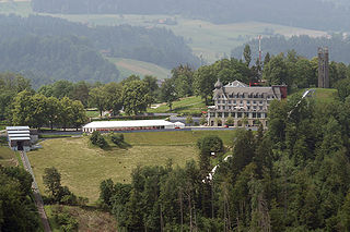
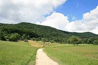
The Gurten is a mountain situated just to the south of Bern, the capital city of Switzerland. It is 858 metres (2,815 ft) high, and the summit yields views of Bern, of the Jura mountains and of the Alps.

The Chasseral Ouest is a prominence west of the Chasseral, in the Jura Mountains. It is located on the border between the Swiss cantons of Neuchâtel and Bern. The Chasseral Ouest reaches an elevation of 1,552 metres above sea level and is the highest point of the canton of Neuchâtel.

Mont Soleil is a mountain of the Jura Mountains, located north of Saint-Imier in the canton of Bern, Switzerland. The summit reaches to 1,291 metres (4,236 ft) and the area can be easily accessed with Funiculaire Saint-Imier-Mont-Soleil, a funicular from Saint-Imier, reaching a height of 1,180 m (3,870 ft).
The Weisshorn is a mountain of the Bernese Alps, located on the border between the Swiss cantons of Bern and Valais. It lies on the main chain of the Bernese Alps, between the Rawil Pass and the Plaine Morte Glacier.


