Fochteloo

Last updated
Fochteloo
De Fochtel
Village
Fochteloo.jpg
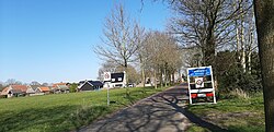
Welcome to Fochteloo
Map NL Eaststellingwerf De Fochtel.png
Location in Ooststellingwerf municipality
2010-NL-P02-Fryslan-positiekaart-gemnamen.jpg
Red pog.svg
Fochteloo
Location in the Netherlands
Netherlands location map.svg
Red pog.svg
Fochteloo
Fochteloo (Netherlands)
Coordinates: 52°59′33″N6°20′5″E / 52.99250°N 6.33472°E / 52.99250; 6.33472 Coordinates: 52°59′33″N6°20′5″E / 52.99250°N 6.33472°E / 52.99250; 6.33472
Country Flag of the Netherlands.svg Netherlands
Province Frisian flag.svg Friesland
Municipality Ooststellingwerf flag.svg Ooststellingwerf
Area
[1]
  Total19.77 km2 (7.63 sq mi)
Elevation
[2]
7 m (23 ft)
Population
 (2021) [1]
  Total350
  Density18/km2 (46/sq mi)
Postal code
8428 [1]
Dialing code 0516

Fochteloo (West Frisian : De Fochtel) is a village with around 400 inhabitants [3] in the municipality of Ooststellingwerf in southeastern Friesland in the Netherlands.

Contents

History

The village was first mentioned in 1408 as Fyochtelo, and probably means moist forest. [4] The church was demolished in 1832, but the bell tower with two bells has remained. From 1908 until 2008, there was a chapel in the dairy factory. In 1840, Fochteloo was home to 163 people. [5]

In 1942, Camp Ybenheer was established as a Jewish forced labour camp. On Yom Kippur 1942 (2–3 October), all 215 labourers were moved to Westerbork transit camp from where they were transported to Auschwitz and Sobibor. After the war, the camp was used for South Moluccan refugees. In 2002, a memorial was placed at the former camp grounds. [6] [7]

Geography

There is a nature reserve located between Fochteloo and Veenhuizen, called Fochteloërveen  [ nl ].

Related Research Articles

<span class="mw-page-title-main">Westerbork (village)</span> Village in Drenthe, Netherlands

Westerbork is a village in the municipality of Midden-Drenthe in the Netherlands. It is located in the middle of the eastern province of Drenthe. During World War II, the Westerbork transit camp was located near the village. The Westerbork Synthesis Radio Telescope and the Camp Westerbork Museum are now situated at the site.

<span class="mw-page-title-main">Den Hoorn, North Holland</span> Village in North Holland, Netherlands

Den Hoorn is a village in the Dutch province of North Holland. It is a part of the municipality of Texel, and lies about 9 km north of Den Helder.

<span class="mw-page-title-main">Sambeek</span> Village in North Brabant, Netherlands

Sambeek is a village in the southern Netherlands. It is located in the former municipality of Boxmeer, North Brabant. Since 2022 it has been part of the new municipality of Land van Cuijk.

<span class="mw-page-title-main">Garderen</span> Place in Gelderland, Netherlands

Garderen is a village in the Dutch province of Gelderland. It is located in the municipality of Barneveld, in the forests of the Veluwe. The village has 1,994 inhabitants.

<span class="mw-page-title-main">Appelscha</span> Village in Friesland, Netherlands

Appelscha is a village in the municipality of Ooststellingwerf in the province of Friesland, Netherlands. It has just under 4,800 inhabitants.

<span class="mw-page-title-main">Abbegea</span> Village in Friesland, Netherlands

Abbegea is a village in the Dutch province of Friesland. It is in the municipality of Súdwest-Fryslân, about 6 km west of the city of Sneek. Abbegea had about 245 inhabitants in January 2017.

<span class="mw-page-title-main">Allingawier</span> Village in Friesland, Netherlands

Allingawier is a small village in Súdwest-Fryslân municipality in the Dutch province of Friesland. It is about 7 km southwest of the city of Bolsward.

<span class="mw-page-title-main">Tzum</span> Village in Friesland, Netherlands

Tzum is a village in Waadhoeke municipality in the province of Friesland, the Netherlands. It had a population of around 1,164 in January 2014. Tzum is known for its 72 metre tall church tower.

<span class="mw-page-title-main">Wijnjewoude</span> Village in Friesland, Netherlands

Wijnjewoude is a village in the municipality of Opsterland in the east of Friesland, the Netherlands. It had a population of around 2,025 in January 2017. The villages of Duurswoude and Wijnjeterp were founded in the late Middle Ages next to one-another. After World War II the villages started to expand, and merged into a single village called Wijnjewoude in 1974.

<span class="mw-page-title-main">Waskemeer</span> Village in Friesland, Netherlands

Waskemeer is a village in the municipality of Ooststellingwerf in the east of Friesland, the Netherlands.

<span class="mw-page-title-main">Ravenswoud</span> Village in Friesland, Netherlands

Ravenswoud is a village consisting of about 400 inhabitants in the municipality of Ooststellingwerf in the east of Friesland, the Netherlands.

<span class="mw-page-title-main">Nijeberkoop</span> Village in Friesland, Netherlands

Nijeberkoop is a village consisting of about 270 inhabitants in the municipality of Ooststellingwerf in 2017 in the east of Friesland, the Netherlands.

<span class="mw-page-title-main">Oldeberkoop</span> Village in Friesland, Netherlands

Oldeberkoop is a village consisting of about 1,580 inhabitants in the municipality of Ooststellingwerf in the east of Friesland, the Netherlands.

<span class="mw-page-title-main">Haulerwijk</span> Village in Friesland, Netherlands

Haulerwijk is a village in the municipality of Ooststellingwerf in the east of Friesland, the Netherlands. In 2017, it had a population of around 3,300.

<span class="mw-page-title-main">Haule</span> Village in Friesland, Netherlands

Haule is a village consisting of about 600 inhabitants in the municipality of Ooststellingwerf in the east of Friesland in the Netherlands.

<span class="mw-page-title-main">Elsloo, Friesland</span> Village in Friesland, Netherlands

Elsloo is a village consisting of around 600 inhabitants in the municipality of Ooststellingwerf in the east of Friesland in the Netherlands.

<span class="mw-page-title-main">Donkerbroek</span> Village in Friesland, Netherlands

Donkerbroek is a village in the municipality of Ooststellingwerf, the Netherlands. In 2017, it had a population of around 1,830.

<span class="mw-page-title-main">Hartwerd</span> Village in Friesland, Netherlands

Hartwerd is a small village, near Bolsward, in the municipality of Súdwest-Fryslân in the Province of Friesland in the Netherlands. It had around 125 residents in January 2017.

<span class="mw-page-title-main">Ypecolsga</span> Village in Friesland, Netherlands

Ypecolsga is a village in Súdwest-Fryslân in the province of Friesland, the Netherlands. It had a population of around 50 in January 2017.

<span class="mw-page-title-main">Scharl, Netherlands</span> Village in Friesland, Netherlands

Scharl is a small village in Súdwest-Fryslân municipality in the province of Friesland, the Netherlands. It had a population of around 55 in January 2017.

References

  1. 1 2 3 "Kerncijfers wijken en buurten 2021". Central Bureau of Statistics. Retrieved 1 April 2022.
  2. "Postcodetool for 8428HA". Actueel Hoogtebestand Nederland (in Dutch). Het Waterschapshuis. Retrieved 1 April 2022.
  3. Villages Archived 2017-09-28 at the Wayback Machine - Ooststellingwerf Municipality (in Dutch)
  4. "Fochteloo - (geografische naam)". Etymologiebank (in Dutch). Retrieved 1 April 2022.
  5. "Fochteloo". Plaatsengids (in Dutch). Retrieved 1 April 2022.
  6. "Monument Rijkswerkkamp Ybenheer". Traces of War (in Dutch). Retrieved 1 April 2022.
  7. "Fochteloo, 'Ybenheer'". 4 en 5 mei (in Dutch). Retrieved 1 April 2022.