Ooststellingwerf is a municipality in the province of Friesland in the northern Netherlands. It is one of the municipalities of Friesland where the spoken language is not West Frisian; instead, Stellingwerfs, a dialect of Dutch Low Saxon, is spoken here.

Stiens is a town in the municipality of Leeuwarden, Netherlands. As of January 2017, the town has a population of about 7,545. Between 1944 and 2018, it was the capital of the municipality of Leeuwarderadeel.

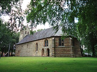
The village of Britsum is located in the municipality of Leeuwarden, in the Netherlands. Britsum was built on an artificial bank (terp) running along the eastern side of the former Middelzee. The church, built around 1300, is also located on this bank. It had a population of about 910 citizens in January 2017.

Appelscha is a village in the municipality of Ooststellingwerf in the province of Friesland, the Netherlands. It has just under 4800 inhabitants.

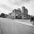
Makkinga is a village in the Dutch municipality of Ooststellingwerf in the province of Friesland. On 1 January 2017, it had 1,040 inhabitants.

Paesens is a village in Noardeast-Fryslân in the province of Friesland, the Netherlands. It has a population of around 242 in January 2017. Before 2019, the village was part of the Dongeradeel municipality.

Metslawier is a village in Noardeast-Fryslân in the province of Friesland, the Netherlands. It had a population of around 908 in January 2017. Before 2019, the village was part of the Dongeradeel municipality.

Wierum is a village in Noardeast-Fryslân in the province of Friesland, the Netherlands with a population of around 339 in January 2017. Before 2019, the village was part of the Dongeradeel municipality.

Oostrum is a village in Noardeast-Fryslân in the province of Friesland, the Netherlands. It had a population of around 188 in January 2017. Before 2019, the village was part of the Dongeradeel municipality.

Waskemeer is a village in the municipality of Ooststellingwerf in the east of Friesland, the Netherlands.

Ravenswoud is a village consisting of about 400 inhabitants in the municipality of Ooststellingwerf in the east of Friesland, the Netherlands.

Oosterwolde is the largest town in the municipality of Ooststellingwerf in the east of Friesland, the Netherlands.

Nijeberkoop is a village consisting of about 270 inhabitants in the municipality of Ooststellingwerf in 2017 in the east of Friesland, the Netherlands.
Oldeberkoop is a village consisting of about 1,580 inhabitants in the municipality of Ooststellingwerf in the east of Friesland, the Netherlands.

Langedijke is a village consisting of about 290 inhabitants in the municipality of Ooststellingwerf in 2017 in the east of Friesland, the Netherlands.

Haulerwijk is a village in the municipality of Ooststellingwerf in the east of Friesland, the Netherlands. In 2017, it had a population of around 3,300.

Haule is a village consisting of about 600 inhabitants in the municipality of Ooststellingwerf in the east of Friesland in the Netherlands.

Fochteloo is a village with around 400 inhabitants in the municipality of Ooststellingwerf in southeastern Friesland in the Netherlands.

Elsloo is a village consisting of around 600 inhabitants in the municipality of Ooststellingwerf in the east of Friesland in the Netherlands.

Wolvega, is the largest town in the municipality of Weststellingwerf in the province of Friesland (Fryslan), in the Netherlands. It had a population of around 13,090 in 2021. Wolvega is the capital and largest town of the municipality.