Makkinga

Last updated
Makkinga
Makkingea
Village
Weyert Makkinga 01.JPG
Windmill De Weyert
Map NL Eaststellingwerf Makkingea.png
Location in Ooststellingwerf municipality
2010-NL-P02-Fryslan-positiekaart-gemnamen.jpg
Red pog.svg
Makkinga
Location in the Netherlands
Netherlands location map.svg
Red pog.svg
Makkinga
Makkinga (Netherlands)
Coordinates: 52°59′N6°13′E / 52.983°N 6.217°E / 52.983; 6.217
Country Flag of the Netherlands.svg Netherlands
Province Frisian flag.svg Friesland
Municipality Ooststellingwerf flag.svg Ooststellingwerf
Area
[1]
  Total
16.59 km2 (6.41 sq mi)
Elevation
[2]
5 m (16 ft)
Population
 (2021) [1]
  Total
1,020
  Density61/km2 (160/sq mi)
Postal code
8423 [1]
Dialing code 0516

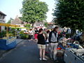
Makkinga (West Frisian : Makkingea) is a village in the Dutch municipality of Ooststellingwerf in the province of Friesland. On 1 January 2017, it had 1,040 inhabitants. [3]

Contents

Makkinga is known among transportation planners and engineers as the first community to introduce the concept of shared space, which means the removal of traffic controls in the high street to encourage safer interaction between vehicles and pedestrians.

History

The village was first mentioned in 1527 Mackinge(n) and means "settlement of the people of Makke (person)". [4] Makkinga is a peat excavation village with a similar shape as an esdorp but without a communal pasture. It started to developed from the 15th century onwards. The Dutch Reformed church dates from 1777 and is a replacement of an earlier church. [5]

Makkinga was home to 294 people in 1840. [6] Between 1848 until 1886, it was the capital of the Ooststellingwerf municipality. [5]

Attractions

In Makkinga, the Old Ark museum is devoted to old tools. [6] There is a restored windmill, De Weyert, in the village. It was originally built in 1868 as a sawmill in Gorredijk. In 1925, it was moved to Makkinga and converted to a grist mill. [7] On the last Saturday of the month from March to October, a large flea market is organized in the village. [6]

Notable residents

References

  1. 1 2 3 "Kerncijfers wijken en buurten 2021". Central Bureau of Statistics. Retrieved 1 April 2022.
  2. "Postcodetool for 8423SB". Actueel Hoogtebestand Nederland (in Dutch). Het Waterschapshuis. Archived from the original on 21 September 2013. Retrieved 1 April 2022.
  3. Villages Archived 2017-09-28 at the Wayback Machine - Ooststellingwerf Municipality (in Dutch)
  4. "Makkinga - (geografische naam)". Etymologiebank (in Dutch). Retrieved 1 April 2022.
  5. 1 2 Ronald Stenvert & Sabine Broekhoven (2000). "Kollum" (in Dutch). Zwolle: Waanders. ISBN   90 400 9476 4 . Retrieved 1 April 2022.
  6. 1 2 3 "Makkinga". Plaatsengids (in Dutch). Retrieved 1 April 2022.
  7. "De Weyert". Molen database (in Dutch). Retrieved 1 April 2022.
  8. "Jan Kromkamp". Soccer base. Retrieved 1 April 2022.