
The Rhinogydd are a range of mountains located east of Harlech in North Wales. The name Rhinogydd derives from the names of two of the more famous peaks, Rhinog Fawr and Rhinog Fach, although the greatest elevation in the range is reached by Y Llethr, 756 m.

The Glyderau are a mountain group in Snowdonia, North Wales. The name derives from the highest peaks in the range, Glyder Fawr and Glyder Fach. According to Sir Ifor Williams, the word "Glyder" derives from the Welsh word "Cludair", meaning a heap of stones.

Elidir Fawr is a mountain in Snowdonia, north Wales, the northernmost peak in the Glyderau. Its name means 'Big Elidir', named after a legendary warrior king of the 6th century also known as Eliffer Gosgorddfawr.

Foel-fras is a mountain in the Carneddau range, about 10 km east of Bethesda in North Wales. It lies on the border between the counties of Gwynedd and Conwy. With a summit elevation of 944 metres, it is officially the eleventh-highest summit in Wales. Foel-fras is located at the northern end of the main ridge of the Carneddau, between Drum to the north and Foel Grach to the south with the subsidiary summit of Garnedd Uchaf between it and Foel Grach. Due south and 400 m below lies the reservoir of Llyn Dulyn, while the smaller reservoir of Llyn Anafon lies to the north.

Moel Eilio is a mountain in Snowdonia, North Wales, that is situated approximately 3 miles north-west of Snowdon itself. It has two subsidiary tops, Foel Gron and Foel Goch (Eilio). The average annual temperature of the mountain is around 6 °C (43 °F). During the winter season, some significant accumulations of snowfall is known to take place on Moel Eilio, due to its relatively flat, grassy slopes.

The Beacons Way is a waymarked long distance footpath in the Brecon Beacons National Park, Wales. It is a linear route which runs for 99 miles (159 km) east to west through the National Park, and passes many of the most important landmarks and mountain peaks in the mountain range. It also includes a few of the towns in the park as well as popular attractions such as Carreg Cennen Castle near Llandeilo at the western end of the path.
Gallt yr Ogof is a mountain in Snowdonia, North Wales. It is a subsidiary top of Glyder Fawr, and is the most easterly point in the Glyderau mountain range, not including the hill Cefn y Capel. Gallt yr Ogof is 763 metres high.

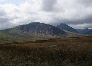
Carnedd y Filiast is a mountain in Snowdonia, Wales, forming part of the Glyderau. It, along with its top Y Fronllwyd, forms the most northerly summit in the Glyderau. The average annual temperature on Carnedd y Filiast is estimated to be around 4 Celsius.

Mynydd Perfedd is a mountain in Snowdonia, Wales, forming part of the Glyderau. The summit has a shelter cairn, offering good views of Foel-goch's north-eastern face, and the Carneddau.

Arenig Fach is a mountain in southern Snowdonia, north Wales. It is a peak in the Arenig range and lies to the north of its parent peak Arenig Fawr.

Moel Llyfnant is a mountain in the southern portion of the Snowdonia National Park in Gwynedd, Wales. It is a peak in the Arenig mountain range. It lies to the west of Arenig Fawr. It has one notable top, the twin peaked Gallt y Daren, being at the end of its west ridge.

Foel y Geifr is a subsidiary summit of Esgeiriau Gwynion, and included in a group of hills known as the Hirnantau. These hills rise from the south east shores of Bala Lake. Confusion arises when trying to establish to which mountain range these belong to. Since Foel y Geifr forms part of the Hirnant horseshoe, many consider it to be a Berwyn peak. However, geographically it belongs to the Aran Fawddwy group, its parent peak being Esgeiriau Gwynion. It is the eastern outpost of the Arans.

Foel Goch is a subsidiary summit of Esgeiriau Gwynion, and is included in a group of hills known as the Hirnantau. These hills rise from the south east shores of Bala Lake.

Trum y Gwragedd is a top of Foel y Geifr in the Hirnantau. These hills rise from the south east shores of Bala Lake.

Foel Goch is a mountain in north-east Wales, and forms part of the Arenig mountain range. It is the only member of the Arenig group that lies outside of the Snowdonia National Park.
Fforest Fawr Geopark is a Geopark in the Brecon Beacons National Park, south Wales. It is the first designated Geopark in Wales having gained membership of both the European Geoparks Network and the UNESCO-assisted Global Network of National Geoparks in October 2005. The Geopark aims to promote and support sustainable tourism and other opportunities to improve the economy of the area whilst safeguarding the natural environment. Its aims largely coincide with the statutory duties and purpose of the National Park within which it sits.

Y Garn Goch is a hill in the Brecon Beacons National Park in the east of Carmarthenshire, Wales. The name means the 'red cairn'. It lies near the village of Bethlehem, three miles southwest of Llangadog and four miles east of Llandeilo on the southern side of the broad Towy Valley. It is also commonly known as either Garn Goch or Carn Goch. Current owners and land managers are the Brecon Beacons National Park Authority.

Moel Emoel is a hill within the Snowdonia National Park in Gwynedd, North Wales.

