The Netherlands began its colonization of the Americas with the establishment of trading posts and plantations, which preceded the much wider known colonization activities of the Dutch in Asia. While the first Dutch fort in Asia was built in 1600 in present-day Indonesia, the first forts and settlements along the Essequibo River in Guyana date from the 1590s. Actual colonization, with the Dutch settling in the new lands, was not as common as by other European nations.

Fort Zeelandia is a fortress in Paramaribo, Suriname. In 1640 the French built a wooden fort on the spot which, during British colonial period, was reinforced and became Fort Willoughby. It was taken by the Dutch in 1667 and renamed Fort Zeelandia.

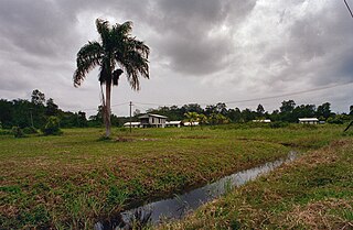
Commewijne is a district of Suriname, located on the right bank of the Suriname River. Commewijne's capital city is Nieuw Amsterdam. Tamanredjo is another major town, while Meerzorg is the most populated.

Berbice is a region along the Berbice River in Guyana, which was between 1627 and 1792 a colony of the Dutch West India Company and between 1792 and 1815 a colony of the Dutch state. After having been ceded to the United Kingdom of Great Britain and Ireland in the latter year, it was merged with Demerara-Essequibo to form the colony of British Guiana in 1831. It became a county of British Guiana in 1838 till 1958. In 1966, British Guiana gained independence as Guyana and in 1970 it became a republic as the Co-operative Republic of Guyana.

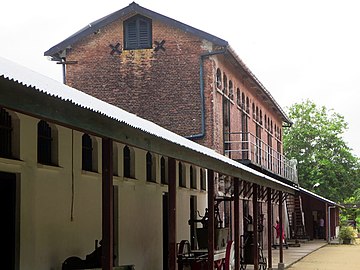
Nieuw Amsterdam is the capital of the Commewijne District in Suriname. It is a small coastal town situated at the confluence of the Suriname River and Commewijne River, just across from Paramaribo, the country's capital. Its population at the 2012 census was 5,650, with around 1,200 people living in the main town, most of whom are of Javanese and East Indian origin. It is the location of the historical Fort Nieuw-Amsterdam, today an open-air museum. The town of Mariënburg with former sugarcane factory is located 3 km from Nieuw Amsterdam and part of the resort.

The Suriname River is 480 kilometres (300 mi) long and flows through the country of Suriname. Its sources are located in the Guiana Highlands on the border between the Wilhelmina Mountains and the Eilerts de Haan Mountains. The source of the Upper Suriname River is at the confluence of the Gran Rio and Pikin Rio near the village of Goddo. The river continues shortly after the reservoir along Brokopondo as the Lower Suriname River. Than it flows Berg en Dal, the migrant communities Klaaskreek and Nieuw-Lombé, Jodensavanne, Carolina, Ornamibo and Domburg, before reaching the capital Paramaribo on the left bank and Meerzorg on the right bank. At Nieuw-Amsterdam it is joined by the Commewijne and immediately thereafter at the sandspit Braamspunt it flows into the Atlantic Ocean.

Commewijne River is a river in northern Suriname.

Tapanahoni is a resort in Suriname, located in the Sipaliwini District. Its population at the 2012 census was 13,808. Tapanahoni is a part of Sipaliwini which has no capital, but is directly governed from Paramaribo. Tapanahony is an enormous resort which encompasses a quarter of the country of Suriname. The most important town is Diitabiki which is the residence of the granman of the Ndyuka people since 1950, and the location of the oracle.
Laarwijk is a settlement and a former sugar plantation in the Commewijne District in Suriname. Laarwijk is situated along the Suriname River and can only be reached by boat.

Meerzorg is a town and resort (municipality) in Suriname, located on the eastern bank of the Suriname River, directly opposite the capital Paramaribo. Its population at the 2012 census was 12,405. Since 2000 it has been connected to Paramaribo by the Jules Wijdenbosch Bridge, named after the former President Jules Wijdenbosch.

Alkmaar is a resort in Suriname, located in the Commewijne District. Its population at the 2012 census was 5,561.

The Cassard expedition was a sea voyage by French Navy captain Jacques Cassard in 1712, during the War of the Spanish Succession. Targeting English, Dutch, and Portuguese possessions, he raided and ransomed the colonies of Cape Verde, Sint Eustatius, and Curaçao—factories, depots, and seasoning camps used in the Atlantic slave trade. He also raided and ransomed Montserrat, Antigua, Surinam, Berbice, and Essequibo—wealthy sugar-producing colonies in the Caribbean whose economies were based on the exploitation of slave labor.

Fort Nassau was the capital of the Dutch colony of Berbice, in present-day Guyana. It was situated on the Berbice River approximately 88 kilometres upstream from New Amsterdam.

Surinam, also unofficially known as Dutch Guiana, was a Dutch plantation colony in the Guianas, bordered by the equally Dutch colony of Berbice to the west, and the French colony of Cayenne to the east. It later bordered British Guiana from 1831 to 1966.

Suriname-Rivier is a lightvessel permanently berthed in a wet dock in the Fort Nieuw-Amsterdam Open-Air Museum in Nieuw-Amsterdam, Commewijne, Suriname.
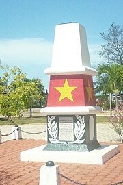
Bokilifu Boni was a freedom fighter and guerrilla leader in Suriname, when it was under Dutch colonial rule. Born in Cottica to an enslaved African mother who escaped from her Dutch master, he grew up with her among the Maroons in the forest. He was such a powerful leader that his followers were known as Boni's people after him. They built a fort in the lowlands and conducted raids against Dutch plantations along the coast. Under pressure from Dutch regular army and hundreds of freedmen, they went east across the river into French Guiana. Boni continued to conduct raids from there, but was ultimately killed in warfare.

Braamspunt is a nature reserve, fishing village, and a former military outpost in the Johan & Margaretha resort of the Commewijne District of Suriname. Braamspunt is the most western point of the Commewijne District at the combined mouth of the Suriname and Commewijne River. The capital Paramaribo is located to the south of Braamspunt. The name is a corruption of Byam's Point which refers William Byam who was a quartermaster of Willoughby.

The Ferry terminal Leonsberg is a ferry jetty in the north of Paramaribo, Suriname. From here various private operators offer transport service the other side of the Suriname river and the Commewijne River.

Fort Sommelsdijk was a fort in Suriname built in 1686 at the confluence of the Commewijne and Cottica rivers. Later it was used as a mission post and hospital. In 1870, it lost its function and was only used a military outpost. In the 21st century, the fort was taken over by nature.


