
The Alpine Line or Little Maginot Line was the component of the Maginot Line that defended the southeastern portion of France. In contrast to the main line in the northeastern portion of France, the Alpine Line traversed a mountainous region of the Maritime Alps, the Cottian Alps and the Graian Alps, with relatively few passes suitable for invading armies. Access was difficult for construction and for the Alpine Line garrisons. Consequently, fortifications were smaller in scale than the fortifications of the main Line. The Alpine Line mounted few anti-tank weapons, since the terrain was mostly unsuitable for the use of tanks. Ouvrage Rimplas was the first Maginot fortification to be completed on any portion of the Maginot Line, in 1928. The Alpine Line was unsuccessfully attacked by Italian forces during the Italian invasion of France in 1940. Following World War II, some of the larger positions of the Alpine Line were retained in use through the Cold War.
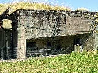
Ouvrage Bousse, also known as Ouvrage Bois de Bousse, is a lesser work of the Maginot Line in the Fortified Sector of Boulay. The ouvrage is located between petit ouvrage Hobling and gros ouvrage Anzeling, near Hestroff in the Bois du Bousse, facing Germany. A small position, it was manned primarily by reservists. It is noted for the events of 15 June 1940, when it received orders to prepare for an evacuation as German forces advanced along the Line in the Battle of France. As the garrison prepared to abandon the position, sabotaging equipment, they destroyed their telephone connection, leaving them unable to receive the order countermanding the evacuation. The garrison was captured three days after leaving Bousse. Bousse is now managed as a museum and is open to public visitation.

Ouvrage Métrich located in the village of Kœnigsmacker in Moselle, comprises part of the Elzange portion of the Fortified Sector of Thionville of the Maginot Line. A gros ouvrage, it is the third largest of the Line, after Hackenberg and Hochwald. It lies between petit ouvrage Sentzich and gros ouvrage Billig, facing Germany. Located to the east of the Moselle, it cooperated with Ouvrage Galgenberg to control the river valley.
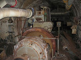
Ouvrage Sentzich is part of the Fortified Sector of Thionville of the Maginot Line. The petit ouvrage for infantry is located to the south of gros ouvrage Galgenberg, on the edge of the main road to Luxembourg near the village of Sentzich. Gros ouvrage Métrich is to the east. As a small work it was not considered for use after World War II and was abandoned. It is secured, but is not open to the public.

Ouvrage Immerhof, also known as Ouvrage Ferme-Immerhof, is one of the largest petit ouvrages of the Maginot Line of northeast France. Located near the community of Hettange-Grande, it is 7 km north of Thionville between the gros ouvrages of Molvange and Soetrich, the closest ouvrage to the Luxembourg frontier. It was part of the Fortified Sector of Thionville, in the Fortified Region of Metz, the strongest portion of the Line. Apart from its function as a communication post between the neighbouring gros ouvrages, Immerhof also controlled the road and railway routes from Luxembourg, which pass in the immediate vicinity. In addition, Immerhof protected other Maginot works in the vicinity: the casemates of Kanfen, the infantry shelter of Stressling, the observation point and shelter of Hettange-Grande, and a number of nearby blockhouses constructed during the Phoney War.
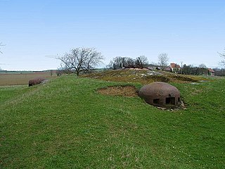
Ouvrage Soetrich is a gros ouvrage of the Maginot Line in northeastern France. Soetrich is located between petits ouvrages Immerhof and Bois Karre, facing the France-Luxembourg border near the town of Hettange-Grande, part of the Fortified Sector of Thionville. Compared with other gros ouvrages, Soetrich is compact in arrangement, with the entries and underground ammunition magazines and barracks in close proximity to the combat blocks, accessed through underground galleries at an average depth of 30 metres (98 ft). Its primary purpose was to cover the main road to Luxembourg, just to the west. Along with its neighbors, Ouvrage Rochonvillers and Ouvrage Molvange, Soetrich was used during the Cold War as a secure command center for NATO forces.

Ouvrage Bois- Karre is located in the Fortified Sector of Thionville of the Maginot Line, facing the France - Luxembourg border. The petit ouvrage is situated in the Cattenom Forest between the gros ouvrages Soetrich and Kobenbusch, just south of Boust. It is unusual for a Maginot fortification in its construction as a single blockhouse, with no underground gallery system or remotely located entries. Bois-Karre has been preserved and is maintained as a museum.

Ouvrage Oberheid, also called Ouvrage Oberheide, forms a portion of the Fortified Sector of Thionville of the Maginot Line in northeast France. The petit ouvrage d'infanterie is located on a salient point of the Cattenom Forest between the gros ouvrages Kobenbusch and Galgenberg, which provided covering fire during June 1940, when Oberheid faced daily bombardments and infiltrations. Oberheid has been abandoned and after extensive vandalism has been sealed.

Ouvrage Galgenberg forms a portion of the Fortified Sector of Thionville of the Maginot Line. It is situated in the Cattenom Forest, near the gros ouvrage Kobenbusch and petit ouvrage Oberheid. The ouvrage was tasked with controlling the Moselle valley and as such was called the "Guardian of the Moselle." Galgenberg did not see significant action in 1940 or 1944. After a period of reserve duty in the 1950s and 1960s it was deactivated. It is now a museum.

Ouvrage Rohrbach is a petit ouvrage of the Maginot Line located in the community of Bettvillier, near Rohrbach-lès-Bitche in the Moselle département, facing Germany. The Fortified Sector of Rohrbach was built somewhat later than its neighbors to the east and west, and in company with positions on the extreme western end of the Maginot Line, became one of the "New Fronts."

The fortified region of Belfort(place fortifiée de Belfort) formed the first line of defense in the Séré de Rivières system of fortifications in the Belfort Gap. Located in northeastern France between Épinal and Besançon, the primary line was built in the late 19th century to deal with advances in artillery that had made older defensive systems obsolete.
The Fortified Sector of the Crusnes was the French military organization that in 1940 controlled the section of the Maginot Line extending eastwards approximately 28 kilometres (17 mi) from Longuyon. The sector roughly follows the valley of the Crusnes river. Crucially, the trace of the Maginot Line in the Crusnes sector is about 7 kilometres (4.3 mi) behind the industrial city of Longwy which sits directly against the French borders with Belgium and Luxembourg. The Crusnes sector was one of the strongest Maginot Line sectors. It was attacked in 1940 by German forces in the Battle of France. Despite the withdrawal of the mobile forces that supported the fixed fortifications, the sector successfully fended off German assaults before the Second Armistice at Compiègne. The positions and their garrisons finally surrendered on 27 June 1940. Following the war many positions were reactivated for use during the Cold War. Three locations are now preserved and open to the public, with a fourth position under restoration.
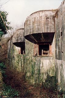
The Fortified Sector of Thionville was the French military organization that in 1940 controlled the section of the Maginot Line immediately to the north of Thionville. The sector describes an arc of about 25 kilometres (16 mi), about halfway between the French border with Luxembourg and Thionville. The Thionville sector was the strongest of the Maginot Line sectors. It was surrounded but not seriously attacked in 1940 by German forces in the Battle of France, whose main objective was the city of Metz. Despite the withdrawal of the mobile forces that supported the fixed fortifications, the sector successfully fended off German assaults before the Second Armistice at Compiègne. The majority of the positions and their garrisons finally surrendered on 27 June 1940, the remainder on 2 July. Following the war many positions were reactivated for use during the Cold War. Four locations are now preserved and open to the public.

The Fortified Sector of Montmédy was the French military organization that in 1940 controlled the section of the Maginot Line between Sedan and Longuyon, a distance of about 60 kilometres (37 mi). The sector was not as strongly defended as other sections of the Maginot Line, facing the southern Ardennes region of Belgium. Large portions of the Montmédy sector were defended by fortified houses, blockhouses, or casemates. The sector includes only four ouvrages of the type found in stronger sections of the Line. The weakly defended area in front of Sedan was the scene of a major breakthrough by German forces in the opening of the Battle of France. This was followed by a German assault on the Maginot Ouvrage La Ferté, which killed the entire garrison, the only such event on the Maginot Line.
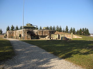
The Fortified Sector of Haguenau was the French military organization that in 1940 controlled the most easterly section of the Maginot Line, to the north of Strasbourg. The left (western) wing of the Haguenau sector adjoined the Fortified Sector of the Vosges, includes two of the largest Maginot fortifications, Ouvrage Hochwald and Ouvrage Schoenenbourg. The right wing, started after 1931, was progressively scaled back in order to save money during the Great Depression, abandoning plans for four petit ouvrages and substituting casemates. The sector's northern and eastern sides bordered on Germany. To the south the sector borders the Fortified Sector of the Lower Rhine, from which it received several casemates in a boundary shift in 1940.

The Fortified Sector of the Vosges was the French military organization that in 1940 controlled the section of the Maginot Line at the northern end of the Vosges Mountains in northeastern France. The sector was bordered to the west by the Fortified Sector of Rohrbach and to the east by the Fortified Sector of Haguenau. The sector featured two gros ouvrages mounting heavy artillery at either end of the sector and one petit ouvrage mounting infantry weapons, linked by a line of casemates. The sector was attacked in 1940 by German forces in the Battle of France. German forces penetrated the casemate line and moved behind French lines. Despite the withdrawal of the mobile forces that supported the fixed fortifications, the three ouvrages successfully fended off German assaults before the Second Armistice at Compiègne, but were unable to hinder German activities to their south. The positions and their garrisons finally surrendered on 1 July 1940. Following the war several positions were reactivated for use during the Cold War. One position, Ouvrage Four-à-Chaux, is open to the public and may be visited.

The Fortified Sector of Rohrbach was the French military organization that in 1940 controlled the section of the Maginot Line in the vicinity of Bitche. The sector was bordered to the west by the Fortified Sector of the Sarre and to the east by the Fortified Sector of the Vosges. With lower priority than other sectors, the SF Rohrbach was built somewhat later than its neighbors to the east and west, and in company with positions on the extreme western end of the Maginot Line, became one of the "New Fronts." The sector contains several major ouvrages and was the scene of fighting in both 1940 and 1944. It was attacked in 1940 by German forces in the Battle of France. The sector was heavily engaged by German forces in mid-June 1940, with several casemates and the petit ouvrage Welschhof surrendering before the Second Armistice at Compiègne. The remaining positions and their garrisons finally surrendered on 27 June 1940. In 1944 German forces occupied several positions in the SF Rohrbach, forcing advancing American forces to attack them individually or to bypass them. The German Operation Nordwind offensive of early 1945 caused American forces to fall back, returning to complete the capture of the Rohrbach sector in March 1945. Following the war many positions were reactivated for use during the Cold War. Two locations are now preserved and open to the public.
The Fortified Sector of the Sarre was the French military organization that in 1940 controlled the section of the Maginot Line on either side of the Sarre river. The sector's defenses relied primarily on a system of inundations that could be created by fortified dikes and regulating weirs, backed by blockhouses. Weakly defended compared with other sections of the Maginot Line, the sector received a measure of attention and funding from the mid-1930s when the formerly demilitarized Saarland was reintegrated into Germany. However, with a single petit ouvrage it remained a weak point in the Line. In 1940 the Sarre sector was attacked by German forces in the Battle of France. The inundations were only partly successful, and German forces were able to pierce the Maginot Line at the Sarre, allowing German divisions to move behind the main French line.

The Fortified Sector of Faulquemont was the French military organization that in 1940 controlled the section of the Maginot Line in the area of Faulquemont to the east of Metz. With five petit ouvrages the sector was poorly equipped with fortress artillery, limiting the ouvrages ability to provide mutual support. The sector was attacked in 1940 by German forces in the Battle of France. Despite the withdrawal of the mobile forces that supported the fixed fortifications, the sector mounted a strong resistance. Two of the petit ouvrages fell to German attack, the remainder holding out until the Second Armistice at Compiègne. The surviving positions and their garrisons finally surrendered on 2 June 1940. During the Cold War, Ouvrage Kerfent was partially reactivated as a communications station for Royal Canadian Air Force units stationed in northwestern France with NATO. At present, most of the underground works in the sector are flooded by groundwater. Only Ouvrage Bambesch has been preserved and may be toured by the public.

The Fortified Section of Savoy(Secteur fortifié de la Savoie) was the French military organization that in 1940 controlled the section of the Alpine Line portion of the Maginot Line facing Italy in the Savoy region. The sector constituted part of the Alpine Line portion of the Maginot Line, between the Defensive Sector of the Rhône to the north, and the Fortified Sector of the Dauphiné to the south. The works combined a number of pre-1914 fortifications with Maginot-style ouvrages, with many forward-positioned cavern-style frontier stations or avant-postes that proved effective in holding invading forces near the order.


