Frazer, Montana | |
---|---|
Coordinates: 48°03′12″N106°02′53″W / 48.05333°N 106.04806°W | |
Country | United States |
State | Montana |
County | Valley |
Area | |
• Total | 1.65 sq mi (4.27 km2) |
• Land | 1.62 sq mi (4.20 km2) |
• Water | 0.03 sq mi (0.07 km2) |
Elevation | 2,060 ft (630 m) |
Population (2020) | |
• Total | 354 |
• Density | 218.11/sq mi (84.23/km2) |
Time zone | UTC-7 (Mountain (MST)) |
• Summer (DST) | UTC-6 (MDT) |
ZIP code | 59225 |
Area code | 406 |
FIPS code | 30-29275 |
GNIS feature ID | 2408256 [2] |
Frazer is a census-designated place (CDP) in Valley County, Montana, United States, located within the Fort Peck Indian Reservation, about 80 miles from the Canadian border. [3] The population was 420 at the 2020 census. [4]
The St. Paul, Minneapolis & Manitoba Railway established Frazer as a station in 1888. [5] A post office opened in 1907. [5]
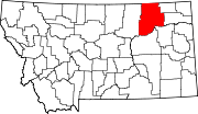
According to the United States Census Bureau, the CDP has a total area of 1.7 square miles (4.4 km2), of which 1.7 square miles (4.4 km2) is land and 0.04 square miles (0.10 km2) (1.75%) is water.
Census | Pop. | Note | %± |
---|---|---|---|
2020 | 354 | — | |
U.S. Decennial Census [6] |
Amtrak’s Empire Builder, which operates between Seattle/Portland and Chicago, passes through the town on BNSF tracks, but makes no stop. The nearest station is located in Wolf Point, 19 miles (31 km) to the east.
Frazer School educates students from kindergarten through 12th grade. [7] Frazer High School's team name is the Bearcubs. [8]
Busby is a census-designated place (CDP) in Big Horn County, Montana, United States. It is on the Northern Cheyenne reservation. The population was 745 at the 2010 census.
Pryor is a census-designated place (CDP) in Big Horn County, Montana, United States. The community is located on Crow Tribe's reservation. The population was 618 at the 2010 census. The area is named for Nathaniel Hale Pryor, a sergeant in the Lewis and Clark Expedition.
Wyola is a census-designated place (CDP) in Big Horn County, Montana, United States. The population was 215 at the 2010 census. 79% of the residents are Native American, and the majority are members of the Crow Tribe.
Hays is a census-designated place (CDP) in Blaine County, Montana, United States. The population was 843 at the 2010 census. The community lies within the Fort Belknap Indian Reservation, near the reservation's southern end. The nearby community of Lodge Pole lies to the east.
Lodge Pole is a census-designated place (CDP) in Blaine County, Montana, United States. The population was 265 at the 2010 census. It lies within the Fort Belknap Indian Reservation, near the reservation's southern end.
Gildford is an unincorporated community and census-designated place (CDP) in Hill County, Montana, United States. The population was 179 at the 2010 census.
Rudyard is an unincorporated community and census-designated place (CDP) in Hill County, Montana, United States. The population was 258 at the 2010 census.
Charlo is an unincorporated community and census-designated place (CDP) in Lake County, Montana, United States. The population was 385 at the 2020 census.
Rollins is an unincorporated community and census-designated place (CDP) in Lake County, Montana, United States. The population was 209 at the 2010 census, up from 183 in 2000.
Clinton is an unincorporated community and census-designated place (CDP) in Missoula County, Montana, United States. It is part of the Missoula metropolitan area. The population was 1,018 at the 2020 census.
Evaro is a census-designated place (CDP) in Missoula County, Montana, United States, and part of the Missoula metropolitan area. It is located on the southernmost part of the Flathead Indian Reservation, approximately 20 miles (32 km) north of downtown Missoula via US Highway 93. As of the 2020 census, the population of the CDP was 373, up from 322 in 2010.
Heart Butte is a census-designated place (CDP) in Pondera County, Montana, United States. The population was 698 at the 2000 census. The town is on the Blackfeet Indian Reservation.
Victor is a census-designated place (CDP) in Ravalli County, Montana, United States. The population was 789 at the 2020 Census, compared to 745 at the 2010 census.
Lame Deer is a census-designated place (CDP) in Rosebud County, Montana, United States. The community is named after Miniconjou Lakota chief Lame Deer, who was killed by the U.S. Army in 1877 under a flag of truce south of the town. It was the site of a trading post from the late 1870s.
Custer is a census-designated place (CDP) in Yellowstone County, Montana, United States. The population was 145 at the 2000 census.
Huntley is a census-designated place (CDP) in Yellowstone County, Montana, United States. The population was 411 at the 2000 census. Huntley lent its name to the Huntley Project, a federal irrigation project that began delivering water to the arid district in 1907. Today, Huntley is an eastern suburb of Billings and is located east of Shepherd and west of Worden.
Lockwood is a census-designated place (CDP) in Yellowstone County, Montana, United States. It is not an organized city or town. The population was 7,195 at the 2020 census.The population was 7,222 at the 2020 census. Lockwood is a suburb of Billings and is the second largest community in the Billings Metropolitan Statistical Area. Annexation of Lockwood to Billings has been studied; however, the June 2009 Billings City Council Annexation Plan states that the city has no plans to annex Lockwood in the foreseeable future. Lockwood is the site of a major Exxon refinery.
Worden is a census-designated place (CDP) in Yellowstone County, Montana, United States. The population was 582 at the 506 at the 2020 census. Worden, along with Ballantine, Huntley, and Pompey's Pillar, is part of the Huntley Project, an irrigation district established by the United States Bureau of Reclamation in 1907.
Arlee is an unincorporated community and census-designated place (CDP) on the Flathead Reservation, Lake County, Montana, United States. The population was 725 at the 2020 census. It is named after Alee, a Salish chief. The chief's name has no "r", as the Salish alphabet has no letter "r".
Fox Lake is a census-designated place (CDP) in Richland County, Montana, United States. The population was 158 at the 2010 census.