Frederick Douglass High School (Maryland)

Last updated
Frederick Douglass High School
Address
Frederick Douglass High School (Maryland)
8000 Croom Road

,
20772

United States
Coordinates 38°46′54″N76°46′59″W / 38.78167°N 76.78306°W / 38.78167; -76.78306
Information
Other namesMarlboro High School
School type Public, high school
Opened1935
School district Prince George's County Public Schools
SuperintendentMonica Goldson
PrincipalEddie Scott
Grades9–12
Enrollment1,011
Language English
CampusSuburban
Color(s)Burgundy and Gold   
MascotEagles
Rival Gwynn Park High School
Feeder schools James Madison Middle School
Website Official website

Frederick Douglass High School (FDHS), is an American public high school established in 1935 and located in the Croom census-designated place of unincorporated Prince George's County, Maryland, United States, with a mailing address of Upper Marlboro and near Upper Marlboro.

Contents

It started as a segregated school for African American students, and c.1964 it became integrated. Douglass is a part of the Prince George's County Public Schools system, and is named after the famous abolitionist, journalist, and orator, Frederick Douglass. It was preceded by Marlboro Colored High School (1923–1935).

About

The school serves: [1] sections of the Croom and Rosaryville CDPs, [2] [3] and all of the Marlton CDP. [4]

The current principal is Eddie Scott. The July 2019 student enrollment was approximately 1,050-students in grades nine through twelve. The school hours are from 7:45am until 2:25pm. There is a mandatory uniform policy in effect at Douglass. The school features an International Baccalaureate (IB) Middle Years Programme (MYP) a P-TECH program as well as a school-wide America's Choice School Design signature program.

History

Frederick Douglass High School was preceded by the Marlboro Colored High School. In 1935 a new building serving elementary through high school opened, [5] and the school was given its current name. [6] The former building was converted into offices. [7] The present Frederick Douglass High School campus at 8000 Croom Road opened in 1959. [6]

In the period 1950 to 1964, Douglass served about 33% of the county's Black high school students; the remainder attended Fairmont Heights High School, then near Fairmount Heights, which opened in 1950. [7] Circa 1964 PGCPS ended legalized racial segregation of schools. [8] When the late 1960s came, Douglass was a majority white high school because a lot of the black high school students were reassigned to schools closer to their houses. By 2000 Douglass returned to being majority black. [5]

In the early 1980s the former Douglass High was razed. A commemorative plaque was installed at the site in September 2000 by the Frederick Douglass High School Class of 1950.

Campus

The school is the Croom census-designated place of unincorporated Prince George's County, Maryland, with a mailing address of Upper Marlboro; [9] [2] it is 4 miles (6.4 km) southeast of Upper Marlboro. [5] The school was previously defined by the U.S. Census Bureau as being in the Greater Upper Marlboro CDP. [10]

Around 2016 the official capacity of Douglass was over 1,400 students, but it previously had an official capacity of 1,283. The PGCPS operations officer, Monica Goldson, stated that the Douglass principal reviewed the new number and that the district took into account the total classroom space. Board member Sonya Williams advocated for the former capacity and feared that the school district could use the new capacity to officially state the school was under-enrolled and close it at a later time. [11]

In 2015 the school received a new tennis court and rubberized field; the upgrades to its athletic facilities totaled $317,270. [12]

The media center is named after former principal Robert F. Frisby, who had the nickname "Baldy". [5]

Student body

In the pre-1964 segregation era many of the students previously attended rural one and two schoolhouses and lived in rural residences with no electricity, telephone, and/or water services. [5]

Pre-1964 many students who graduated from Douglass matriculated to Bowie State University (previously Maryland Normal and Industrial School at Bowie, Maryland Teachers College at Bowie, and Bowie State College) and University of Maryland Eastern Shore (then known as Maryland State College), as well as Hampton University (formerly Hampton Agricultural and Industrial School, and later Hampton Institute). [5]

Athletics

Pre-1964 Douglass entered in athletic competitions with Cardozo Education Campus (formerly Cardozo High School) in Washington, Carver High School in Rockville, Bel Alton High School in Charles County, and schools in Baltimore. [5]

Notable people

Related Research Articles

<span class="mw-page-title-main">Prince George's County, Maryland</span> County in Maryland, United States

Prince George's County is located in the U.S. state of Maryland bordering the eastern portion of Washington, D.C. As of the 2020 U.S. census, the population was 967,201, making it the second-most populous county in Maryland, behind neighboring Montgomery County. The 2020 census counted an increase of nearly 104,000 in the previous ten years. Its county seat is Upper Marlboro. It is the largest and the second most affluent African American-majority county in the United States, with five of its communities identified in a 2015 top ten list.

<span class="mw-page-title-main">Accokeek, Maryland</span> Census-designated place in Maryland, United States

Accokeek, "at the edge of the hill" in Algonquin, is a census-designated place (CDP) located in Prince George's County, Maryland, United States. The CDP is located on the Potomac River, borders Charles County and is approximately 17 miles from Washington. It is a part of the Washington metropolitan area. The population of the CDP, as of the 2020 United States Census was 13,927.

<span class="mw-page-title-main">Beltsville, Maryland</span> CDP in Maryland

Beltsville is a census-designated place (CDP) in northern Prince George's County, Maryland, United States. The community was named for Truman Belt, a local landowner. The 2020 census counted 20,133 residents. Beltsville includes the unincorporated community of Vansville.

<span class="mw-page-title-main">District Heights, Maryland</span> City in Maryland

District Heights is an incorporated municipality in Prince George's County, Maryland, United States, located near Maryland Route 4. Per the 2020 census, the population was 5,959. For more information, see the separate articles on Forestville and Suitland.

<span class="mw-page-title-main">Greater Upper Marlboro, Maryland</span> Unincorporated area in Maryland

Greater Upper Marlboro is an area of Prince George's County, Maryland that completely surrounds Upper Marlboro, the county seat. It was formerly a census-designated place (CDP), with a population of 18,720 at the 2000 census. However, the 2010 census divided the area into several smaller CDPs, including portions of Marlboro Meadows, Brock Hall, Marlboro Village, Queenland, and Croom.

<span class="mw-page-title-main">Largo, Maryland</span> Census-designated place in Maryland

Largo, located within Greater Upper Marlboro, Maryland, is an unincorporated area and census-designated place in Prince George's County, Maryland, United States. The population was 11,605 at the 2020 census.

<span class="mw-page-title-main">Marlton, Maryland</span> Census-designated place in Maryland

Marlton is an unincorporated area and census-designated place (CDP) in Prince George's County, Maryland, United States. The population was 9,802 at the 2020 census. The Marlton housing development, at first briefly called "Brandywine Country", grew up along U.S. Route 301 in the 1970s, and is part of the greater Upper Marlboro community. Originally made up of only single-family homes, more recently townhouses have been added.

<span class="mw-page-title-main">Rosaryville, Maryland</span> Census-designated place in Maryland, US

Rosaryville is an unincorporated area and census-designated place (CDP) in Prince George's County, Maryland, United States, located south of Cinton and Upper Marlboro beside U.S. Route 301. Per the 2020 census, the population was 11,548. including housing developments and rural open space. It was named for a local Roman Catholic church. Close to Rosaryville are the Marlton housing development, Maryland Veterans Cemetery, the Southern Maryland Farmers Market, and Rosaryville State Park.

<span class="mw-page-title-main">Upper Marlboro, Maryland</span> Town in Maryland, United States

Upper Marlboro, officially the Town of Upper Marlboro, is the seat of Prince George's County, Maryland. As of the 2020 census, the population within the town limits was 652, although Greater Upper Marlboro, which covers a large area outside the town limits, is many times larger.

<span class="mw-page-title-main">Bladensburg High School</span> Public secondary school in Bladensburg, Maryland, United States

Bladensburg High School is a public high school located in Bladensburg, Maryland, United States. The school, which serves grades 9 through 12, is a part of the Prince George's County Public Schools district.

Largo High School is a public High School in Largo census-designated place, Prince George's County, Maryland, United States. Operated by Prince George's County Public Schools, it serves students of grades 9 to 12.

Bowie High School is a public high school in Bowie, Maryland, United States and a part of Prince George's County Public Schools.

<span class="mw-page-title-main">Croom, Maryland</span> Census-designated place in Maryland

Croom is an unincorporated community and census-designated place in Southern Prince George's County, Maryland, United States. As of the 2020 census it had a population of 2,720. Croom largely consists of former tobacco farms and forests converted to Washington bedroom subdivisions such as nearby Marlton. The main part of Patuxent River Park is in Croom.

<span class="mw-page-title-main">Fairmont Heights High School</span> Public comprehensive secondary school in Landover, Maryland , United States

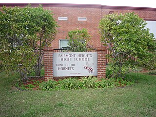
Fairmont Heights High School (est.1950) is an American public comprehensive secondary school located in Landover, Maryland, just outside Washington D.C. It is part of the Prince George's County Public Schools system. Two middle schools feed into Fairmont Heights. It is part of the School Board District 3.

Dr. Henry A. Wise Jr. High School is a public high school in the Westphalia census-designated place in unincorporated Prince George's County, Maryland, United States, with an Upper Marlboro postal address. A part of the Prince George's County Public Schools (PGCPS), it opened in the fall of 2006.

<span class="mw-page-title-main">Brock Hall, Maryland</span> Census-designated place in Maryland

Brock Hall is an unincorporated area and census-designated place in eastern Prince George's County, Maryland, United States, located south of Largo and Bowie, and north of Upper Marlboro. As of the 2020 census, the CDP had a population of 13,181.

Marlboro Village is an unincorporated community and census-designated place (CDP) in Prince George's County, Maryland, United States. Per the 2020 census, the population was 9,221. It was newly delineated for the 2010 census prior to which the area was part of the Greater Upper Marlboro census-designated place.

Queensland is a census-designated place south of Upper Marlboro in Prince George's County, Maryland, United States. The population of the CDP was 2,191 at the 2020 census. It was formerly known as Queenland until 2014 when its name was changed to Queensland and a small portion of its geography was transferred to Upper Marlboro.

Westphalia is a census-designated place in southern Prince George's County, Maryland, United States. The population of the CDP was 11,770 at the 2020 census.

Lakeland High School was a high school for black children located in the Lakeland community of Prince George's County, Maryland, United States, now a part of College Park. It was the second high school for black children in the county. It ceased being used for educational purposes in 1983. As of 2012, the building was being used as a church.

References

  1. "NEIGHBORHOOD HIGH SCHOOLS AND BOUNDARIES SCHOOL YEAR 2018-2019." Prince George's County Public Schools. Retrieved on September 2, 2018.
  2. 1 2 "2010 CENSUS - CENSUS BLOCK MAP (INDEX): Croom CDP, MD." U.S. Census Bureau. Retrieved on August 28, 2018. Pages: 1, 2, 3, and 4.
  3. "2010 CENSUS - CENSUS BLOCK MAP: Rosaryville CDP, MD." U.S. Census Bureau. Retrieved on September 2, 2018. The CDP previously had a different shape: "CENSUS 2000 BLOCK MAP: ROSARYVILLE CDP" with pages 1 and 2. The 1990 U.S. Census Bureau map for Prince George's County (index map) shows Rosaryville CDP on pages 23, 29, 30, and 35.
  4. "2010 CENSUS - CENSUS BLOCK MAP (INDEX): Marlton CDP, MD." U.S. Census Bureau. Retrieved on September 2, 2018. Pages: 1, 2, and 3.
  5. 1 2 3 4 5 6 7 Meyer, Eugene L. (2000-09-28). "Douglass High: A School of Their Own". Washington Post . Retrieved 2018-09-06.
  6. 1 2 "About Us > The History of Frederick Douglass High School." Frederick Douglass High School. October 12, 2011. Retrieved on September 6, 2018.
  7. 1 2 Wynter, Leon (1981-02-19). "Rebuilding a Legacy at Fairmont Heights". Washington Post . Retrieved 2018-09-05.
  8. "Fairmont Heights High School History". Fairmont Heights High School. 2018-09-04. Archived from the original on 2005-10-04. Retrieved 2018-09-04.
  9. Home. Frederick Douglass High School. Retrieved on August 28, 2018. "Frederick Douglass High School, 8000 Croom Rd, Upper Marlboro, MD 20772"
  10. "CENSUS 2000 BLOCK MAP: GREATER UPPER MARLBORO CDP." U.S. Census Bureau. Retrieved on August 27, 2018. Pages: 1, 2, 3, and 4. 1990 U.S. Census maps of Prince George's County (index map) show Greater Upper Marlboro on pages: 18, 19, 20, 23, 24, 25, 29, 30, and 31.
  11. Keyes, Candace Rojo (2016-05-18). "Board passes facilities plan, new school sites". Prince George's Sentinel . Retrieved 2018-09-06.
  12. Clinkscales, Johnathon (2015-10-15). "9 Prince George's County high schools get new athletic facilities". The Enquirer-Gazette . Retrieved 2018-09-06.