Rosaryville, Maryland

Last updated

Rosaryville, Maryland
Prince George's County Maryland Incorporated and Unincorporated areas Rosaryville Highlighted.svg
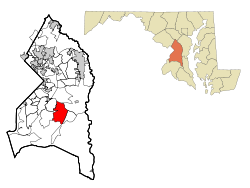
Location of Rosaryville, Maryland
Coordinates: 38°46′4″N76°50′8″W / 38.76778°N 76.83556°W / 38.76778; -76.83556
CountryFlag of the United States.svg  United States
State Flag of Maryland.svg  Maryland
County Flag of Prince George's County, Maryland (1963-present).svg Prince George's
Area
[1]
  Total9.20 sq mi (23.82 km2)
  Land9.18 sq mi (23.78 km2)
  Water0.01 sq mi (0.04 km2)
Elevation
223 ft (68 m)
Population
 (2020)
  Total11,548
  Density1,257.54/sq mi (485.55/km2)
Time zone UTC−5 (Eastern (EST))
  Summer (DST) UTC−4 (EDT)
Area code(s) 301, 240
FIPS code 24-68300
GNIS feature ID0597990

Rosaryville is an unincorporated area and census-designated place (CDP) in Prince George's County, Maryland, United States, located south of Cinton and Upper Marlboro beside U.S. Route 301. [2] Per the 2020 census, the population was 11,548. [3] including housing developments and rural open space. It was named for a local Roman Catholic church. [4] Close to Rosaryville are the Marlton housing development, Maryland Veterans Cemetery, the Southern Maryland Farmers Market, and Rosaryville State Park.

Contents

History

His Lordship's Kindness was listed on the National Register of Historic Places and as a National Historic Landmark in 1970. [5]

Geography

Rosaryville is located at 38°46′4″N76°50′8″W / 38.76778°N 76.83556°W / 38.76778; -76.83556 (38.767664, 76.835568). [6]

According to the United States Census Bureau, the CDP has a total area of 9.2 square miles (23.8 km2), of which 0.02 square miles (0.04 km2), or 0.18%, is water. [7]

Demographics

Historical population
CensusPop.Note
1990 8,976
2000 12,32237.3%
2010 10,697−13.2%
2020 11,5488.0%
U.S. Decennial Census [8]
2010 [9] 2020 [10]

2020 census

Rosaryville CDP, Maryland – Demographic Profile
(NH = Non-Hispanic)
Note: the US Census treats Hispanic/Latino as an ethnic category. This table excludes Latinos from the racial categories and assigns them to a separate category. Hispanics/Latinos may be of any race.
Race / EthnicityPop 2010 [9] Pop 2020 [10] % 2010% 2020
White alone (NH)1,19978411.21%6.79%
Black or African American alone (NH)8,6629,40080.98%81.40%
Native American or Alaska Native alone (NH)42160.39%0.14%
Asian alone (NH)1681831.57%1.58%
Pacific Islander alone (NH)8110.07%0.10%
Some Other Race alone (NH)24710.22%0.61%
Mixed Race/Multi-Racial (NH)2754222.57%3.65%
Hispanic or Latino (any race)3196612.98%5.72%
Total10,69711,548100.00%100.00%

2000 Census

As of the census [11] of 2000, there were 12,322 people, 4,112 households, and 3,367 families residing in the CDP. The population density was 901.4 inhabitants per square mile (348.0/km2). There were 4,267 housing units at an average density of 312.2 per square mile (120.5/km2). The racial makeup of the CDP was 34.13% White, 59.57% African American, 0.64% Native American, 2.67% Asian, 0.11% Pacific Islander, 0.63% from other races, and 2.25% from two or more races. Hispanic or Latino of any race were 2.12% of the population.

There were 4,112 households, out of which 40.5% had children under the age of 18 living with them, 64.7% were married couples living together, 12.6% had a female householder with no husband present, and 18.1% were non-families. 14.3% of all households were made up of individuals, and 3.6% had someone living alone who was 65 years of age or older. The average household size was 2.99 and the average family size was 3.29.

In the CDP, the population was spread out, with 28.0% under the age of 18, 6.8% from 18 to 24, 32.3% from 25 to 44, 25.8% from 45 to 64, and 7.1% who were 65 years of age or older. The median age was 37 years. For every 100 females, there were 95.4 males. For every 100 females age 18 and over, there were 92.4 males.

The median income for a household in the CDP was $79,715, and the median income for a family was $85,225. Males had a median income of $48,776 versus $41,843 for females. The per capita income for the CDP was $27,817. About 1.7% of families and 2.9% of the population were below the poverty line, including 3.3% of those under age 18 and none of those age 65 or over.

Government

Prince George's County Police Department District 5 Station in Clinton CDP serves the community. [12]

Education

Rosaryville residents are assigned to schools in Prince George's County Public Schools: [13]

Elementary schools serving sections of the 2010 CDP include Melwood Elementary School and Rosaryville Elementary School. [14]

Most residents are zoned to James Madison Middle School, with some zoned to Gwynn Park Middle School. [15]

Dr. Henry A. Wise Jr. High School and Frederick Douglass High School serve sections of the CDP. [16]

Related Research Articles

<span class="mw-page-title-main">Brandywine, Maryland</span> Census-designated place in Maryland

Brandywine is the name of an unincorporated area in Prince George's County, Maryland, United States, that refers both to a census-designated place (CDP) and a zip code area which is much larger (20613), whose areas overlap. The population of Brandywine at the 2020 U.S. Census was 10,550 for the CDP, and the population of ZIP code 20613 was 11,860 in 2010.

<span class="mw-page-title-main">Camp Springs, Maryland</span> Census-designated place in Maryland

Camp Springs is an unincorporated area and census-designated place (CDP) in Prince George's County, Maryland, United States. The population was 22,734 at the 2020 census. Camp Springs is not an official post office designation; the area is divided among the surrounding mailing addresses of Temple Hills, Fort Washington, Clinton, and Suitland.

<span class="mw-page-title-main">Clinton, Maryland</span> Census-designated place in Maryland, United States

Clinton is an unincorporated census-designated place (CDP) in Prince George's County, Maryland, United States. Clinton was formerly known as Surrattsville until after the time of the Civil War. The population of Clinton was 38,760 at the 2020 census. Clinton is historically known for its role in the American Civil War concerning the Abraham Lincoln assassination. Clinton is adjacent to Camp Springs, Rosaryville, Melwood, and Andrews Air Force Base.

<span class="mw-page-title-main">Coral Hills, Maryland</span> Census-designated place in Maryland

Coral Hills is an unincorporated area and census-designated place (CDP) in Prince George's County, Maryland, United States. As of the 2020 census, the population was 9,997.

<span class="mw-page-title-main">Eagle Harbor, Maryland</span> Town in Maryland, United States

Eagle Harbor is an incorporated town in the far southeast corner of Prince George's County, Maryland, United States, and near the rural community of Aquasco that is known as a historic African American community founded in 1925. Per the 2020 census, the population was 67. The Chalk Point Generating Station, owned by NRG Energy, which was sold to Mirant by the Potomac Electric Power Company (PEPCO) in 2000, is located adjacent to the town.

<span class="mw-page-title-main">East Riverdale, Maryland</span> Census-designated place in Maryland

East Riverdale is an unincorporated area and census-designated place (CDP) in Prince George's County, Maryland, United States. The population was 18,459 at the 2020 census.

<span class="mw-page-title-main">Friendly, Maryland</span> Census-designated place in Maryland

Friendly is an unincorporated area and census-designated place (CDP) in Prince George's County, Maryland, United States, with an African-American majority population, located a few miles south of Washington, D.C. The population was 9,937 at the 2020 census.

<span class="mw-page-title-main">Kettering, Maryland</span> Census-designated place in Maryland, United States

Kettering is an unincorporated area and census-designated place in Prince George's County, Maryland, United States. At the 2020 United States Census, the population was 14,424,. Kettering is adjacent to Prince George's Community College, the upscale gated community of Woodmore, Six Flags America, Evangel Temple megachurch, and the community of Largo at the end of the Washington Metro Blue Line. Watkins Regional Park in Kettering offers a large playground, a colorful carousel, miniature golf, a miniature train ride, and various animals.

<span class="mw-page-title-main">Marlow Heights, Maryland</span> Census-designated place in Maryland

Marlow Heights is an unincorporated area and census-designated place (CDP) in Prince George's County, Maryland, United States. The population was 6,169 at the 2020 census. The Marlow Heights Shopping Center first opened in 1957, adjacent to the large community of Hillcrest Heights. It was joined ten years later, in 1967, by the two-level Iverson Mall, the Washington metropolitan area's first enclosed mall.

<span class="mw-page-title-main">Marlton, Maryland</span> Census-designated place in Maryland

Marlton is an unincorporated area and census-designated place (CDP) in Prince George's County, Maryland, United States. The population was 9,802 at the 2020 census. The Marlton housing development, at first briefly called "Brandywine Country", grew up along U.S. Route 301 in the 1970s, and is part of the greater Upper Marlboro community. Originally made up of only single-family homes, more recently townhouses have been added.

<span class="mw-page-title-main">Mitchellville, Maryland</span> Census-designated place in Maryland

Mitchellville is an upper-class majority African-American unincorporated area and census-designated place (CDP) in Prince George's County, Maryland, United States. Per the 2020 census, the population was 11,136.

<span class="mw-page-title-main">South Laurel, Maryland</span> Census-designated place in Maryland

South Laurel is an unincorporated area and census-designated place (CDP) in Prince George's County, Maryland, United States. Per the 2020 census, the population was 29,602.

<span class="mw-page-title-main">Springdale, Maryland</span> Census-designated place in Maryland

Springdale is an unincorporated area and census-designated place (CDP) in Prince George's County, Maryland, United States. Per the 2020 census, the population was 5,301.

<span class="mw-page-title-main">Walker Mill, Maryland</span> Census-designated place in Maryland

Walker Mill is an unincorporated area and census-designated place (CDP) in Prince George's County, Maryland, United States. Per the 2020 census, the population was 12,187.

<span class="mw-page-title-main">West Laurel, Maryland</span> Census-designated place in Maryland

West Laurel is an unincorporated area and census-designated place (CDP) in Prince George's County, Maryland, United States. Per the 2020 census, the population was 4,428.

<span class="mw-page-title-main">Woodlawn, Prince George's County, Maryland</span> Census-designated place in Maryland

Woodlawn is an unincorporated area and census-designated place (CDP) in Prince George's County, Maryland, United States. As of the 2020 census it had a population of 7,541.

<span class="mw-page-title-main">Woodmore, Maryland</span> Census-designated place in Maryland

Woodmore is an unincorporated area and census-designated place in Prince George's County, Maryland, United States. Per the 2020 census, the population was 4,513. The CDP is located within the boundaries of Route 193 to the west, Church Road to the east, Route 214 to the south and Route 50 to the north. Woodmore Road runs east and west through the center. It contains a large gated community and country club, developments of Woodmore Meadows, and Woodmore South on the south side, as well as various other custom built homes and farmland.

<span class="mw-page-title-main">Calverton, Maryland</span> Census-designated place in Maryland, United States

Calverton is an unincorporated area and census-designated place located on the boundary between Montgomery and Prince George's counties, Maryland, in the United States. At the 2020 census, it had a population of 17,316.

<span class="mw-page-title-main">Hillandale, Maryland</span> Census-designated place in Maryland, United States

Hillandale is an unincorporated area and census-designated place located in Montgomery and Prince George's counties, Maryland, United States. As of the 2020 census, it had a population of 5,774. Hillandale is contained between the Prince George's / Montgomery County line to the east, the Anacostia River to the west, McCeney Avenue to the north, and D.C.'s Capital Beltway to the south. It borders the communities of Adelphi, Avenel, White Oak and Beltsville.

Queensland is a census-designated place south of Upper Marlboro in Prince George's County, Maryland, United States. The population of the CDP was 2,191 at the 2020 census. It was formerly known as Queenland until 2014 when its name was changed to Queensland and a small portion of its geography was transferred to Upper Marlboro.

References

  1. "2020 U.S. Gazetteer Files". United States Census Bureau. Retrieved April 26, 2022.
  2. U.S. Geological Survey Geographic Names Information System: Rosaryville, Maryland
  3. "Rosaryville CDP, Maryland". United States Census Bureau . Retrieved April 15, 2022.
  4. "Our Parish History". St. Mary of the Assumption Church. Retrieved November 3, 2017.
  5. "National Register Information System". National Register of Historic Places . National Park Service. July 9, 2010.
  6. "US Gazetteer files: 2010, 2000, and 1990". United States Census Bureau. February 12, 2011. Retrieved April 23, 2011.
  7. "Geographic Identifiers: 2010 Demographic Profile Data (G001): Rosaryville CDP, Maryland". United States Census Bureau . Retrieved December 23, 2011.
  8. "Decennial Census of Population and Housing by Decades". US Census Bureau.
  9. 1 2 "P2 HISPANIC OR LATINO, AND NOT HISPANIC OR LATINO BY RACE – 2010: DEC Redistricting Data (PL 94-171) – Rosaryville CDP, Maryland". United States Census Bureau .
  10. 1 2 "P2 HISPANIC OR LATINO, AND NOT HISPANIC OR LATINO BY RACE – 2020: DEC Redistricting Data (PL 94-171) – Rosaryville CDP, Maryland". United States Census Bureau .
  11. "U.S. Census website". United States Census Bureau . Retrieved January 31, 2008.
  12. "District 5 Station - Clinton." Prince George's County Police Department. Retrieved on September 9, 2018. " 6707 Groveton Drive Clinton, MD 20735". Beat map. See 2010 U.S. Census index map of Clinton CDP: area with police station is on the edge of page 6 with surroundings on page 5.
  13. "2010 CENSUS - CENSUS BLOCK MAP: Rosaryville CDP, MD." U.S. Census Bureau. Retrieved on September 2, 2018. The CDP previously had a different shape: "CENSUS 2000 BLOCK MAP: ROSARYVILLE CDP" with pages 1 and 2. The 1990 U.S. Census Bureau map for Prince George's County (index map) shows Rosaryville CDP on pages 23, 29, 30, and 35.
  14. "NEIGHBORHOOD ELEMENTARY SCHOOLS AND BOUNDARIES SCHOOL YEAR 2018-2019." Prince George's County Public Schools. Retrieved on September 2, 2018.
  15. "NEIGHBORHOOD MIDDLE SCHOOLS AND BOUNDARIES SCHOOL YEAR 2018-2019." Prince George's County Public Schools. Retrieved on September 2, 2018.
  16. "NEIGHBORHOOD HIGH SCHOOLS AND BOUNDARIES SCHOOL YEAR 2018-2019." Prince George's County Public Schools. Retrieved on September 2, 2018.