Brandywine, Maryland | |
|---|---|
 Location of Brandywine, Maryland | |
| Coordinates: 38°41′55″N76°50′57″W / 38.69861°N 76.84917°W | |
| Country | |
| State | |
| County | |
| Area | |
• Total | 21.12 sq mi (54.70 km2) |
| • Land | 21.04 sq mi (54.49 km2) |
| • Water | 0.077 sq mi (0.20 km2) |
| Elevation | 220 ft (67 m) |
| Population (2020) | |
• Total | 10,550 |
| • Density | 501/sq mi (193.6/km2) |
| Time zone | UTC−5 (Eastern (EST)) |
| • Summer (DST) | UTC−4 (EDT) |
| ZIP code | 20613 |
| Area codes | 301, 240 |
| FIPS code | 24-09325 |
| GNIS feature ID | 0597115 |
| Website | www |
Brandywine is the name of an unincorporated area in Prince George's County, Maryland, United States, that refers both to a census-designated place (CDP) and a zip code area which is much larger (20613), whose areas overlap. [2] The population of Brandywine at the 2020 U.S. census was 10,550 for the CDP, [3] and the population of ZIP code 20613 was 11,860 in 2010. [4]
Contents
- Geography
- Demographics
- 2020 census
- 2000 census
- History
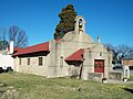
- Historical sites
- Enterprises and recreation
- Government
- Education
- Notable people
- References
- External links
Brandywine is in the southernmost area of Prince George’s County, surrounded by a rural setting. It is in the Southern Maryland region. Brandywine is also a suburb of two cities: it lies within the outer suburban Washington D.C. area and is also a close suburb of Waldorf.